

Executive Overview
The American landscape is undergoing a perilous transformation, forged in the crucible of escalating temperatures, prolonged droughts, and unchecked residential expansion. Nowhere is this convergence of danger more apparent than in the wildland-urban interface (WUI)—the shifting borderlands where suburban neighborhoods march directly into fire-prone shrublands, forests, and grasslands.
In the late summer, this latent volatility materialized with devastating clarity in communities across the American West. From the foothills of Reno, Nevada, to the suburban fringes of Spokane, Washington, ferocious wildfires tore through residential developments, incinerating homes, blanketing cities in toxic smog, and displacing tens of thousands of residents. The Hawk Fire near Reno and the catastrophic blazes in Spokane are not isolated aberrations; they represent the terrifying new normal of a warming planet.
As climate change supercharges seasonal wildfire conditions—exacerbated by record-low winter snowpacks, plummeting humidity, and blistering heat waves—millions of Americans find themselves living directly in the crosshairs. Compounding this environmental crisis is a socioeconomic one: decades of explosive population growth in high-risk zones, driven by urban housing shortages and the perennial allure of scenic, open-space living.
This investigative report examines the collision between climate change and suburban sprawl, drawing on frontline accounts, meteorological data, and peer-reviewed research to explore why America’s fastest-growing neighborhoods are increasingly becoming its most vulnerable.
Detailed Chronology: The Anatomy of a Modern Wildfire Crisis
The trajectory of the recent wildfire crises across the Western United States follows a terrifyingly familiar script: a spark, a parched landscape, relentless winds, and a residential community ill-prepared for the speed of the advance.
The Somersett Outbreak and the Hawk Fire
The morning of August 22 began with deceptive tranquility in Somersett, a master-planned community situated a short drive from downtown Reno, Nevada. Characterized by sweeping high-desert views, winding cul-de-sacs, and manicured golf courses interwoven with native shrubland and trailheads, Somersett represents the quintessential modern Western suburb.
However, months of relentless summer heat and critically low humidity had primed the surrounding vegetation to burn like tinder. When the Hawk Fire ignited on that Saturday morning, it capitalized instantly on the hyper-dry grasses and gusty winds.
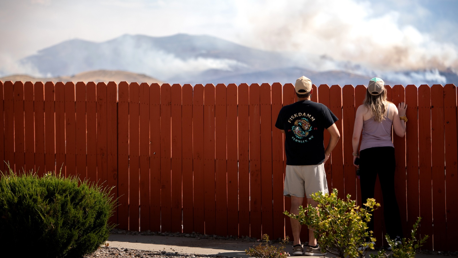
In a matter of days, the blaze was violently propelled more than 23 miles across the landscape. Dense, choking smoke and eerie, apocalyptic orange skies blanketed Reno, forcing roughly 90,000 residents under evacuation notices or warnings. By Wednesday, the fire’s relentless march had reduced dozens of suburban homes to ash and forced the closure of U.S. Route 395—a vital transportation artery straddling the Nevada-California border.
The Hawk Fire did not occur in a vacuum. Just two weeks earlier, the massive Bug Fire had scorched 150 square miles of terrain directly north of the same region, signaling an intensely active and destructive fire season.
Parallels in Spokane and Los Angeles
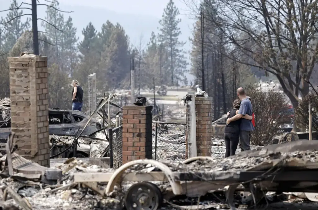
The devastation in Nevada mirrors recent catastrophes across the West. Earlier in the month, a trio of massive wildfires slammed into suburban developments around Spokane, Washington, the state’s second-largest city, consuming more than 900 structures and leaving residents to sift through smoking wreckage.
This followed the catastrophic events of January 2025, when the Eaton and Palisades fires erupted in the brush-choked suburban sprawl surrounding Los Angeles. Those fires forced the emergency evacuation of more than 200,000 people and obliterated thousands of structures, demonstrating that neither small high-desert communities nor sprawling coastal megalopolises are immune to the threat.
Supporting Context & Metrics: The Science of Sprawl and Warming
To understand why these fires are becoming increasingly destructive, experts point to a lethal combination of climatic shifts and structural demographic changes.
A Warming Continent and Shifting Weather Patterns
According to scientific consensus, climate change has exponentially increased the likelihood and severity of catastrophic wildfires in North America and Europe. Across the United States alone, more than 7.9 million acres have burned this year. A parallel crisis is unfolding in Canada, where First Nations communities and residents of Ontario have absorbed the brunt of more than 5,100 fires nationwide.
In the Western United States, this year’s extreme fire seasons have been severely exacerbated by two primary meteorological factors:
- Record-Low Winter Snowfall: Deprived the regional landscape of the deep snowpacks that traditionally melt slowly throughout the spring and summer, continuously seeping vital moisture into the soil and vegetation.
- Prolonged Heat Waves: Extreme, long-lasting high temperatures have baked the terrain, effectively turning living brush and timber into kiln-dried fuel.
Cities like Reno are on the front lines of this atmospheric shift. Designated by the nonprofit Climate Central as the fastest-warming city in the United States, Reno experiences amplified temperature spikes that drastically accelerate soil evaporation and vegetation drying.
The Rise—and Risk—of the Wildland-Urban Interface (WUI)
While a warming atmosphere provides the spark and the atmospheric hunger, human expansion provides the fuel and the targets.
For decades, population growth in the United States has gravitated toward naturally fire-prone ecosystems. Researchers refer to this convergence zone as the wildland-urban interface, or WUI—defined as the geographical space where human housing development meets or intermingles with undeveloped wildland vegetation.
More than a third of all homes in the continental United States are now situated within the WUI. Although the explosive development boom of the 1990s through the 2010s has decelerated slightly, these half-wild, half-suburban neighborhoods remain among the most rapidly growing types of land use in the country.
This expansion is driven largely by economic necessity and lifestyle preferences. Severe housing shortages and soaring costs in major urban centers have pushed prospective home buyers to the suburban and exurban peripheries, where land acquisition and construction are cheaper, and where local zoning and permitting requirements are frequently less stringent. Simultaneously, millions of Americans are drawn to these regions by the promise of open space, scenic mountain views, and immediate proximity to outdoor recreation.
The mathematical consequences of this demographic shift are staggering. A recent landmark study published in Natural Hazards, a journal from the Nature portfolio, revealed that the ongoing expansion of WUI housing, when combined with the accelerative force of climate change, has quadrupled the risk of destructive wildfire in California.
Official Statements & Frontline Perspectives
Experts, firefighters, and emergency managers on the front lines of the crisis are increasingly vocal about the unsustainable nature of current building and living patterns in fire zones.
Rethinking the Nomenclature
Tim Brown, director of the Western Regional Climate Center at the Desert Research Institute in Nevada, argues that our terminology fails to capture the true magnitude of the danger.
"What’s happened over the last decades is we’ve had explosive population growth in naturally fire-prone areas," Brown explains. "People are moving in to where fire happens. Maybe we need to stop calling it the WUI and call it what it is: fire-prone."
Researchers have been warning about the structural vulnerabilities of homes in these transitional zones since the 1980s, yet development has largely outpaced risk mitigation.
The Human Element
According to public information officers, the statistical probability of a catastrophic ignition scales directly with population density in natural vegetation zones. Chris Buckley of the U.S. Forest Service notes that Reno’s population has surged by 26 percent over the last 15 years, swelling past 283,000 residents.
"It’s a very beautiful place to make your home," Buckley remarks. "But during this type of weather in this part of the country, anything that can cause a spark is just so dangerous."
Mirroring national statistics—which show that the vast majority of wildfires are sparked by human activity—the Hawk Fire was definitively human-caused, a stark reminder that every resident, visitor, and piece of infrastructure introduces potential ignition vectors into an ecosystem primed for disaster.
The Evacuation Gridlock Trap
Beyond the immediate thermal destruction of the flames, suburban sprawl in the WUI introduces profound logistical nightmares during evacuation procedures. Traditional suburban planning prioritizes cul-de-sacs and limited ingress and egress routes to maximize neighborhood privacy and reduce through-traffic. In a fast-moving wildfire, however, these design choices can prove fatal.
During the recent fires in Spokane, the sudden surge of fleeing vehicles created hours-long traffic jams, trapping families in their cars as walls of fire advanced. This phenomenon echoes the tragic gridlock seen during the 2018 Camp Fire in Paradise, California, where evacuation drives that typically required 25 minutes stretched into hours.
"Our roads are not built for all people to leave all at once," explains Brett Taylor, a mitigation specialist with the Truckee Meadows Fire Protection District near Reno.
Taylor emphasizes the critical importance of early evacuation—departing before mandatory orders are issued—to prevent catastrophic gridlock and preserve emergency resources.
"We really lose our effectiveness if all we’re worrying about is evacuating people and not fighting the fire," Taylor warns.
Future Outlook: Mitigation, Toxicity, and Adaptation
As the atmospheric and demographic realities of the 21st century set in, communities in fire-prone regions are being forced to adapt rapidly. The challenge, however, extends far beyond the immediate presence of flames.
The Invisible Killer: Toxic Smoke
Public health researchers warn that the physical dangers of modern wildfires do not end when the flames are extinguished. As global temperatures rise, peer-reviewed modeling estimates that wildfire smoke exposure is on track to prematurely kill 70,000 Americans annually by the year 2050.
When massive fires sweep through densely populated suburban areas rather than remote forests, the nature of the smoke changes fundamentally. The combustion of automobiles, residential structures, synthetic building materials, and household plastics produces a far more toxic aerosol cocktail than burning timber and brush alone.
Studies investigating the aftermath of the Los Angeles fires revealed that millions of residents were exposed to alarmingly high atmospheric concentrations of chromium-6, a potent, cancer-causing heavy metal.
"You can smell the difference in the smoke," Taylor observes, noting the pungent, chemical signature of modern urban-wildland fires.
Hardening Homes and Managing Fuels
In response to these escalating threats, progressive jurisdictions—led by states like California—have implemented stringent wildfire-safety regulations. Homeowners in designated high-risk zones are increasingly required to establish and maintain defensible space by clearing combustible vegetation, dead brush, and low-hanging tree branches away from their structures.
Structural hardening is equally critical. Homes engineered with ignition-resistant building materials, multi-pane tempered glass, enclosed eaves, and fine mesh ember-exclusion vents dramatically increase their survivability.
"Many homes burn from the inside out," Tim Brown explains, noting that wind-driven embers often penetrate attic vents or lodge under decks, igniting the structure long before the exterior wall of fire arrives.
The Resource Deficit
For emergency districts in regions like Reno and Truckee, proactive mitigation is a race against time. Fire officials routinely conduct home assessments, advising residents on necessary property modifications to withstand a blaze. Concurrently, local fire protection districts are investing millions of dollars—drawn from a patchwork of state, federal, and local grants—into mechanical thinning projects, controlled burns, and brush clearance along wildland borders.
These treatments successfully slow down or redirect the momentum of advancing fires, providing crucial windows for suppression and evacuation. Yet, officials admit that current efforts are merely scratching the surface.
"We’re making a dent," Taylor concludes, surveying the vast, sun-baked landscape surrounding the Sierra Nevada foothills. "But it’s a tiny fraction of what needs to be done."
Ultimately, as the boundaries of urban and suburban America continue to press deeper into the arid wilderness, the nation faces an uncompromising choice: radically reform how and where we build, or prepare to weather an era where the frontier routinely comes home to burn.



