

Executive Overview
Archaeological paradigms are rarely rewritten overnight, yet a groundbreaking discovery in the rugged terrain of south-west Ireland has fundamentally shifted our understanding of when and how the island was first populated. According to an international consortium of researchers, the earliest known humans to set foot on Irish soil were most likely intrepid hunter-gatherers hailing from modern-day Wales. This monumental conclusion is the direct result of the identification of ancient cave art—an "exciting" and unprecedented find that pushes the timeline of human habitation in Ireland back by at least 5,000 years.
The discovery hinges on a geological and climatic anomaly of the Last Glacial Maximum, an era when vast continental ice sheets dominated much of the British Isles. Amidst this glacial expanse, plummeting sea levels exposed a crucial geographical feature: a subterranean-free passage connecting the western shores of Great Britain to the south-eastern tip of Ireland. Coordinated by Dr. George Nash, a renowned rock art expert from the University of Liverpool, the Lost Land Bridge Project has successfully mapped eight cave sites in south-west Ireland containing markings dating back at least 15,000 years.
This comprehensive report explores the multidisciplinary investigative efforts behind this discovery, details the harsh yet resource-rich environment of the Pleistocene epoch, examines the academic and scientific weight of the findings, and outlines the future trajectory of Palaeolithic research across the Irish Sea.
Detailed Chronology: Unlocking the Secrets of the Pleistocene
To understand the magnitude of the discovery, one must look back into the depths of the Late Pleistocene epoch, specifically the Devensian glaciation period. The timeline of this historic revelation bridges millennia of geological evolution with cutting-edge modern archaeological techniques.
The Last Glacial Maximum and the Emergence of the Bridge
During the peak of the last Ice Age, an immense continental glacier choked the northern and central landscapes of the British Isles. The sheer volume of water locked away in these towering sheets of ice triggered a dramatic drop in global sea levels. As the marine waters receded, a vast, submerged plateau emerged between modern-day Pembrokeshire in south-west Wales and the south-east coast of Ireland near Rosslare.
According to Dr. George Nash, who spearheaded the Lost Land Bridge Project, this geographical corridor created a coastal-to-coastal expanse measuring approximately 46 miles (76 kilometers). Rather than being a barren, icy wasteland, this terrestrial highway formed a low-lying plateau characterized by a mix of sparse grasslands and resilient boreal forests.
The Pioneer Migration
As megafauna sought greener pastures and more hospitable microclimates, predatory human groups—highly skilled Upper Palaeolithic hunter-gatherers traversing western Britain—inevitably followed. Dr. Nash and his team theorize that these resilient bands utilized the land bridge as a seasonal hunting route, eventually pushing further westward into the untouched river valleys and coastal caves of what would become Ireland.
For decades, mainstream archaeological consensus held that Ireland remained entirely devoid of human life until the Mesolithic period, roughly 10,000 years ago. The oldest confirmed human footprints and artifacts previously discovered dated back no further than 10,000 to 11,000 years before the present era. However, the identification of Upper Palaeolithic cave art shatters this timeline, pushing human antiquity in Ireland back to at least 15,000 years ago, aligning the nation’s prehistory more closely with contemporary continental European milestones.
The Multidisciplinary Hunt
The breakthrough was not a matter of sheer luck, but the culmination of years of targeted, cross-disciplinary geographical and archaeological detective work. Driven by a long-held conviction that prehistoric humans would never have ignored the rich biological opportunities presented by the land bridge, Dr. Nash assembled an elite international team of specialists.
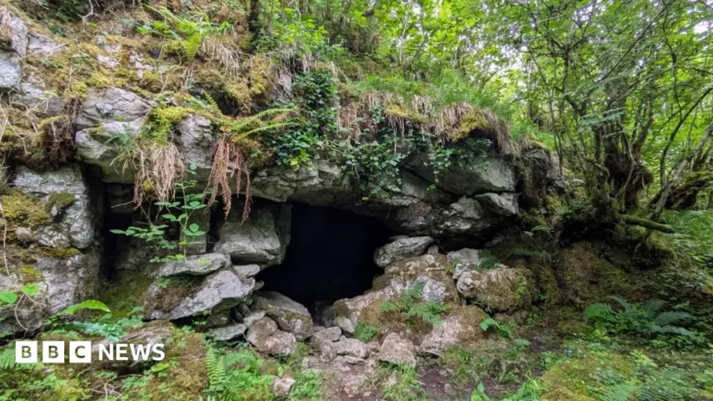
The consortium drew expertise from prestigious institutions including University College Dublin and the University of Adelaide, alongside specialized academic contributors from Dubai, Wales, and Portugal. By combining LiDAR scanning, geological sediment analysis, speleothem dating, and rigorous stylistic evaluations of cave markings, the team successfully identified and authenticated eight distinct cave sites across south-west Ireland bearing the unmistakable artistic and symbolic signatures of Upper Palaeolithic makers.
Supporting Context & Metrics: Navigating the Ice Age Ecosystem
Reconstructing a vanished ecosystem from 15,000 years ago requires a synthesis of paleoclimatology, paleobotany, and mammalian zoology. The conditions that greeted the earliest Welsh pioneers in Ireland were severe, yet rich enough to sustain human survival.
Climate and Atmospheric Conditions
The climate of the Lost Land Bridge and the emerging Irish coastal fringes was unforgiving. Summertime temperatures typically plummeted between -10°C and -20°C, while winters were characterized by deep, persistent snowpacks and howling polar winds. Despite these freezing conditions, the region was not a sterile glacial desert.
The soil, though heavily influenced by permafrost, supported specialized flora capable of thriving in extreme cold. Hardy sedges, resilient mosses, and crustose lichens formed a low-lying vegetative mat across the landscape, providing the primary trophic foundation for a thriving biomass of large herbivores.
Megafauna and the Hunter-Gatherer Economy
For the hunter-gatherers making the crossing from Pembrokeshire, the land bridge served as a natural buffet. The fragile yet fertile soils sustained impressive herds of megafauna that are now entirely extinct or localized to remote sub-arctic regions. Faunal remains and ecological models suggest the corridor was roamed by:
- Woolly Mammoths: The iconic heavy-coated pachyderms browsing on tough tundra vegetation.
- Wild Horses (Equus caballus): Agile herds capable of navigating frozen terrain and providing high-yield protein and hide resources for nomadic humans.
- Steppe Bison: Massive bovids that offered substantial amounts of meat, fat, and durable bone material for toolmaking.
- Reindeer (Rangifer tarandus): Essential animals whose antlers, sinews, and hides were cornerstones of Upper Palaeolithic survival technology.
+--------------------------------------------------------------------------+
|                  THE ICE AGE CORRIDOR (15,000+ YEARS AGO)                |
+--------------------------------------------------------------------------+
|  Pembrokeshire (Wales) <====== 46-Mile Plateau ======> Rosslare (Ireland)|
|                                                                          |
|  • Climate: Summer temps -10°C to -20°C                                  |
|  • Flora: Hardy sedges, mosses, lichens                                  |
|  • Fauna: Mammoths, wild horses, steppe bison, reindeer                  |
|  • Human Activity: Upper Palaeolithic hunter-gatherer expansion          |
+--------------------------------------------------------------------------+
The Technological Imperative
Surviving in this environment demanded advanced survival technology. The pioneers crossing the Welsh-Irish bridge possessed sophisticated flint-knapping skills, specialized clothing production techniques utilizing bone needles, and complex communal organization strategies. The discovery of cave art indicates that these groups also shared a rich symbolic culture, using visual expression to map territories, ritualize hunting successes, or communicate across generational lines.
Official Statements and Expert Analysis
The announcement of the Lost Land Bridge Project’s findings has generated immense excitement within the global archaeological community, prompting reflections from leading figures on the nature of prehistoric human mobility.
Dr. George Nash, coordinating lead of the project and senior researcher at the University of Liverpool, emphasized the psychological and practical inevitability of the migration:
"I had always believed—from what I had gleaned throughout my career about human movement during the Upper Palaeolithic period—that it was completely inconceivable that prehistoric people would not have utilized the extraordinary opportunity the pathway presented. When you have a rich, game-filled plateau stretching coast-to-coast, hunter-gatherers go where the food and survival resources are. They did not recognize modern geopolitical borders; they recognized survival."
Reflecting on the collaborative nature of the discovery, Dr. Nash noted the vital contributions of his international colleagues:
"This was never a solo endeavor. To verify art of this antiquity requires absolute precision. By bringing together experts in speleology, geomorphology, and Palaeolithic iconography from institutions spanning Dublin to Adelaide, we have built an airtight case that places humans in Ireland 5,000 years earlier than previously documented."
Other members of the multi-disciplinary team have echoed these sentiments, pointing out that the discovery forces textbooks to be rewritten regarding maritime capabilities and terrestrial expansion during the tail end of the Ice Age. While traditional models assumed Ireland remained isolated until watercraft technology evolved sufficiently for intentional sea crossings, this new evidence proves that Mother Nature provided a ready-made land bridge long before boats became strictly necessary.
Future Outlook: The Next Phase of Irish Palaeolithic Research
The identification of these eight cave sites in south-west Ireland is merely the tip of the iceberg. As academic protocols shift to accommodate this newly minted timeline, the international research team is already planning the next phases of investigation.
Advanced Dating and Non-Invasive Mapping
Future operations will focus heavily on non-invasive laser scanning, micro-stratigraphic analysis of cave sediment floors, and advanced Uranium-Thorium dating of the calcite flowstones encrusting the rock art. These techniques will provide even tighter chronological parameters, allowing researchers to determine whether the cave sites represent a single migration event or multiple seasonal crossings over hundreds of generations.
Expanding the Search Radius
Geomorphologists are currently reviewing regional elevation models of the seabed and coastal topography to identify other submerged or hidden cave systems that may have escaped initial notice. Given that much of the ancient coastal landscape is now submerged beneath the Irish Sea, underwater archaeology will likely play a crucial role in uncovering further evidence of camps, hearths, and tool-manufacturing sites along the former shoreline of the Lost Land Bridge.
Rewriting the Educational Narrative
Beyond field excavations, the findings present an exciting challenge for public education and museum curation. Heritage authorities in both Ireland and Wales are already discussing collaborative exhibitions to showcase the shared ancestral heritage of the two nations. By illuminating the deep historical ties forged during the depths of the Ice Age, this discovery bridges past and present, offering a profound reminder of human resilience, adaptability, and the innate drive to explore the unknown.



