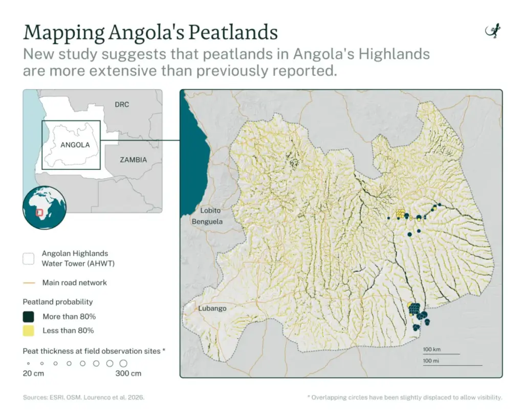
Deep within the high-altitude landscapes of southwestern Africa, a critical ecological treasure trove has been hiding in plain sight. According to a landmark study published on August 20 in the Philosophical Transactions of the Royal Society, the Angolan Highlands Water Tower (AHWT)—locally revered as Lisima Lya Mwono, or "The Source of Life"—harbors vastly more peatland than previously understood.
Spanning an expansive 380,382-square-kilometer (146,866-square-mile) region, the AHWT acts as a grand hydrological engine for central and southern Africa. It stores and gradually releases the freshwater resources that feed vital cross-border systems, most notably the Okavango Basin and the iconic Okavango Delta in neighboring Botswana.
Led by geospatial ecologist and data analyst Mauro Lourenço of the Wild Bird Trust, an international coalition of researchers combined high-resolution satellite imagery with rigorous, boots-on-the-ground expeditions. Their findings estimate that peatlands cover between 2.28% and 2.94% of the entire AHWT landscape. Specifically, the study mapped 8,662 square kilometers (3,344 square miles) of peatland with high certainty (81–100% probability) and an additional 11,167 square kilometers (4,311 square miles) with lower certainty (51–100% probability).
While peatlands cover only about 3% of the global land surface worldwide, they are disproportionately powerful carbon sinks, housing up to one-third of all global soil carbon. In the Angolan Highlands, however, these subterranean carbon reservoirs are increasingly threatened by anthropogenic pressures—principally subsistence agriculture, soil drainage, and unregulated fires. With samples revealing that some of this stored carbon is up to 11,000 years old, conservationists warn that once these carbon sinks are compromised, the emissions are virtually irrecoverable within human timeframes.
This comprehensive mapping effort provides a critical baseline for policymakers, offering the data required to integrate peatland preservation into Angola’s national climate strategies and formalize protection for a landscape that sustains millions of lives and globally significant biodiversity across southern Africa.
Detailed Chronology of the Research
The realization that Angola harbors significant peat deposits is a relatively recent development in African conservation science, emerging from years of dedicated, multidisciplinary exploration.
Pre-2020 (Historical Blind Spots): For decades, the peatlands of the Angolan Highlands remained largely unstudied and omitted from global carbon models. Decades of conflict during the Angolan civil war left vast swathes of the interior heavily mined, rendering comprehensive field research dangerous and practically impossible.
2020–2022 (Initial Remote Sensing): Mauro Lourenço and his colleagues began focusing intensive research efforts on the AHWT. Early remote-sensing assessments covered a smaller subset of the region (61,590 square kilometers or 23,780 square miles), producing preliminary estimates that pointed toward hidden pockets of organic-rich soils. This phase culminated in foundational publications that established the presence of tropical peatlands trapping carbon and cleaning regional water.
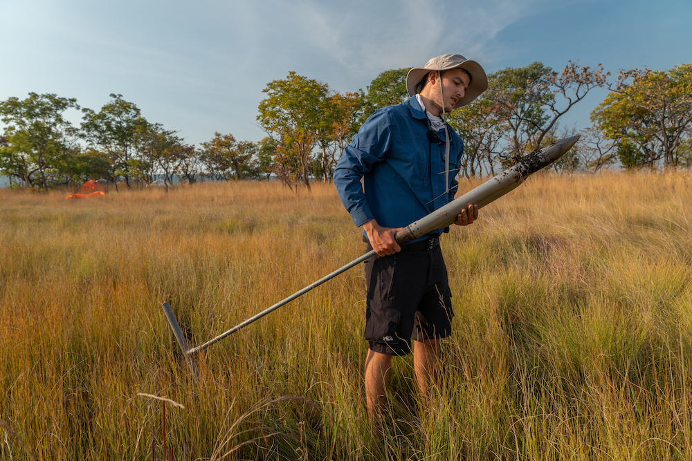
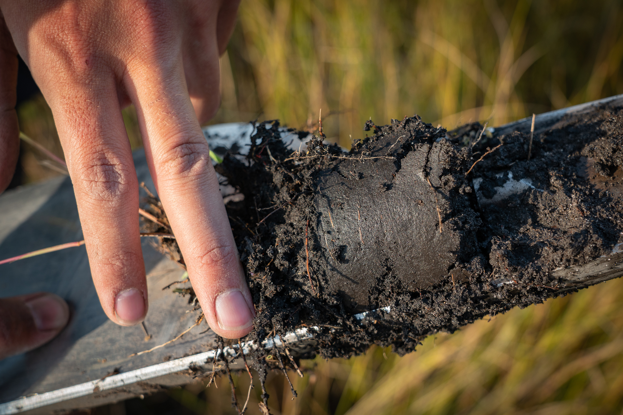
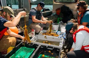
The Field Expedition Phase (2024–2025): Transitioning from purely digital observation to empirical validation, researchers executed five distinct field expeditions targeting 51 high-probability sites identified through Sentinel-2 Earth observation satellite data. Because landmines remained a persistent hazard, teams relied on specialized clearance organizations like the Halo Trust to clear access paths safely. Scientists extracted core soil samples to analyze the physical and chemical characteristics of the peat, confirming its ancient origins.
October 2025 (Ramsar Designation): Recognizing the hydrological importance of the region, the Angolan government officially designated a sprawling 53,000-square-kilometer (20,463-square-mile) area within the AHWT as the country’s first Ramsar Site, or Wetland of International Importance. This milestone cemented the landscape’s global value for its sponge-like ability to filter and steadily release freshwater.
August 20, 2026 (Publication of the Probabilistic Map): The culmination of years of satellite analysis and field verification was published in the Philosophical Transactions of the Royal Society. The study scaled up the mapping initiative across the entirety of the 380,382-square-kilometer water tower, establishing the definitive probabilistic footprint of Angola’s tropical peatlands.
Supporting Context and Metrics
To fully grasp the significance of the new Angola mapping initiative, one must understand the unique mechanics of peatlands and the geographical scale of the AHWT.
The Science of Peat and Carbon Storage
Peatlands are terrestrial wetland ecosystems where waterlogged conditions prevent plant material from fully decomposing. Over millennia, this accumulating organic matter forms a thick, spongy layer of soil known as peat.
Global Footprint: Peatlands occupy roughly 3% of the Earth’s terrestrial surface.
Carbon Capacity: Despite their modest geographical footprint, peatlands store an estimated 33% (up to one-third) of all global soil carbon.
Ancient Reserves: Laboratory analyses of core samples extracted during the Angolan expeditions revealed that portions of the carbon locked within these tropical peats are up to 11,000 years old.
Geographical Scale and Hydrological Impact
The Angolan Highlands Water Tower (Lisima Lya Mwono) is a massive geographical feature defined by its ability to produce extraordinary volumes of water relative to its size.
Total AHWT Area: 380,382 square kilometers (146,866 square miles).
Total Proportional Coverage: Peatlands account for between 2.28% and 2.94% of the entire water tower.
Cross-Border Lifeline: Water flowing out of the AHWT feeds major regional arteries, including the Okavango River basin, eventually terminating in Botswana’s Okavango Delta—a UNESCO World Heritage site and one of the planet’s premier inland delta systems. Furthermore, these flows nourish the Kavango-Zambezi Transfrontier Conservation Area (KAZA), the largest terrestrial transboundary conservation zone in the world.
Official Statements and Expert Insights
The collaborative nature of the research—spanning local non-profits, academic institutions, and international conservation giants—brings diverse perspectives on what these findings mean for the future of Angola and southern Africa.
Lead author Mauro Lourenço, a geospatial ecologist and data analyst at the Wild Bird Trust, emphasized the vital intersection of regional water security and carbon governance in an email interview:
“[The Angolan Highlands Water Tower] is crucial for water security, development, and ecosystem services in Southern African countries. The groundwater-fed peatlands store carbon, regulate river flow and sustain water supplies far beyond Angola, yet remain remarkably understudied.”
Lourenço noted that prior to this research, decision-makers lacked spatial clarity on where these vital resources were concentrated:
“Our map provides a timely baseline for protecting them before significant degradation takes place.”
Sekgowa Motsumi, the Okavango Program Director for the Nature Conservancy (TNC) and a study co-author, highlighted the existential stakes of maintaining the water tower’s ecological integrity during a video interview:
“Without the Angolan Highlands Water Tower and its peatlands, that water doesn’t drain into the landscape. And without water, there’s no biodiversity—the very biodiversity this region is known for globally.”
Motsumi also stressed the broader regional implications:
“These peatlands are foundational to the Kavango-Zambezi Transfrontier Conservation Area. Protecting them secures the ecological life support system for communities and wildlife traversing multiple national borders.”
Addressing the severe threats posed by land management practices, Shannon Flaugh, a conservation scientist at TNC, warned about the permanence of peat degradation:
“Once that carbon is lost, we’re not going to sequester it again within our lifetimes. We are actively working with local communities to co-design solutions and peatland conservation strategies, which include the improved management of fires.”
Future Outlook: Challenges and Conservation Pathways
While the publication of the probabilistic map marks a major scientific triumph, the road ahead for Angolan peatland conservation is fraught with complex socioeconomic and administrative challenges.
Pressing Threats
Agricultural Expansion and Drainage: The Luchazi people and other rural communities inhabiting the highlands rely heavily on subsistence farming and hunting. To clear space for crops, traditional and emerging farming practices often involve ditching and draining wetlands. Draining peat exposes it to oxygen, breaking down the organic matter and releasing massive volumes of carbon dioxide into the atmosphere.
Unregulated Fire Regimes: Fire is frequently used as a tool for land clearance across the region. Uncontrolled or poorly timed fires can ignite dry surface peat layers, triggering smoldering underground fires that release thousands of years of sequestered carbon in a matter of days.
Policy and Protection Gaps: Currently, the Angolan highlands lack comprehensive formal protection under national conservation laws. Only about 11% of Angola’s terrestrial territory is under formal protection, falling drastically short of the international Kunming-Montreal Global Biodiversity Framework target, which commits nations to safeguarding 30% of their land and seas by 2030.
Pathways to Action
Integrating Peat into Climate Commitments: Conservation partners like TNC, the Wild Bird Trust, and Fundação Lisima are working closely with the Angolan government to incorporate peatland carbon accounting into the country’s Nationally Determined Contributions (NDCs) under the Paris Agreement. By factoring peat into its national climate pledges, Angola can position itself as a regional leader in climate mitigation, distinguishing itself from nations focusing solely on adaptation.
Community-Led Stewardship: Recognizing that local livelihoods are intertwined with the health of the wetlands, conservation strategies are shifting toward collaborative models. Co-designed fire management programs and sustainable agricultural training aim to reduce anthropogenic pressures while respecting the cultural heritage and economic needs of indigenous communities.
Expanding Research Frontiers: Researchers emphasize that the newly mapped peatlands in the AHWT likely represent only a fraction of Angola’s true peat inventory. Future scientific expeditions are slated to examine other major, largely unmapped floodplain and river systems across the country, such as the Cameia, Luena, Cuando/Luanginga, and Congo river tributaries.
Ultimately, the mapping of the Angolan Highlands Water Tower transforms an invisible ecological asset into a visible focal point for global climate action. By safeguarding Lisima Lya Mwono, Angola holds the key not only to its own sustainable development, but to the hydrological and climatic stability of the entire southern African subcontinent.