The American Southwest stands at a precipice of unprecedented socio-ecological vulnerability. For over a century, the sprawling metropolitan centers, vast agricultural enterprises, and industrial engines of seven U.S. states have relied on a single, increasingly depleted hydrological lifeline: the Colorado River. Today, that lifeline is fracturing under the relentless weight of climate change, structural over-allocation, and decades of political paralysis.
With regional stakeholders failing to reach a consensus after more than ten years of fractious negotiations, the federal government has announced a sweeping, mandatory allocation scheme set to take effect this October. This unprecedented intervention will impose dramatic reductions—slashing up to 40 percent, or more than 3 million acre-feet annually—from the water supplies of the Lower Basin states of California, Arizona, and Nevada.
The consequences threaten to redraw the map of human habitation in the arid West. As critical infrastructure like the Central Arizona Project faces existential threats of reduction or shutdown, 40 million citizens, tribal nations, and multibillion-dollar agricultural sectors are forced to confront an uncomfortable truth: the hydrological ledger of the 20th century can no longer sustain the 21st century.
Detailed Chronology: A Century of Over-Allocation and Deferred Reckoning
To understand the gravity of the modern crisis, one must trace the historical trajectory that transformed an arid frontier into a bustling web of modern metropolises.
1922: The Original Sin of the Compact
The legal architecture governing the American Southwest was forged in an era of hydrological naivety. In 1922, representatives from the Upper Basin states (Colorado, New Mexico, Utah, and Wyoming) and the Lower Basin states (Arizona, Nevada, and California) convened to sign the Colorado River Compact. At the time, the region was sparsely populated. Nevada was a quiet enclave of barely 2,000 residents; Los Angeles hovered around half a million; and Phoenix was a modest agricultural outpost of roughly 30,000 people.
Operating under limited historical data, the framers of the Compact divided the river’s bounty neatly in half, awarding 7.5 million acre-feet annually to the Upper Basin and 7.5 million acre-feet to the Lower Basin—a total allocation of 15 million acre-feet. An acre-foot represents enough water to cover a football field to a depth of one foot, equivalent to roughly 326,000 gallons (1.2 million liters).
The fatal flaw of the 1922 agreement was its baseline assumption: that the river’s flow would remain reliably abundant. Data gathered over subsequent decades revealed that this allocation was based on an unusually wet hydrological period. The river simply never possessed that much water on a consistent annual basis.
The Decades of Explosive Growth
Buoyed by guaranteed legal access to fresh water, the Southwest experienced an economic and demographic explosion. Canals, reservoirs, and federal reclamation projects coaxed the desert into bloom.
Today, the demographic reality bears little resemblance to the 1920s. Phoenix now hosts 1.7 million residents, with an additional 4 million inhabiting its sprawling suburban periphery. Los Angeles anchors a metropolitan network of 12 million souls. Las Vegas has mushroomed from a dusty outpost into a desert oasis supporting 700,000 residents within city limits and 2 million regionally.
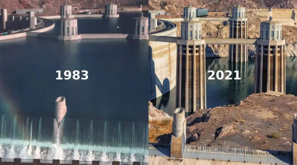
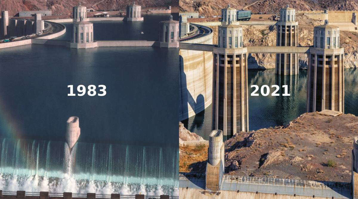
This vast human and economic footprint has been entirely underwritten by the Colorado River and its subterranean aquifers. However, as populations soared, the river’s actual output dwindled. Today, the Colorado supplies a meager 12 million acre-feet to the seven states—a persistent deficit that has steadily drained vital storage reservoirs like Lake Mead and Lake Powell.
The Breakdown of Interstate Diplomacy
For more than a decade, state delegations, municipal water authorities, and federal mediators have attempted to negotiate a modernized sharing agreement. These talks have routinely collapsed under the weight of competing regional interests. California, wielding senior water rights and immense political leverage, has historically resisted bearing the brunt of reductions. Arizona, bound by historical compromises, faced the prospect of disproportionate losses.
Despite repeated federal warnings, cajoling, and implicit threats of unilateral intervention, the states remained gridlocked. Recognizing that the current interim guidelines are set to expire this fall, the federal government stepped into the vacuum, asserting its operational control over major federal dams to force a structural reset.
Supporting Context & Metrics: The Anatomy of a Hydrological Crisis
The mathematics of the Colorado River basin present an unforgiving reality. Modern hydrological assessments indicate that stabilizing the river system requires removing more than 3 million acre-feet of consumption annually—roughly a quarter of the river’s average natural flow. Even these steep reductions may prove insufficient during multi-year megadroughts exacerbated by atmospheric warming.
The 40 Percent Reduction Framework
Under the newly minted federal blueprint slated for implementation, the Lower Basin states face draconian cuts. Reports from The Guardian outline a ten-year strategy that could strip up to 3 million acre-feet per year from California, Arizona, and Nevada. For the initial years of 2027 and 2028, allocations will immediately drop by 1.25 million acre-feet, with provisions for escalating penalties depending on snowpack and reservoir elevations.
The Central Arizona Project (CAP) and the Faustian Bargain
No piece of infrastructure better illustrates the region’s high-stakes dependency than the Central Arizona Project (CAP). Authorized in 1968 after decades of intense legislative maneuvering, the CAP is a 366-mile concrete artery stretching southeast from Lake Havasu down to Tucson. Before its construction, Arizona relied heavily on deep underground aquifers, depleting them at an unsustainable rate. Without the CAP, modern Phoenix—with its endless grids of master-planned communities and commercial corridors—would simply not exist. Phoenix currently draws approximately 40 percent of its municipal water supply from the canal.
However, bringing the CAP through Congress required a fateful concession. Arizona was forced to enter into a legal subordinate relationship with California, stipulating that in times of extreme shortage, California’s claims to the Colorado River take precedence over Arizona’s junior rights.
As the federal cuts loom, that historical compromise has transformed into an immediate threat. In a worst-case scenario where river volumes plunge further, the CAP could face severe operational curtailments or even complete shutdown. Such an outcome would trigger an unprecedented socioeconomic shockwave across the desert Southwest.
The Disparity in Pricing and Agricultural Overuse
A critical element largely missing from mainstream political discourse is the profound disparity in water pricing. Agricultural and industrial consumers—who utilize the vast majority of Colorado River water distributed via the CAP and other regional networks—frequently pay a fraction of the rates charged to residential users.
State and local authorities historically established these subsidized pricing structures to attract commercial enterprises, boost employment, and expand the municipal tax base. Farmers capitalized on cheap water to cultivate highly water-intensive crops such as alfalfa, hay, and lettuce (which is roughly 95 percent water) in an arid desert climate. As hydrologists and economists frequently warn, maintaining artificially low prices for water-intensive industries in a drying basin accelerates systemic exhaustion, risking a future where water is unavailable at any price.
Official Statements and Stakeholder Perspectives
The federal government’s top-down intervention has elicited a spectrum of reactions, ranging from profound anxiety to sharp criticism over political expediency.
Academic and Environmental Warnings
Independent experts have raised alarms that the ten-year federal plan may ultimately exacerbate systemic instability. Noah Garrison, a water researcher at the UCLA Institute of the Environment and Sustainability, characterized the intervention as a temporary fix.
"This just kicks the can down the road," Garrison noted when the outline of the plan was first released. "There is a potential for extremely serious consequences if we don’t address this. We’re putting the water supply for 40 million people at risk."
Dr. John Berggren, regional policy manager at Western Resource Advocates, echoed these sentiments, emphasizing that marginal adjustments are no longer viable.
"In order to best protect the system, there needs to be pretty significant shortages," Berggren stated. "We’re going to have to do more."
Municipal Desperation and Infrastructure Costs
At the municipal level, leaders are grappling with the immediate fiscal and infrastructural fallout. Brenda Burman, general manager of the Central Arizona Project, underscored the sheer absurdity of imagining a dry canal network:
"They are threatening to shut down the Southwest. It’s not possible to picture it."
In Phoenix, Mayor Kate Gallego has called on the federal government to provide substantial financial backing for advanced purification infrastructure—specifically multi-billion-dollar facilities capable of recycling wastewater into potable drinking water.
"Given the magnitudes of these cuts, we would like them to step up in a really big and meaningful way," Mayor Gallego urged, drawing parallels between regional water scarcity disaster relief and federal hurricane recovery funding. However, analysts note that shifting political winds and proposed rollbacks to federal disaster management agencies render such federal assistance increasingly uncertain.
Tribal Rights and Historical Tensions
Adding another layer of complexity to the allocation battle is the status of Indigenous tribal communities. Many Native American tribes possess senior water rights within the Colorado River basin, a reality frequently sidelined in early 20th-century negotiations. As modern distribution schemes are re-evaluated, tribal leaders are demanding full recognition of their legal entitlements. This dynamic has sparked friction with municipal newcomers, as Indigenous nations assert priority claims that challenge decades of established non-Native usage patterns.
Future Outlook: Navigating the Climate Cliff
The underlying driver of the Colorado River crisis is a rapidly shifting global climate system. Climatologists point to compounding pressures across the Rocky Mountains: diminishing winter snowpack and accelerated spring melt-offs driven by higher average ambient temperatures. Yet, regional planning frameworks have frequently proceeded with business-as-usual momentum, sustained by political lobbies and legacy special interests.
As the October deadline approaches for the implementation of the new federal allocation plan, the American Southwest faces a defining crossroads. The choices made today will determine whether the region transitions toward an era of radical conservation, technological innovation, and sustainable resource management, or stumbles blindly toward a systemic societal collapse.
The warning signs are unmistakable. Whether civil society possesses the collective foresight to heed scientific consensus—or whether it chooses to repeat historical patterns of willful ignorance—remains the central question of our era. In the words of modern environmental historians, humanity stands at the edge of a climate precipice, where the light of reason must guide policy before the natural world delivers a verdict from which there is no return.