

Originally reported by Capital & Main
Executive Overview
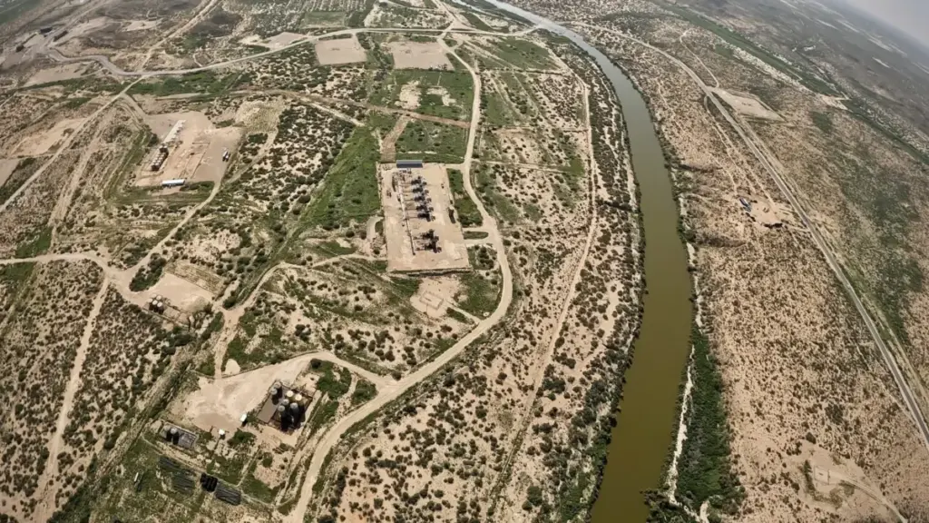
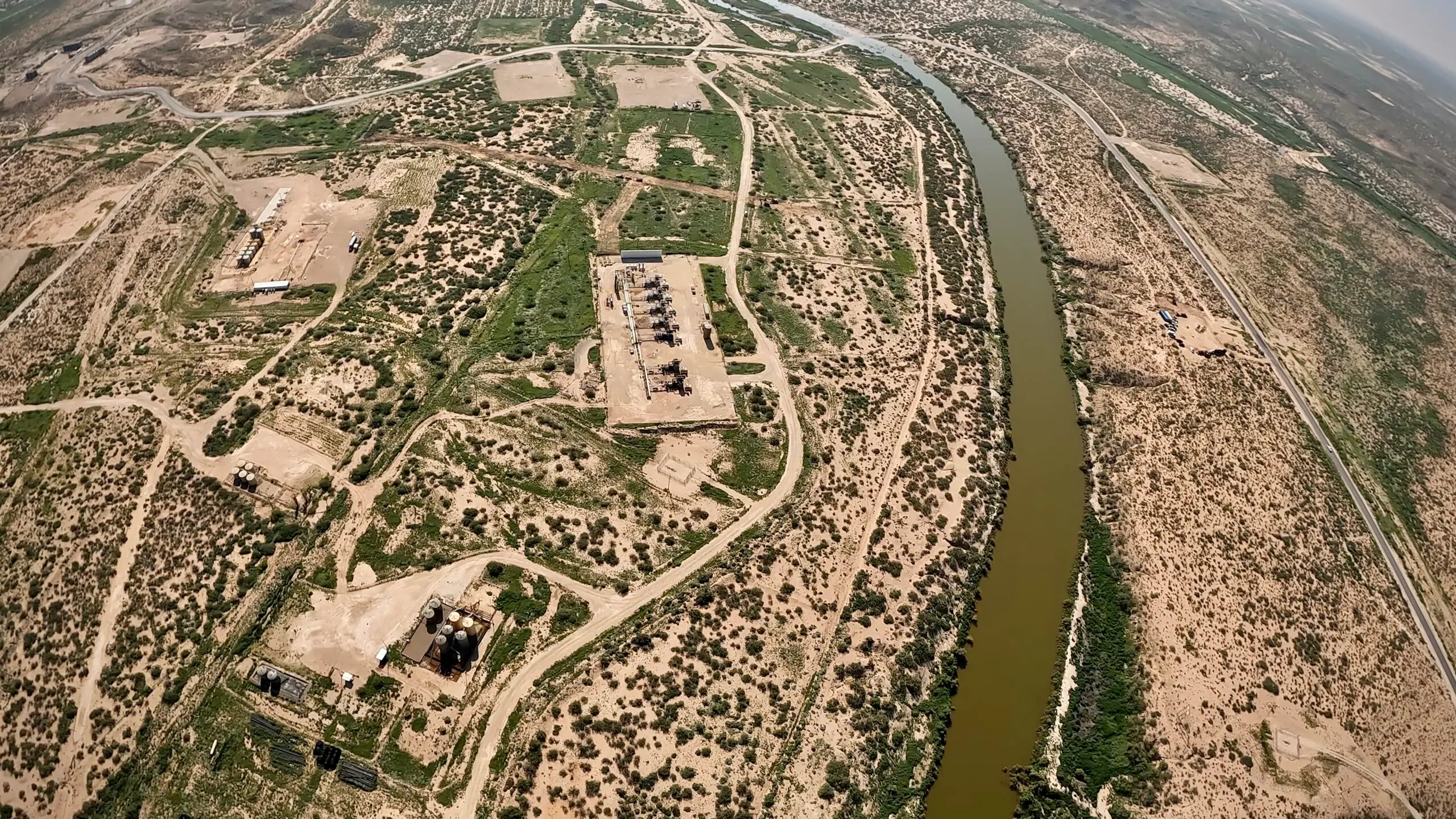
In the sun-baked expanses of southern New Mexico, a profound ecological contradiction plays out every single day. Just a mile upstream from where the Black River empties into the Pecos River, an idyllic stretch of clear water gurgles through tall grasses while dragonflies hover in the humid air. Yet, this fragile riparian oasis exists in the middle of an industrial crucible. Towering flares burn continuously, heavy semi-trucks rumble relentlessly across nearby bridges, and thousands of drilling rigs pierce the horizon.
This is the southeastern corner of New Mexico—the western edge of the Permian Basin, one of the most prolific and aggressive fossil fuel extraction zones on the planet. Here, the pursuit of energy has fundamentally altered the landscape, the atmosphere, and the hydrological cycle.
Charlie Barrett, a thermographer with the industry watchdog group Oilfield Witness, encapsulates the grim irony of the region with a blunt assessment: "It’s a beautiful river in the middle of a hellscape."
As global climate change exacerbates severe, long-term drought conditions across the American Southwest, the Pecos River is running dangerously low. But the river’s struggle is not merely a byproduct of changing weather patterns. It is directly besieged by the very industry dominating its banks: an oil and gas boom that generates staggering volumes of toxic wastewater, pumps greenhouse gases into the atmosphere, and places unprecedented stress on an already over-allocated watershed.
With state and federal policies shifting to accommodate fossil fuel production—often at the expense of environmental safeguards—the Pecos River stands as a frontline indicator of the steep ecological costs of America’s energy independence.
Detailed Chronology: A Day in the Field with Oilfield Witness
The May Afternoon: Discoveries at the Pullout
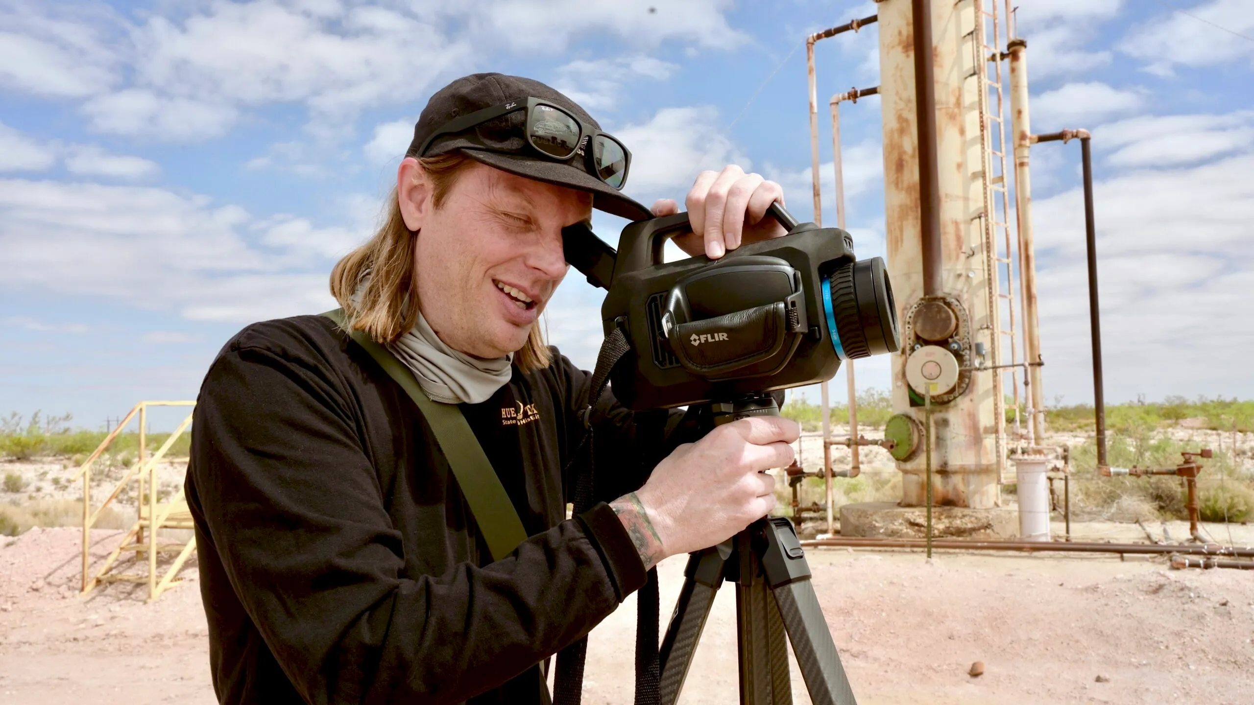
It is an early May afternoon under a mercilessly cloudless New Mexican sky. Charlie Barrett has parked his pickup truck in a county road pullout just a few hundred feet from the Black River. He is there to perform routine surveillance on a nearby oil and gas facility, deploying an advanced video camera capable of detecting heat signatures and invisible hydrocarbon gases.
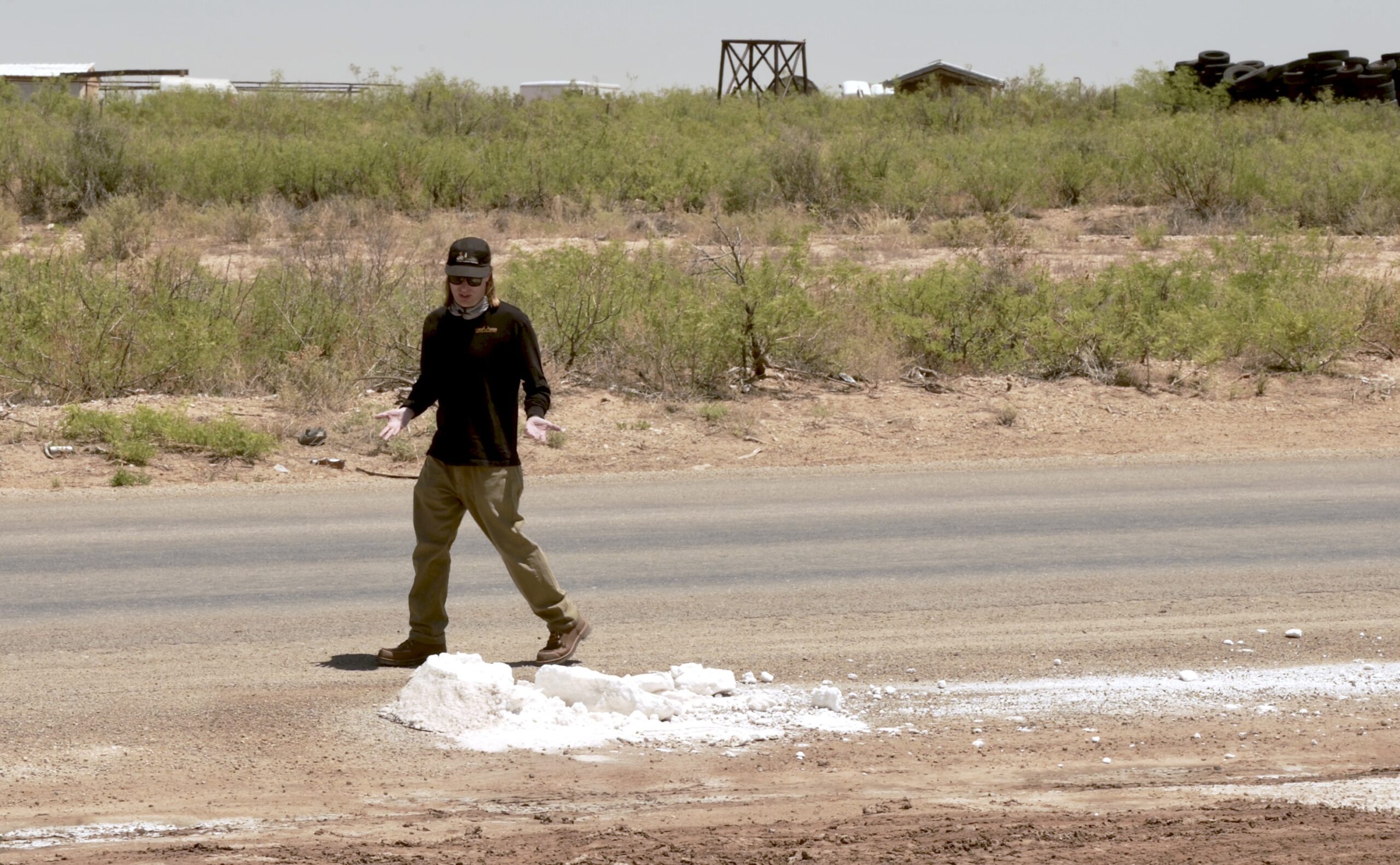
Stepping out of the driver’s side, Barrett notes that the pullout is uncharacteristically muddy and slick, dotted with puddles—an anomaly given the region’s persistent drought. Protruding from a puddle flecked with shimmering white crystals is a solid, gray chunk of salt roughly the size of a medicine ball.
"Unfortunately, this is pretty common," Barrett notes, staring down at the residue. "It’s also quite dangerous."
The diagnostic signs point to an illegal or accidental dumping of oilfield wastewater—locally referred to as "produced water." This extremely saline and toxic byproduct of oil and gas extraction carries a lethal cocktail of petroleum compounds, heavy metals, and synthetic chemicals. Frequently, it is also radioactive. Barrett’s primary concern is that unsuspecting motorists will pull off the road, drive through the muck, or walk through the toxic residue, tracking hazardous materials into their vehicles and homes.
The Thermal Lens: Uncovering Violations
Returning to his equipment, Barrett sets up his optical gas imaging camera and begins to film the nearby infrastructure. As trucks carrying produced water rumble past on the adjacent highway, the camera’s viewfinder transforms the invisible into vivid, wavy, candy-colored hues.
Looking through the screen toward a residential property, Barrett’s frustration mounts.
"Oh, man, that’s fucking terrible," he mutters.
The thermal imagery clearly exposes the heat signatures of three active industrial flares burning in uncomfortably close proximity to a family home.
"Got a person’s home here and then this mess — all producing CO2 and methane and other volatile organic compounds, blowing right into their home," he says, shaking his head. "Jesus, man. It’s ridiculous."
When Barrett uploads and analyzes the footage later on a high-resolution screen, the situation proves even worse than initially thought. The thermal data reveals four distinct flares burning simultaneously in a single camera shot. This flagrant display occurs despite a sweeping New Mexico state ban on nearly all routine flaring implemented in 2022.
Along the Pecos: A River Under Siege
Later that afternoon, Barrett sits quietly on a boulder along a peaceful bend in the Pecos River. The acoustic contrast is jarring: the soothing sounds of flowing water and rustling grasses are repeatedly interrupted by the concussive thrum of heavy-duty oilfield transport trucks crossing a nearby bridge.
For Barrett, the physical proximity between the pristine river and the sprawling industrial complex highlights an ecological crisis in real time. Months prior, during a previous inspection of the exact same spot, Barrett found the entire road and riverbank flooded with thick salt deposits.
"I mean, the whole road was flooded over," he recalls. "We couldn’t confirm one way or another if that was an actual produced water spill, but there are few other possibilities."
Such an event would represent just the latest environmental shock for a river system already pushed to the absolute brink by a century of anthropogenic interference, water diversions, and accelerating climate change.
Supporting Context & Metrics: The Anatomy of the Permian Crisis
The Wastewater Deluge
The extraction of oil and gas in the Permian Basin yields far more than just hydrocarbons; it produces an astronomical volume of wastewater. On average, for every single barrel of crude oil extracted in New Mexico, more than three barrels of toxic produced water come up from the subterranean depths.
As fossil fuel production in the basin has skyrocketed, the volume of wastewater has scaled exponentially. Furthermore, as oilfields and individual wells age, they undergo a geological process known as "watering out," wherein the ratio of water to oil steadily increases.
With state regulations strictly prohibiting the use of produced water for anything outside of oilfield operations, the industry relies on a massive, parallel infrastructure network:
- Transportation: Hundreds of semi-trucks haul wastewater daily across local roads to disposal stations.
- Reinjection: Millions of gallons are pumped deep underground into disposal wells.
This massive subterranean injection has triggered documented consequences, including a sharp spike in regional seismic activity (earthquakes) and catastrophic industrial failures, such as high-pressure blowouts that have sent 70-foot geysers of toxic wastewater shooting into the New Mexican air.
The Geography of the Pecos River
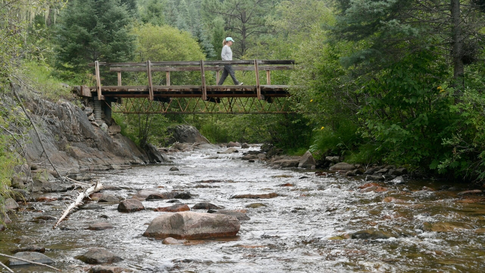
The Pecos River is not merely a local waterway; it is a geographic and historical lifeline. Originating in the high, pine-covered slopes and steep canyons east of Santa Fe—earning it a prestigious National Wild and Scenic River designation—the river rushes south for more than 500 miles before crossing into Texas at New Mexico’s lowest elevation.
Along its upper reaches, it sustains diverse ecosystems, farms, and ranches. However, by the time it exits New Mexico, the river has been transformed into a tightly managed, heavily monitored conduit flowing directly through the heart of the Permian Basin.
According to data compiled by American Rivers, which named the Pecos one of the nation’s most endangered rivers in 2021 and again in 2024, the waterway is buckling under immense anthropogenic pressure:
- 380: The number of active oil and gas wells located within just a half-mile of the Pecos River in New Mexico.
- 11: The number of wastewater injection wells operating within that same narrow riparian corridor.
- 75,000: The total square mileage of the Permian Basin, spanning 55 counties across New Mexico and Texas.
Official Statements & Regulatory Shifts
State-Level Challenges: The 50-Year Water Action Plan
As New Mexico faces a hotter, drier future driven by global climate change, water management has become an existential administrative challenge. U.S. Geological Survey data spanning four decades reveals a steady, alarming decline in annual snowpack in the mountains surrounding the Pecos River’s headwaters.
Hannah Riseley-White, director of the New Mexico Interstate Stream Commission, manages the heavy burden of ensuring the state meets its legal water allocation obligations.
"Everyone this spring got tired of me at the beginning of every meeting screen-sharing the snowpack figures for all of the basins that we manage," Riseley-White said. "It fell off the cliff. It wasn’t just record-breaking. It was beyond anything that we could have imagined in terms of snowpack."
Long-term projections are equally grim. Riseley-White notes that the state’s official 50-Year Water Action Plan, commissioned by Gov. Michelle Lujan Grisham, anticipates a staggering 25% to 30% decrease in river water availability by the year 2070.
Faced with this impending aridification, the state water plan explores alternative water sources—including the possibility of treating oilfield produced water to industrial purity standards so it can be safely repurposed outside of the oilfield.
However, this proposal has sparked intense controversy. The oil and gas industry strongly advocates for repurposing and discharging treated wastewater into local river systems. Conversely, environmental groups and local watchdogs strongly oppose the initiative, arguing that current water-treatment technologies cannot guarantee the complete removal of all radioactive isotopes and complex organic chemicals.
While legal and regulatory pushes to alter New Mexico’s discharge rules have faced fierce resistance and administrative hurdles, neighboring Texas faces similar battles, with the Texas Sierra Club tracking multiple proposals to discharge treated produced water into the Texas portion of the Pecos River watershed.
"Do I think [treated] produced water will solve all of our problems in the Pecos? No," Riseley-White acknowledged. "But thinking about it as one of the many sort of tools in the toolbox I think makes sense… It’s just a question of whether financially the incentives are there."
Federal Policy Rollbacks and Wildlife Impacts
Compounding regional water stress are recent federal regulatory changes from Washington that weaken environmental protections across the Pecos watershed.
Historically, the river valley has provided critical habitat for vulnerable and endangered species, including the dunes sagebrush lizard and the Texas hornshell mussel. However, regulatory protections have eroded rapidly:
- February 2026: The U.S. Fish and Wildlife Service formally stripped the lesser prairie chicken of its protections under the Endangered Species Act (ESA) despite declining population numbers.
- July 2026: The Department of the Interior executed a sweeping rollback of conservation standards by redefining the legal definition of "harm" to endangered species to mean only direct physical injury or death. Under this new rule, chronic disturbances like industrial noise and habitat fragmentation are no longer recognized as federal threats.
- Late July 2026: The department rescinded the foundational "blanket rule" that automatically extended threatened species the same robust protections given to endangered species, while mandating that federal agencies explicitly factor the economic costs—such as financial impacts on oil and gas production—into conservation decisions.
For ecologist Charlie Barrett, these federal rollbacks ignore the cumulative, systemic damage inflicted on wildlife by industrial buildout.
"The sound pollution and light pollution also affect this river ecosystem," Barrett notes, drawing on his professional background in wildlife management and ecology. "The oilfield disturbance drives a lot of species away from this ecosystem, which can lead to extirpation, which is regional extinction."
Future Outlook: Finding Balance in a Fragile Basin
The intersection of the Permian Basin and the Pecos River represents a profound crossroads for the American Southwest. On one side stands a multi-billion-dollar energy apparatus that powers modern society while driving regional aridification, atmospheric warming, and localized contamination. On the other stands a fragile, historic riverine ecosystem struggling to survive against vanishing snowpacks, industrial pollution, and weakened regulatory defenses.
Despite the immense structural and environmental hurdles, state officials maintain a cautious optimism that cooperative solutions remain possible.
"My hope in the Pecos is that as we face these challenges, we can get all of the different interests at the table and find solutions that make sense to everybody," Riseley-White concluded. "I think it’s challenging, but I think it’s definitely possible."
For watchdogs like Charlie Barrett, however, the reality on the ground demands unyielding vigilance. As long as tanker trucks rumble past fragile riverbanks, unpermitted flares burn beside residential homes, and toxic salt deposits dot the desert floor, the battle for the soul—and survival—of the Pecos River is far from over.



