Executive Overview
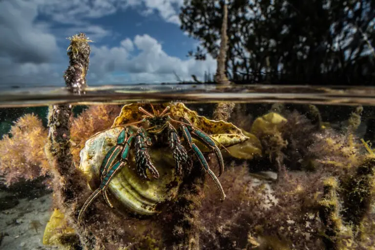
Mangrove forests have long stood at the volatile junction of land and sea, recognized by conservationists and coastal engineers alike for their vital ecosystem services. Among their most critical functions is acting as a natural buffer, shielding fragile coastlines from storm surges, tidal flooding, and the creeping threat of sea-level rise. When a tempestuous wave crashes into an outcrop of mangroves, its kinetic energy is absorbed by the dense, labyrinthine network of twisted, salt-tolerant roots. Emerging on the opposite side, the wave’s intensity is radically diminished, frequently sparing vulnerable human communities from catastrophic water damage.
While this wave-attenuation property is well-documented in scientific literature, a persistent knowledge gap has plagued coastal defense planning: nearly all empirical data supporting mangrove attenuation has been gathered during mild, calm weather periods. Quantifying how these coastal forests perform during extreme meteorological events—such as major typhoons and hurricanes—has historically been exceptionally difficult. Severe storms introduce complex variables, including intense turbulence, shifting wind dynamics, and unpredictable hydrodynamic friction, which traditional modeling frameworks struggle to parse.
This limitation has grown increasingly dangerous. Driven by climate change, extreme weather systems have intensified globally, impacting tens of millions of people in recent years through catastrophic flooding and high-impact storms. To bridge this critical data gap, an international team of researchers from the M5 lab (Mudflat, Marsh, Mangrove, Measurement & Modeling) at Sun Yat-sen University in Guangzhou, China, has pioneered a breakthrough predictive framework. Utilizing a novel equation known as the HU method, scientists can now use routine, calm-weather wave measurements to accurately predict how mangrove forests will diminish record-breaking, storm-driven waves. Published in Climate Risk Management, this research represents a paradigm shift in nature-based coastal engineering, providing vulnerable nations with a vital tool to deploy adaptive defenses before disaster strikes.
Detailed Chronology: Tracking Typhoon Yagi and the M5 Lab Breakthrough
The foundational groundwork for this breakthrough unfolded between August and September 2024, when researchers within the M5 lab captured high-resolution wave dynamics at a restored mangrove site along the Zhanjiang coast in southern China. Nature provided a rigorous stress test during this monitoring window in the form of Typhoon Yagi. Sweeping furiously through the Philippines and southern China in early September 2024, Yagi unleashed ferocious high-speed winds that generated unprecedented wave heights. Upon striking the frontline edge of the Zhanjiang mangrove forest, these storm-whipped waves reached nearly 0.9 meters (3 feet)—a record-breaking wave height ever recorded within a monitored mangrove ecosystem.
Despite the extreme power of Typhoon Yagi, the mangroves held their ground and performed their ecological duty with astonishing efficiency. Field data revealed that even these massive waves were drastically dissipated after washing through just a football-field length of mangrove forest, shrinking down to 0.36 meters (1.18 feet) in height. Across the entire monitoring duration, the Zhanjiang mangroves consistently slashed wave heights by 44% to 70%.
Following this rare empirical triumph, the M5 lab leveraged a second round of calm-weather data collected from the same Zhanjiang site in the spring of 2025. This allowed lead researchers to test whether the newly minted HU method could successfully use calm conditions to retroactively and accurately predict storm-attenuation metrics. The results confirmed that the mathematical relationship holds firm, scaling seamlessly from tranquil tides to tempestuous storm conditions.

To make these complex calculations accessible to global practitioners, the research team launched an interactive online web application. This intuitive interface allows coastal engineers, ecologists, and municipal planners to input local wave data or storm simulations, generating instantaneous predictions regarding mangrove performance and informing future ecological restoration targets.
Supporting Context & Metrics: Decoding the HU Method
Historically, predicting how a mangrove forest will mitigate wave energy has required exhaustive, highly complex mathematical modeling. Field scientists have had to juggle an intricate matrix of physical variables:
- Measured density and trunk diameters of individual mangrove trees
- Hydrodynamic drag coefficients
- Micro-scale turbulence and friction factors
As Ruth Reef, a professor at Monash University in Melbourne, Australia, who was not involved in the research, notes, "We go into this kind of deep dive into physics." This deep mathematical dive requires immense computational power, extensive field campaigns, and specialized technical expertise—resources that many developing nations on the front lines of climate change simply do not possess.
The newly developed HU method radically simplifies this equation. Rather than computing dozens of micro-physical friction and structural variables, the framework relies primarily on two main components:
- $H_Ln$: The relative wave heights divided by the number of waves sampled.
- $Ur$: The Ursell number, a dimensionless parameter calculated using wave height, wave length, and local water depth.
Derived from foundational fluid dynamics and published initially in a companion 2025 study in the Proceedings of the National Academy of Sciences (PNAS), the HU acronym encapsulates a streamlined approach to hydrodynamic prediction. When tested against Typhoon Yagi’s field observations, the HU method vastly outperformed traditional modeling approaches. While older models showed large, unreliable deviations when applied to extreme weather, predictions generated by the HU method closely matched real-world observations.
Despite its impressive accuracy, the scientific community maintains a balanced perspective on its universal application. Professor Reef emphasizes the need for cautious optimism, noting that while the formula proved remarkably effective on a specific stretch of the Zhanjiang coastline, its reliability across globally diverse mangrove ecosystems—featuring different species compositions, soil types, and tidal ranges—remains to be rigorously tested.

Furthermore, the current HU method does not yet account for extreme submergence scenarios, such as when exceptionally high storm surges completely submerge dwarf or juvenile mangrove canopies, temporarily altering their physical resistance capacity. Nonetheless, researchers agree that having a reliable comparative model marks a monumental step forward for climate adaptation science.
Official Statements and Expert Perspectives
The implications of the HU method and its companion web application extend far beyond theoretical oceanography, drawing praise and analytical caution from leading global experts.
Stijn Temmerman, a professor at the University of Antwerp in Belgium and co-author of the study, emphasized the disruptive simplicity of the research during a video interview with Mongabay:
"Hu looked at it from a very different point of view, so he did something new… The point we’re making in this paper is that if you are able to measure during calm conditions, and using this new insight… you’ll be able to predict the wave attenuation functionality, even during storms."
Temmerman further underscored the humanitarian urgency of the work, noting via email that as climate-driven disasters impact over 87 million people annually, vulnerable coastal communities urgently require accessible tools to deploy adaptive defenses before disaster strikes.
Lead researcher Zhan Hu of Sun Yat-sen University highlighted the democratization potential of the web tool for municipal and national governments:

"These tools can provide an approach or method for countries, particularly developing countries or those heavily dependent on coastal protection from mangroves, to better assess how much protection they can expect for a certain area, provided they have measurements in place."
Erik Horstman, a professor at the University of Twente in Enschede, Netherlands, who was also independent of the study, praised the collaborative nature of the digital platform. He pointed out that the web application allows international researchers to upload and exchange localized wave datasets:
"Enabling this kind of data exchanges… could really get us further and improve future models as well. Understanding how wave attenuation in mangroves depends on forest width is key in integrating these resilient systems in coastal management, for the protection of coastal communities now and in the future."
Balancing this enthusiasm, Ruth Reef offered an essential reality check from a disaster-management perspective:
"When you talk about storms and mangrove protection, I mean, we’re talking about people’s lives. It’s yet to be seen how the calculation will work at different study sites. Therefore, the risk is too high to call it management-ready yet. But it is definitely something I would use to see how my data compare."
Future Outlook: Integrating Nature into Coastal Infrastructure
As global climate change continues to intensify tropical storm systems, sea levels, and coastal erosion, traditional "grey infrastructure"—such as concrete sea walls, breakwaters, and dikes—is proving increasingly expensive, ecologically disruptive, and ultimately insufficient. In response, municipal planners and international conservation bodies are pivoting toward "green-grey infrastructure," which blends engineered seawalls with restored natural barriers like mangrove forests, salt marshes, and mudflats.

The development of the HU method and its public-access web application represents a crucial milestone in this transition. By empowering coastal engineers and resource-strapped municipal governments to accurately forecast the protective capacities of mangrove belts using basic, calm-weather field observations, the scientific community has removed a major technical barrier to nature-based adaptation.
Future research initiatives will undoubtedly focus on stress-testing the HU equation across varied geographic contexts, factoring in multi-species forest variations, dynamic sediment transport, and complete tidal submergence events. As data sharing accelerates through open-access digital platforms, humanity inches closer to a comprehensive, empirically backed understanding of how to harness Earth’s natural ecosystems to safeguard coastal populations for generations to come.
Citations & Further Reading
- Hu, Z., et al. (2026). Mangrove forests as natural protection from record-high storm waves. Climate Risk Management, 54, 100874. DOI: 10.1016/j.crm.2026.100874
- Hu, Z., et al. (2025). Predicting nature-based coastal protection by mangroves under extreme waves. Proceedings of the National Academy of Sciences, 122(12), e2410883122. DOI: 10.1073/pnas.2410883122