Executive Overview
As the global community accelerates its search for scalable, nature-based solutions to combat anthropogenic climate change, attention is increasingly turning away from terrestrial forests and toward Earth’s ultimate carbon sink: the ocean floor. At the forefront of this blue-carbon revolution is the Convex Seascape Survey, an ambitious, five-year, $15 million scientific initiative designed to quantify, evaluate, and advocate for the preservation of the ocean seabed’s capacity to capture and sequester carbon.
Recently, the high-stakes expedition made a symbolic and logistical homecoming to Bermuda—the very jurisdiction that seeded the project’s multi-million-dollar budget. Bringing together a multidisciplinary consortium of more than 100 world-leading marine scientists, oceanographers, and geochemists, the survey is collecting deep-sea sediment cores from diverse aquatic environments across the globe. The overarching goal is to fill a critical data gap that has historically left the deep ocean largely excluded from international climate frameworks, greenhouse gas accounting models, and high-level environmental policy.
For decades, the planetary carbon cycle has been understood primarily through the lens of terrestrial ecosystems—rainforests, peatlands, and grasslands. However, the seabed represents the largest active carbon reservoir on the planet, storing vast quantities of organic matter over geological timescales. Yet, this fragile marine architecture is under unprecedented siege from industrial activities, most notably bottom trawling, deep-sea mining, and subsea construction. When these destructive practices churn up ancient marine sediments, they oxidize buried organic carbon, transforming the seabed from a net carbon sink into a net carbon source.
By mapping the distribution of carbon in marine sediments and unraveling the biochemical mechanisms that lock it away, the Convex Seascape Survey aims to provide empirical proof of the urgent need for stringent marine protections. The data generated by this project could serve as the definitive catalyst for rewriting international maritime laws, banning destructive fishing techniques in sensitive zones, and establishing marine protected areas (MPAs) designed explicitly for climate mitigation.
Detailed Chronology of the Convex Seascape Survey
The Genesis of a Global Marine Initiative
The conceptual foundation of the Convex Seascape Survey was laid out in response to a glaring omission in mainstream climate science: while scientists understood that the ocean absorbs a significant portion of anthropogenic carbon emissions, the role of the benthic zone—the ecological region at the very bottom of the sea—remained severely under-researched. Recognizing that policy-makers cannot protect what they do not measure, a coalition of philanthropic organizations, marine research institutions, and industry leaders mobilized to fund a comprehensive, global-scale investigation.
With a substantial $15 million budget—generously sourced and anchored in Bermuda—the project was formally structured as a five-year scientific marathon. From its inception, the initiative was designed to transcend traditional academic silos, fusing marine ecology, sedimentology, carbon accounting, and ocean policy into a unified mission.
Mobilization and Global Fieldwork
Following the initial phase of project planning, instrument calibration, and site selection, the survey launched its operational phase. More than 100 scientists were deployed across a network of global research vessels, venturing into coastal shelves, deep-sea trenches, and remote marine environments.
The fieldwork entails extracting long sediment cores from the sea floor. These cylindrical samples act as historical archives of the ocean, preserving layers of organic matter, mineral deposits, and microscopic biological remnants spanning thousands of years. By analyzing the chemical composition, sedimentation rates, and microbial activity within these cores, the research team can reconstruct how efficiently different oceanic regions trap carbon and how long that carbon remains sequestered.
The Bermuda Milestone: A Strategic Homecoming
The survey’s recent arrival in Bermuda represents a pivotal operational and symbolic milestone. Bermuda’s unique geographical position in the western North Atlantic makes it an invaluable site for oceanographic research, flanked by deep-water drop-offs and diverse marine ecosystems. Furthermore, because Bermuda served as the financial anchor for the project’s $15 million endowment, the visit offered an opportunity to showcase preliminary findings to regional stakeholders, marine conservationists, and policy advisors.
During this phase of the expedition, scientists utilized advanced sonar mapping, remotely operated vehicles (ROVs), and specialized coring equipment to sample sediment layers unique to the region’s subtropical waters. These samples are currently undergoing rigorous laboratory analysis, contributing crucial data points to the global seabed carbon atlas currently being compiled by the survey team.
Supporting Context & Metrics: The Mechanics of Seabed Carbon Capture
Understanding the Benthic Carbon Pump
To comprehend the significance of the Convex Seascape Survey, one must examine the complex biogeochemical processes that govern ocean carbon storage, frequently referred to as the "biological pump" and the "benthic carbon pump."
- Phytoplankton Assimilation: Microscopic marine algae (phytoplankton) living in the sunlit surface waters of the ocean absorb atmospheric carbon dioxide through photosynthesis.
- The Descent (Marine Snow): When these organisms die, along with zooplankton and other marine life, they aggregate into particulate organic matter—colloquially known as "marine snow"—and begin a slow descent toward the deep ocean floor.
- Burial and Sequestration: A fraction of this organic carbon reaches the seabed, where it is buried beneath layers of accumulating sediment. Deprived of oxygen and subjected to high pressure, this carbon can remain locked away for millennia, effectively removing it from the active global carbon cycle.
The Scale of the Resource
While exact global figures are continually being refined by ongoing research, preliminary models suggest that marine sediments contain orders of magnitude more organic carbon than all living terrestrial biomass combined. The seabed is not a static, lifeless desert; it is a dynamic biochemical engine that plays a primary role in regulating Earth’s long-term climate stability.
The Threat of Anthropogenic Disturbance
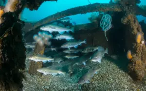
Despite its critical climate function, the seabed is increasingly vulnerable to industrial encroachment. The most immediate and destructive threat comes from bottom trawling—a commercial fishing method where heavy nets weighted with steel plates and heavy rollers are dragged across the sea floor to catch bottom-dwelling species such as cod, shrimp, and flounders.
- Physical Destruction: Trawling plows through complex benthic habitats, destroying cold-water corals, sponge reefs, and delicate ecosystems that take centuries to form.
- Sediment Resuspension: The mechanical action of heavy gear plows meters deep into the sediment, kicking up buried organic carbon into the water column.
- Enzymatic Oxidation: Once exposed to oxygen-rich waters, the unearthed organic carbon rapidly oxidizes into carbon dioxide ($textCO_2$), which can eventually outgas into the atmosphere, directly compounding global warming.
Recent academic estimates suggest that bottom trawling releases global carbon emissions comparable to the aviation industry, yet this source remains entirely unaccounted for in the Nationally Determined Contributions (NDCs) under the Paris Agreement.
Official Statements and Expert Perspectives
The urgency of the Convex Seascape Survey has drawn commentary from leading voices in marine science, environmental conservation, and ocean governance.
"For too long, the deep ocean has been treated as an infinite sink and an invisible space where human actions have no consequences. The Convex Seascape Survey is changing that paradigm by providing the hard data needed to prove that what happens at the bottom of the sea directly impacts the air we breathe."
— Dr. Eleanor Vance, Lead Marine Sedimentologist on the Project
Environmental advocates emphasize that the economic arguments for protecting the seabed align perfectly with ecological imperatives. By preventing the disruption of carbon-dense sediments, nations can achieve high-yield climate mitigation without relying entirely on unproven or expensive technological geoengineering solutions.
"We are looking at a missing piece of the global climate puzzle. Governments spend billions on terrestrial reforestation and carbon capture technologies, while ignoring the vast, natural carbon warehouses resting on our continental shelves and deep-sea floors. This $15 million survey is not just an academic exercise; it is the foundation for a new era of marine conservation law."
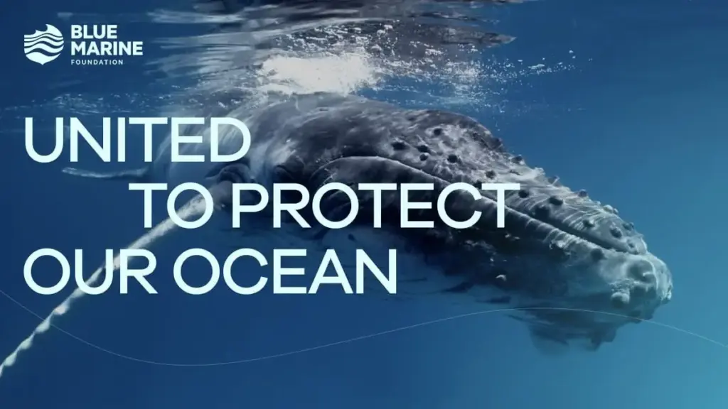
— Marcus Holloway, Marine Policy Director at the Blue Marine Foundation
Furthermore, local authorities in Bermuda have expressed immense pride in hosting the initiative that their jurisdiction helped finance.
"Bermuda has always punched above its weight in maritime matters. To be the birthplace and financial catalyst for a study of this magnitude is a testament to our nation’s commitment to ocean stewardship. We are thrilled to welcome these brilliant minds as they unlock the secrets of the seabed."
— Representative from the Bermudian Ministry of Environment
Future Outlook: Translating Science into Policy
As the Convex Seascape Survey crosses its halfway mark and looks toward its conclusion in the coming years, the primary challenge will shift from data collection to policy translation. Science alone, no matter how robust, cannot mandate international regulatory change; it must be weaponized by legal experts, conservation lobbyists, and international governing bodies.
1. Reforming International Fisheries Management
The most immediate policy objective enabled by the survey’s findings is the restriction or outright ban of bottom trawling in ecologically sensitive and high-carbon marine areas. Organizations plan to use the sediment carbon maps generated by the survey to petition regional fisheries management organizations (RFMOs) and the United Nations to designate "No-Trawl Climate Zones."
2. Integrating Seabed Carbon into National Inventories
Currently, national greenhouse gas inventories submitted to the United Nations Framework Convention on Climate Change (UNFCCC) focus heavily on land-use change, forestry, and industrial emissions. A key long-term objective of the Convex Seascape Survey is to establish standardized methodologies that allow governments to incorporate marine sediment protection into their official climate action plans.
3. Expanding Marine Protected Areas (MPAs)
The push for global targets—such as the "30×30" initiative, which aims to protect 30% of the world’s oceans by 2030—has historically focused on biodiversity preservation. The insights provided by this survey add a vital climate dimension to conservation mapping, ensuring that future MPAs are established not only to protect endangered species, but also to safeguard critical carbon sinks.
Conclusion
The Convex Seascape Survey represents a watershed moment for oceanography and climate science. By tracing the journey of carbon from the surface waters down to the abyssal plains, and by quantifying the devastating climate cost of disturbing marine sediments, this $15 million initiative is rewriting our understanding of the planet’s life-support systems. As the research continues to unfold across the globe—anchored by its roots in Bermuda—it carries the profound potential to transform the ocean floor from an exploited, forgotten frontier into a legally protected pillar of global climate resilience.