

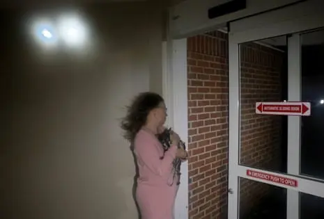
Hurricane Isaias, the historic and long-delayed first Atlantic hurricane of the 2026 season, carved a destructive path across the United States Gulf Coast after making landfall late Friday as a powerful Category 2 storm. Striking the coast near Destin, Florida, with maximum sustained winds of 105 mph, Isaias unleashed torrential rainfall, destructive storm surges, and widespread infrastructure paralysis before rapidly weakening into a post-tropical cyclone.
By Saturday morning, the storm’s maximum sustained winds had dropped significantly to near 35 mph as it tracked inland across Alabama and toward the Tennessee Valley. However, the diminished wind speeds masked a persistent, multifaceted threat. More than 840,000 residents across the Southeast remain without power, with major population centers in Florida, Alabama, and Georgia bearing the brunt of the outages. Flash flooding, impassable roadways choked by fallen timber, and crippled communication networks have severely hampered early recovery efforts. Tragically, the storm has claimed its first confirmed fatality in Escambia County, Florida, even as regional officials scramble to address lingering hazards, structural devastation, and the persistent danger of secondary spin-off tornadoes.
Detailed Chronology: The Path and Progression of Isaias
Friday Night: Landfall on the Gulf Coast
The atmospheric buildup to Isaias culminated late Friday evening when the core of the Category 2 hurricane made landfall near the coastal resort city of Destin, Florida. Bringing an onslaught of 105-mph maximum sustained winds, the storm immediately exerted immense pressure on the Florida Panhandle and the adjacent coastlines of Alabama.

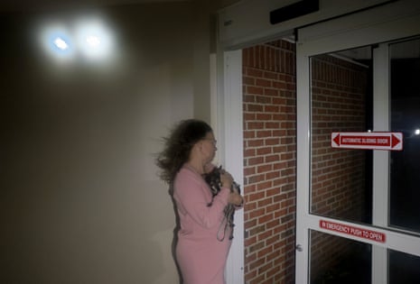
Coastal residents experienced punishing storm surges that pushed seawater deep inland. In Pensacola, Florida, winds whipped through streets and intersections, carrying flying debris and trapping travelers in blackout-stricken hotels. Jonathan Ramos, a 40-year-old government employee sheltering in a Pensacola hotel, described the unfolding chaos: "Things are flying really fast, and I’ve never seen wind this fast before, so it’s intense, it’s scary. I don’t recommend people coming down here for fun to do this."
Saturday Morning: Downgrade and Inland Tracking
By early Saturday morning, the National Hurricane Center (NHC) announced that Isaias had officially weakened to a post-tropical cyclone. As the storm pushed further inland, its maximum sustained winds decreased to near 35 mph with higher gusts.
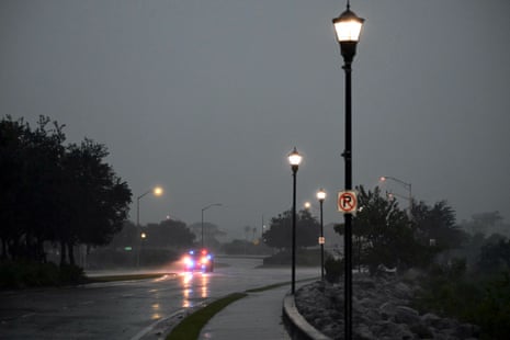
Despite the downgrade, the storm’s geographic footprint expanded its threat matrix. Emergency management agencies across the Florida Panhandle, southern Alabama, and southwestern Georgia reported catastrophic localized damage. In Santa Rosa County, Florida, officials noted that the vast majority of local roads had become entirely impassable due to a web of downed trees and severed power lines. Concurrently, Monroe County, Alabama, suffered severe blows to its public infrastructure. A morning statement from the Monroe County Emergency Management Agency detailed "crippling damage to communications and power infrastructure," warning residents that grid repairs would take multiple days.
Casualty Report and Structural Devastation
While initial assessments suggested miracles in terms of human safety, the grim reality of the storm’s power emerged by midday Saturday. Escambia County Sheriff Chip W. Simmons confirmed the first storm-related fatality in Florida during a social media briefing. A massive tree, uprooted by the fierce winds, crashed directly onto a residential home, tragically killing a female occupant.
Supporting Context & Metrics: Power Outages, Meteorological Anomalies, and Surge Mechanics
Grid Collapse and Regional Outage Metrics
The infrastructural toll of Isaias has been staggering. PowerOutage.com data indicates that over 840,000 customers remain disconnected across the American Southeast. The geographical breakdown of the power crisis underscores the vast corridor affected by the storm system:
- Florida: 438,137 customers without power
- Alabama: 294,662 customers without power
- Georgia: 111,105 customers without power
While crews in Alabama have begun making marginal headway in restoring service, Georgia has experienced a sharp spike in outages over recent hours as the trailing bands of the storm sweep eastward.

An Anomalous Season: The El Niño Effect
Meteorologically, Isaias stands as an extreme outlier in modern hurricane climatology. The storm’s late arrival in October marks a profound deviation from historical norms, driven directly by a persistently strong El Niño cycle.
David Hambling, analyzing the season’s meteorological context, notes that in the 30-year period leading up to 2020, the first Atlantic hurricane typically formed and made its presence felt much earlier—with the historical average arrival dates being August 11 for the first hurricane, August 26 for the second, and September 7 for the third.
At the commencement of the 2026 season, the National Oceanic and Atmospheric Administration (NOAA) accurately predicted an unusually subdued Atlantic season, forecasting only three to six hurricanes compared to the historical average of seven. El Niño conditions—characterized by elevated sea surface temperatures in the Pacific and weakened seasonal trade winds—generate high wind shear across the Atlantic basin. This vertical wind shear disrupts the structural integrity of developing tropical disturbances, preventing them from organizing into major hurricanes. Consequently, while the eastern Pacific has churned out 10 hurricanes this season, the Atlantic remained eerily quiet until Isaias broke the drought in October, shattering the previous record for the latest first Atlantic hurricane date (previously shared by 2002 and 2013 on September 11).
The Physics of Storm Surges
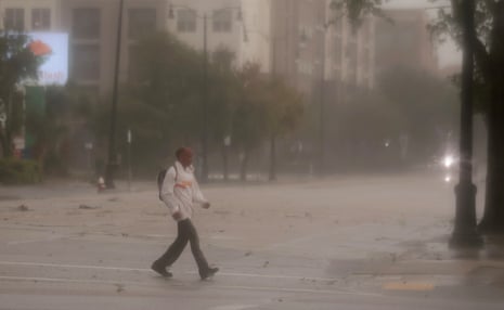
The coastal devastation wrought by Isaias highlights the lethal mechanics of tropical storm surges. As a hurricane advances toward a coastline, its ferocious winds drive massive volumes of ocean water onto the land, while the low atmospheric pressure at the storm’s center effectively elevates the sea surface.
The severity of a surge is dictated heavily by local bathymetry: the shallower the continental shelf, the higher and more destructive the resulting wall of water. Seawater weighs approximately 1,700 pounds (770 kilograms) per cubic yard, endowing a storm surge with immense kinetic energy capable of pulverizing concrete structures, tossing vehicles, and shifting maritime vessels inland. According to the NHC, a mere six inches of fast-moving water is sufficient to knock an adult off their feet. These hazards are magnified exponentially when a surge coincides with normal high tides, a danger underscored by the historic devastation of Hurricane Katrina in 2005, where surges exceeding 25 feet along the Mississippi coastline claimed a vast majority of the storm’s 1,500 victims.
Official Statements and Emergency Responses
Alabama Governor Kay Ivey
In Montgomery, Alabama Governor Kay Ivey issued a stern public advisory via the state’s Joint Information Center, urging citizens to treat the transitioning storm system with extreme caution.
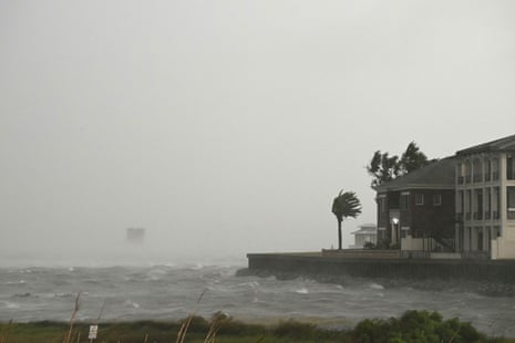
"Right now, we are worried about strong winds, heavy rain and possible spinoff tornadoes in certain parts of the state," Governor Ivey stated. "As we approach the weekend and any travel plans, make sure you have reliable information as conditions develop. We often hear in emergency management: Hope for the best. Prepare for the worst. That is the approach we need with this particular storm system. After all, we only want to see one Tide roll this weekend. Y’all be safe, heed local warnings and stay weather aware."
The governor’s warning regarding "spinoff tornadoes" highlights the secondary convective hazards that frequently accompany decaying tropical systems as they interact with continental air masses.
Florida Governor Ron DeSantis
Speaking from Tallahassee earlier Saturday in an interview with Fox News, Florida Governor Ron DeSantis offered a cautiously optimistic early assessment of the state’s immediate post-storm status, noting an initial absence of formal search and rescue assistance requests.

"I think that may be a sign that people heeded the warnings, took proper precautions," DeSantis remarked. "We sure would love to say we have not gotten a report of a fatality yet, and we’ll see what happens. There’s also a lot of hazards post-storm that people should be careful of, but so far we’ve had a lot of assets in place that have not been called on, which is a good sign. I’d rather be over-prepared, and not have to use them, than not have what you need."
While DeSantis initially noted a lack of reported fatalities prior to the confirmation of the Escambia County tragedy, he emphasized that state emergency crews had been operating through the night to clear blocked arterial roads, inspect bridge safety, and initiate power restoration frameworks.
Future Outlook: Dissipation and Secondary Risks
The National Hurricane Center’s latest advisories indicate that Isaias will continue its gradual weakening trend as it tracks across Alabama and into the Tennessee Valley through the remainder of the weekend. Meteorologists anticipate that the system will completely dissipate by Sunday.
However, the conclusion of the storm’s winds does not signal an all-clear for the region. The primary threat shifts now to severe hydrological and meteorological hazards:
- Flash Flooding and Heavy Rainfall: Persistent, heavy downpours will continue to threaten southern Alabama, the Florida Panhandle, and southwestern Georgia, significantly elevating the risk of life-threatening flash floods in urban and low-lying areas.
- Terrain Hazards: Mountainous and hilly regions, particularly the Southern Appalachians, face a heightened vulnerability to sudden landslides and debris flows as saturated soils give way under ongoing precipitation.
- Tornado Watch Zones: As Ivey emphasized, the atmospheric instability generated by the remnant low-pressure center interacting with local weather fronts creates a volatile environment capable of spawning fast-moving, unpredictable tornadoes across the Deep South.
Emergency management agencies across all affected states reiterate their core directive: residents must stay tuned to local weather alerts, avoid unnecessary travel on debris-strewn roadways, and refrain from venturing near downed electrical wires. Recovery operations are expected to span several days, particularly in hard-hit rural enclaves where electrical grids and telecommunications have been severely compromised.



