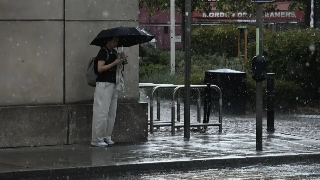
As the meteorological summer officially draws to a close and millions of children return to classrooms across the nation, the United Kingdom is experiencing a sharp meteorological pivot. The idyllic heat spike that graced parts of the country—bringing temperatures close to the 29°C (84°F) mark in the south-east as recently as Sunday—has abruptly given way to a classic, unsettled autumnal Atlantic weather pattern.
Driven by deepening low-pressure systems moving in from the north-west, the UK is bracing for a turbulent start to the week. While England and Wales transition through a band of cloud, rain, and noticeably fresher air, Scotland and Northern Ireland face a much more robust onslaught of heavy rain and potentially disruptive gales, with gusts reaching up to 60mph in exposed western and northern regions.
Yet, this dramatic shift is not happening in a vacuum. It follows what the Environment Agency has confirmed as the wettest week in England since early February, laying bare a stark contrast across the continent. While the UK grapples with persistent regional droughts alongside sudden downpours, countries like Spain continue to bake under extreme continental heat, recently recording a scorching 45.7°C in Huelva—a national high for the year so far.
Fortunately, the current spell of turbulence is expected to be short-lived. Meteorological indicators point toward a more settled, tranquil midweek period as high pressure begins to build, offering temporary relief before scattered showers return toward the weekend.
Detailed Chronology: Weekday Weather Breakdown
Understanding the trajectory of this week’s weather requires tracking the movement of low-pressure systems and associated cold fronts cascading down from the North Atlantic.
Monday: The Cold Front Sweep and Fresher Air
The week begins with a dramatic shift in pressure fields and wind directions. A prominent weather front is currently sweeping down from the north-west, acting as a boundary that ushers in cooler, less humid air from higher latitudes.
England and Wales: The initial weather front is manifesting as a dense band of cloud accompanied by scattered, light showers. However, as this front clears to the south and east, it will be followed by pleasant sunny spells. Despite the influx of fresher air, temperatures in the south-east are still expected to peak at a comfortable 25°C (77°F) during the afternoon, keeping values slightly above the seasonal average for early September.
Scotland, Northern Ireland, and Cumbria: A separate, much more potent band of heavy rain is developing across Northern Ireland early Monday morning. This system will rapidly track eastward into Scotland and Cumbria by the afternoon. Driven by strong and gusty south-westerly winds, these downpours will significantly cap daytime temperatures, holding them near a brisk 17°C (63°F) across northern regions.
Tuesday: Gales and Persistent Showers in the North
By Tuesday, a deep area of low pressure will station itself just to the north-west of Scotland, tightening the isobar lines and creating a squeeze in the pressure gradient.
The Northern Gale Threat: Northern and western Scotland will bear the brunt of this configuration. Forecasters anticipate sustained windy conditions with gusts widely reaching 50 to 60mph. While rural and coastal communities in these areas are well-accustomed to autumnal gales, meteorologists warn that if these high-velocity winds funnel effectively through the central lowlands, localized travel disruptions and structural impacts cannot be ruled out. Frequent, squally showers will accompany these gales.
The Southern Outlook: Further south across England and Wales, the remnants of Monday’s overnight rain will linger in the south-east through Tuesday morning before gradually dissolving. Significantly, this southern rainfall is expected to be light—offering little meaningful respite to large swathes of England and Wales that remain classified as being in a state of drought.
Midweek: Rising Pressure and Temporary Calm
The meteorological narrative shifts positively by Wednesday as the dominant low-pressure center migrates eastward into the North Sea.
Coastal Winds and Clearing Skies: While the east coast of the UK will experience a lingering period of brisk winds as the low exits, the broader picture for Wednesday is overwhelmingly positive. Barometric pressure is on the rise, paving the way for a predominantly dry day characterized by prolonged sunny spells and significantly lighter winds.
Thermal Baseline: Temperatures from Wednesday onward will align closely with the long-term seasonal average, with the warmest pockets once again residing in the south-east, topping out around 22°C (72°F).
Thursday and Friday: The Return of Western Showers
The tranquil midweek conditions will prove transient. By Thursday, a new set of Atlantic fronts will edge toward the British Isles, reintroducing showers to the western edges of the UK. However, as these weather systems migrate eastward through Friday, they are expected to encounter higher pressure ridges, causing the showers to rapidly decay and leaving a largely dry conclusion to the working week.
Supporting Context & Metrics: A Continent of Extremes
The juxtaposition between the UK’s weather and broader European climate indicators underscores a period of profound meteorological volatility.
The UK Hydrological Paradox
According to data released by the Environment Agency, the week preceding this current system was officially recorded as the wettest week in England since early February. This intense accumulation of rainfall comes on the heels of long-term precipitation deficits. Despite localized flash flooding and heavy downpours, large portions of England and the entirety of Wales remain locked in drought conditions. This paradox highlights how intense, short-duration summer storms and rapid-fire frontal systems fail to adequately replenish deep groundwater reserves compared to steady, prolonged winter soaking.
While the UK contends with plunging temperatures and Atlantic gales, mainland Europe continues to battle extreme heat anomalies. Last week, weather stations in Spain recorded an astonishing 45.7°C in Huelva, marking the country’s highest temperature of the year so far. This persistent dome of high pressure over the Iberian Peninsula acts as a thermal engine, occasionally pumping warm air northward toward the UK—as evidenced by Sunday’s brief spike to 29°C—before Atlantic cold fronts sweep in to reset the thermal baseline.
Official Insights and Expert Analysis
Speaking on the transition from summer to autumn, lead weather presenter Elizabeth Rizzini emphasized the abruptness of the seasonal gear-shift.
"Meteorological summer is over, schools are back, and so is the UK’s signature unsettled weather," Rizzini noted. "After a dramatic heat spike on Sunday that caught many by surprise, we are seeing a textbook transition driven by low-pressure systems. While the north bears the brunt of the wet and windy conditions early in the week, the southward sweep of this cold front is successfully flushing out the humidity, returning us to a much fresher, more seasonable feel."
Hydrological experts from environmental monitoring bodies have similarly echoed caution regarding the drought situation. While rainfall events capture public attention, water resource managers stress that cumulative hydrological recovery requires sustained, multi-month wet periods rather than isolated, convective summer storms. Transport authorities in Scotland have also issued advisory notices for freight and high-sided vehicle operators navigating northern routes on Tuesday, as 60mph gusts threaten to impact bridge crossings and exposed arterial roads.
Future Outlook
As the UK navigates this first true test of autumn weather, the medium-range forecast suggests a continuation of the Atlantic conveyor belt. While Wednesday and Thursday offer a brief window of settled, sunny, and calm weather, the persistent positioning of the jet stream near or just south of the UK implies that further low-pressure systems will queue up off the western seaboard as September progresses.
Citizens are advised to keep a close eye on local forecasts—particularly those commuting across northern Scotland on Tuesday—and to enjoy the calmer, average-temperature conditions slated for the midweek window before the next batch of western Atlantic moisture arrives on Thursday.