Executive Overview
As global temperatures continue on an upward trajectory, pushing urban centers into uncharted climatic territory, cities face an existential threat from extreme heat events. The "urban heat island" effect—where concrete, asphalt, and dense architectural designs absorb and re-emit solar radiation far more intensely than surrounding rural areas—has transformed metropolises into thermal traps. Protecting vulnerable urban populations from heat exhaustion, heatstroke, and related mortality is no longer just a public health concern; it is a fundamental architectural and spatial planning crisis.
A groundbreaking new study published in scientific literature offers a vital roadmap for municipal leaders and urban designers navigating this warming world. The research underscores that integrating specific land- and water-based features—collectively known as green-blue infrastructure (GBI)—can significantly mitigate local temperatures. By strategically deploying woodlands, grasslands, lakes, rivers, pocket parks, and vegetated green walls, cities can cultivate cooling microclimates that slash ambient temperatures during peak heatwaves.
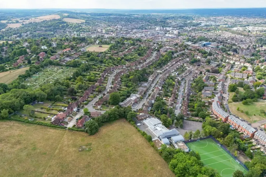
Focusing on the historic market town of Guildford in southeast England, researchers conducted a meticulous, multi-year empirical investigation into how different GBI typologies perform against standard built environments. The findings reveal that while all natural and semi-natural features offer cooling benefits, their efficacy is governed by profound nuances. Woodlands emerged as the undisputed champions of urban cooling, dropping temperatures by up to 6°C (nearly 11°F) on the hottest days, whereas engineered solutions like green walls provided more modest relief.
Coming on the heels of recent United Nations declarations warning that global warming is poised to breach critical thresholds established by the 2015 Paris Agreement, this study transcends academic curiosity. It provides an actionable framework for climate adaptation, shifting the urban planning paradigm away from generalized concepts of "green is good" toward precise, targeted, and context-dependent thermal engineering.
Detailed Chronology: The Guildford GBI Experiment
To understand how nature mitigates the urban heat island effect, researchers turned their attention to Guildford, a town characterized by a diverse mosaic of historic architecture, modern concrete infrastructure, and interspersed green-blue assets. The overarching goal was to capture high-resolution, long-term microclimatic data that could definitively quantify the cooling capacities of distinct natural typologies.
Setting the Baseline and Selecting Sites
The research design required a comparative framework. The scientific team selected six distinct GBI sites within Guildford to represent a broad spectrum of natural and hybrid urban environments:
- A dense woodland ecosystem.
- An open grassland area.
- A lakeside riparian setting.
- A built-in vegetated green wall (a vertical garden integrated into building architecture).
- A municipal pocket park (a small, human-made green space nestled within a dense urban matrix).
- A natural riverside corridor.
To accurately measure the cooling footprint of each feature, researchers established dedicated control points by pairing every GBI site with a nearby, highly built-up comparison site dominated by pavement, brick, and artificial surfaces.
Rigorous Data Collection Across Seasons
The temporal scope of the project was designed to capture both the mundane fluctuations of British weather and the catastrophic spikes of anomalous heatwaves. Beginning in June 2023 and running continuously through the end of August 2025, the research team deployed a dense network of automated environmental sensors.
These sensors were calibrated to record ambient temperature data at precise, one-minute intervals. This high-frequency data collection ensured that transient meteorological shifts, diurnal temperature swings, and the sudden onset of heatwaves were captured without the smoothing errors common in lower-resolution studies.
To complement the ground-level sensor data and establish a macro-scale spatial perspective, the investigators integrated satellite remote-sensing data covering the exact same timeline. This dual-methodology approach—combining hyper-local, continuous sensor telemetry with satellite thermal imaging—provided a robust, scientifically unassailable picture of how heat behaves across varying urban topographies.
Unveiling the Microclimate Dynamics
As the data rolled in through successive summers, patterns began to emerge. The continuous logging revealed that microclimates are highly dynamic entities. Under normal climatic conditions, all six GBI sites consistently outperformed their built-up control counterparts, registering ambient temperatures that were lower by a margin of 1.81°C to 2.49°C (3.26°F to 4.48°F).
However, the true value of these infrastructure types became glaringly apparent during periods of extreme heat stress. When regional temperatures spiked, the magnitude of the cooling effect did not remain static; it amplified.
The woodland site, characterized by dense overhead canopy cover and rich soil moisture, exhibited an extraordinary capacity for temperature regulation, dropping ambient heat by upwards of 6°C (nearly 11°F) compared to nearby asphalt during the hottest peak hours. Similarly, the riverside and pocket park locations demonstrated impressive resilience, recording cooling metrics of approximately 3.5°C (6.3°F) during peak thermal events. At the other end of the spectrum, while the vegetated green wall contributed to overall urban cooling, it registered the lowest temperature reduction among the six tested typologies.
Supporting Context & Metrics: Quantifying Nature’s Air Conditioning
The empirical data gathered in Guildford contributes to a rapidly expanding body of literature seeking to quantify the ecosystem services provided by green-blue infrastructure. Urban heat is not merely a matter of discomfort; it is a lethal environmental hazard that exacerbates cardiovascular and respiratory conditions, disproportionately affecting the elderly, children, and economically disadvantaged populations who lack access to domestic air conditioning.
Deconstructing the Cooling Metrics
To contextualize the findings of the Guildford study, it is helpful to examine the precise performance metrics recorded across the monitored typologies:

- Woodland Ecosystems:
- Average Cooling: ~1.81°C – 2.49°C under normal conditions.
- Extreme Heat Event Cooling: Upwards of 6°C (11°F).
- Mechanism: High-density canopy interception of solar radiation, combined with robust evapotranspiration—the process by which trees draw moisture from the soil and release it as water vapor, cooling the surrounding air.
- Riversides and Lakesides (Blue Infrastructure):
- Extreme Heat Event Cooling: ~3.5°C (6.3°F).
- Mechanism: High thermal inertia of water bodies, which absorb excess heat slowly, coupled with micro-scale wind currents (advection) that flush warm urban air and replace it with cooler, moisture-laden breezes.
- Pocket Parks and Grasslands:
- Extreme Heat Event Cooling: Moderate to high performance, particularly when featuring mature shade trees. Grasslands prevent the extreme heat storage typical of dark asphalt, though they offer less vertical shade than forests.
- Vegetated Green Walls:
- Performance: Lowest overall cooling effect among the tested assets. While they provide building insulation and aesthetic value, their spatial scale and restricted biomass limit their ability to cool the broader ambient air compared to expansive parks or forests.
The Urban Heat Island Phenomenon
Cities are fundamentally altered landscapes. Natural soil and vegetation are systematically replaced by impervious surfaces such as concrete, asphalt, and stone. These materials possess low albedo (reflectivity) and high heat capacity, meaning they absorb vast quantities of shortwave solar radiation during the day and re-emit it as longwave infrared radiation long after the sun has set.
This prevents nighttime cooling cycles, creating a persistent dome of elevated temperatures over urban centers. Green-blue infrastructure disrupts this thermal trap. Vegetation intercepts solar rays before they strike pavement, reduces surface temperatures through shade, and cools the air through latent heat flux (evapotranspiration). Water bodies act as thermal sinks, buffering temperature extremes through high specific heat capacity.
Official Statements & Expert Analysis
The implications of the Guildford study extend far beyond the borders of southeast England, sparking vital conversations among urban planners, climatologists, and municipal policy-makers worldwide.
Moving Beyond Oversimplified Metrics
To gain deeper perspective on the study’s broader significance, researchers and journalists consulted leading experts in the field of urban climate resilience. Vivek Shandas, a professor of geography at Portland State University in the United States who was not affiliated with the Guildford research project, offered critical insights into the evolving nature of urban heat science.
In an interview with Mongabay, Professor Shandas emphasized that the study dismantles simplistic assumptions long held by city planners.
"Those nuances are important because they reinforce something we increasingly see in urban heat research: there isn’t a single number we can attach to a tree, park, lake, or green wall and say, ‘this is how much cooling it provides,’" Shandas explained via email. "Cooling depends on the design of the place, its scale, the surrounding buildings and pavement, weather conditions, and time of day."
This perspective highlights a major shift in how scientific data must be translated into municipal policy. A tree planted in an open, windy plaza will yield vastly different microclimatic results than the exact same tree nestled within a narrow urban canyon bound by towering glass-and-steel skyscrapers.
The Death of "Green is Good"
While the authors of the Guildford study candidly acknowledged limitations—namely, that their observations were derived from single-site representations of each GBI typology, meaning local topography and micro-wind patterns could heavily influence outcomes—experts argue the study marks a crucial methodological maturation.
According to Shandas, the research successfully moves the discourse away from the vague, feel-good axiom that "green is good" and pushes the scientific and planning communities "toward a much more actionable question: How do we design cities so that cooling is available where and when people actually need it?"
This distinction is paramount. Municipalities can no longer satisfy climate adaptation mandates merely by meeting arbitrary tree-planting quotas or mandating green roofs without spatial strategy. Instead, urban interventions must be hyper-localized, accounting for demographic vulnerability, spatial heat distribution, and structural design.
Future Outlook: Designing Cities for a Warming Planet
The urgency of translating microclimatic research into concrete urban policy cannot be overstated. Recent announcements from the United Nations have underscored a sobering global reality: greenhouse gas emissions and cumulative climate momentum will soon push planetary temperatures past the critical threshold established by the 2015 Paris Agreement. As global warming breaches these danger zones, extreme heat events will transition from anomalous weather anomalies to the baseline climate reality for millions of urban residents.
Integrating GBI into Master Planning
For cities to survive and thrive in this high-heat future, urban planning frameworks must undergo a radical transformation. Traditional zoning laws, which have historically prioritized vehicular traffic flow, commercial density, and aesthetic uniformity, must now place thermal equity and climate resilience at the absolute center of design codes.
- Strategic Placement over Quantity: As highlighted by expert commentary, scattering isolated street trees randomly across a grid yields suboptimal cooling. Planners must utilize spatial microclimate modeling to identify urban heat islands and deploy clustered green-blue infrastructure—such as interconnected linear parks, bioswales, and urban forests—where vulnerable populations reside.
- Optimizing Blue-Green Synergies: The combination of water bodies and dense vegetation creates powerful cumulative cooling effects. Restoring urban rivers, daylighting culverted streams, and constructing artificial wetlands can serve dual purposes: mitigating urban flood risks during heavy precipitation events while acting as potent air-conditioning engines during summer heatwaves.
- Architectural Integration: While green walls showed lower ambient cooling impacts in the Guildford study, their capacity to insulate individual buildings and reduce indoor cooling loads remains invaluable. Future building codes should mandate a hybrid approach, combining vertical greening and green roofs with large-scale public parks and tree canopies.
The Path Ahead
The Guildford study serves as both a warning and a beacon of hope. It demonstrates that nature possesses extraordinary capacity to buffer humanity against the worst excesses of a destabilized climate. However, it also issues a stern reminder that nature cannot be deployed haphazardly.
As cities race against time to adapt to a warming planet, the mandate for urban planners is clear. By embracing rigorous, data-driven, and context-specific green-blue infrastructure designs, municipalities can begin to dismantle the thermal traps of the past, transforming concrete jungles into cool, livable, and resilient habitats for the future.