Executive Overview
Throughout modern history, the act of founding a new city has represented one of architecture’s most potent fantasies: the promise of a tabula rasa. To design a settlement on unbuilt land is to believe that a better social order, a more rational economy, or a more harmonious way of life can be drafted onto a blank page, far from the messy compromises of existing urban centers. In Latin America, this utopian impulse has repeatedly found expression in the territorial interior. From the mythical quest for El Dorado to the massive state-sponsored masterplans of the twentieth century, vast landscapes have been treated as empty canvases waiting for an axis, a grid, or a technological system.
Yet, as urban history demonstrates, these territories were never truly empty. At eye level, the ground was already inhabited by complex human ecosystems, indigenous paths, localized economies, and unpredictable climates that refused to conform to an imported blueprint.
This tension between the totalizing view of the master plan and the messy reality of the lived environment forms the core of architectural investigations into three of Latin America’s most ambitious twentieth-century planned settlements: Fordlândia in the Brazilian Amazon, Brasília on the central Brazilian plateau, and Ciudad Guayana at the confluence of the Orinoco and Caroní rivers in Venezuela. Conceived across different decades and driven by wildly divergent ideological imperatives—capitalist expansion, state modernization, and industrial resource extraction—these projects shared a singular faith in the power of the architectural drawing to remake society from the ground up.
Examining these three case studies reveals the recurring friction between top-down statecraft and grassroots habitation. While master planners viewed territory from above as a clean slate ready for geometric optimization, the actual inhabitants lived, adapted, and subverted those visions, demonstrating that architecture cannot easily erase the social and environmental contexts it seeks to colonize.
Detailed Chronology: Three Visions of the New World
1. Fordlândia: Importing the American Midwest to the Amazon (Late 1920s–1930s)
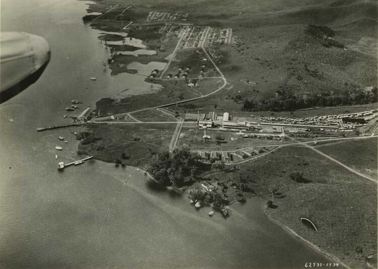
The myth of the blank slate in the Amazonian basin took industrial form in the late 1920s, when American automotive magnate Henry Ford sought to break a British-controlled rubber monopoly. Ford secured a massive tract of land along the Tapajós River in Brazil to establish an enterprise town designed to supply raw latex for his automobile manufacturing plants in Michigan.
Ford’s vision for Fordlândia was rooted in a profound detachment from tropical realities. Operating thousands of miles away, Ford and his managers imagined they could replicate a quintessential American mill town deep in the equatorial rainforest.
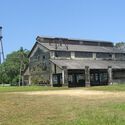
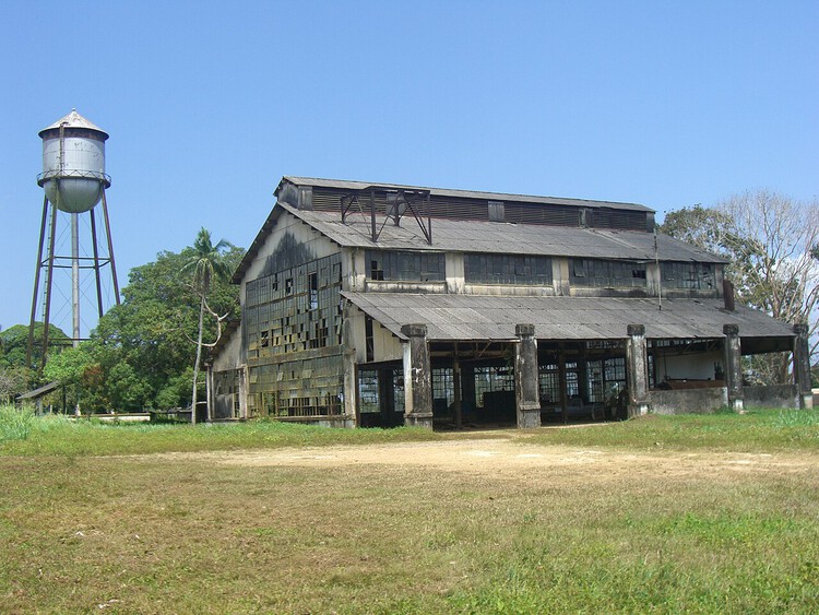
- The Blueprint: Prefabricated wooden bungalows shipped from Michigan lined the riverbanks. A towering steel water tower, manufactured in the United States, dominated the skyline, its whistle regulating the working hours of the local labor force.
- The Social Mandate: Workers were subjected to a strict paternalistic code. They were expected to punch time clocks, eat standard American fare in company dining halls, participate in square dances, and abstain entirely from alcohol. Even the housing was ill-suited for the climate: houses featured metal roofs designed for northern latitudes that trapped stifling heat under the merciless tropical sun, completely ignoring indigenous building traditions that utilized breathable thatch and elevated timber framing.
The project quickly collapsed under the weight of biological reality and social resistance. Planted in dense, unnatural rows rather than scattered naturally as they grew in the wild, Ford’s rubber trees fell victim to catastrophic blight and leaf spot fungi. Simultaneously, the imposition of foreign cultural norms provoked intense friction with the local workforce. In December 1930, a protest over rigid dining hall rules erupted into an open riot, forcing company managers to flee for their lives onto boats anchored in the Tapajós River. Fordlândia stands as a foundational monument to the hubris of exporting architectural and social typologies across climatic and cultural divides without regard for local context.
2. Brasília: The Geometric Monument to National Modernization (1957–1960)
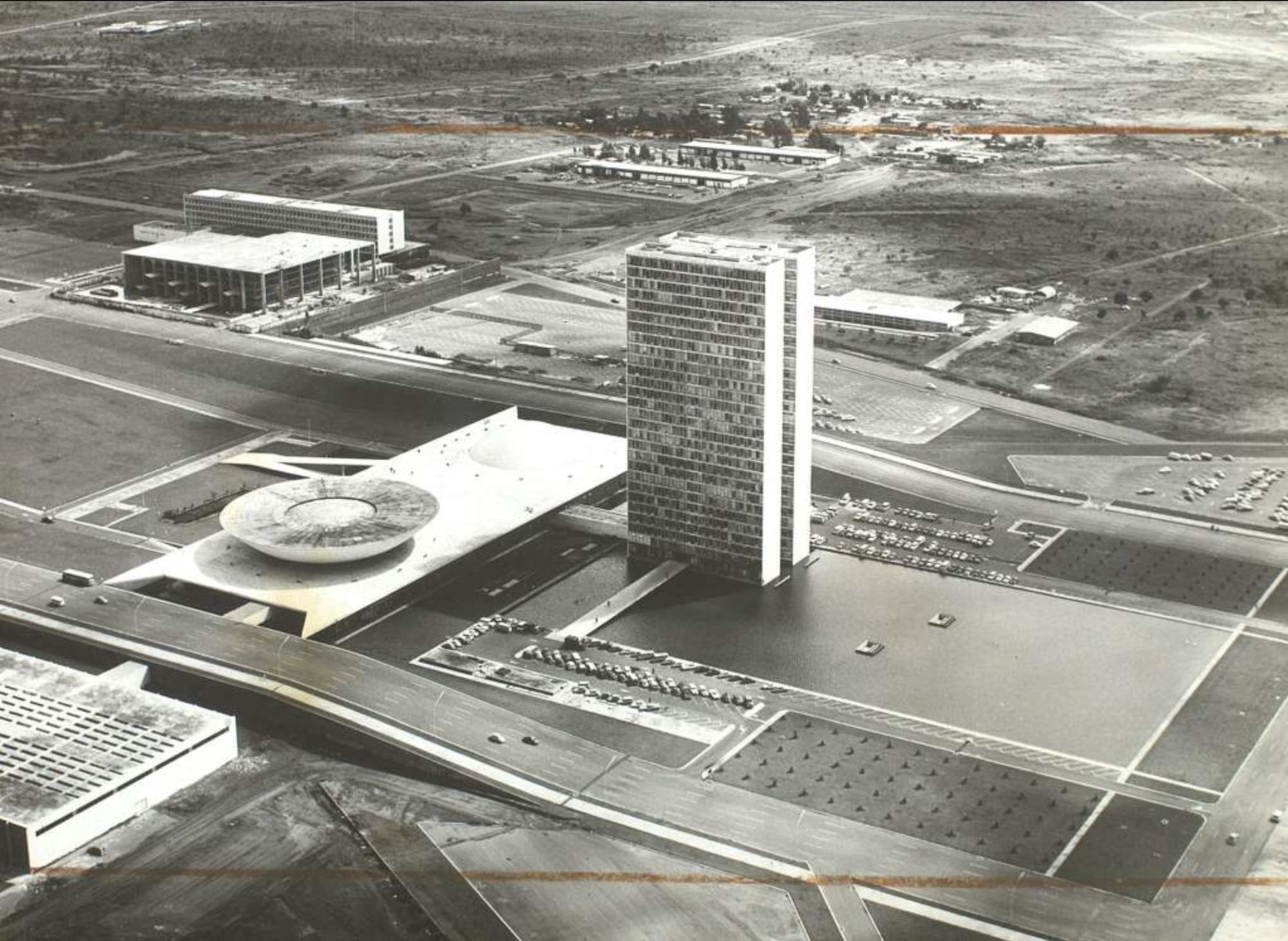
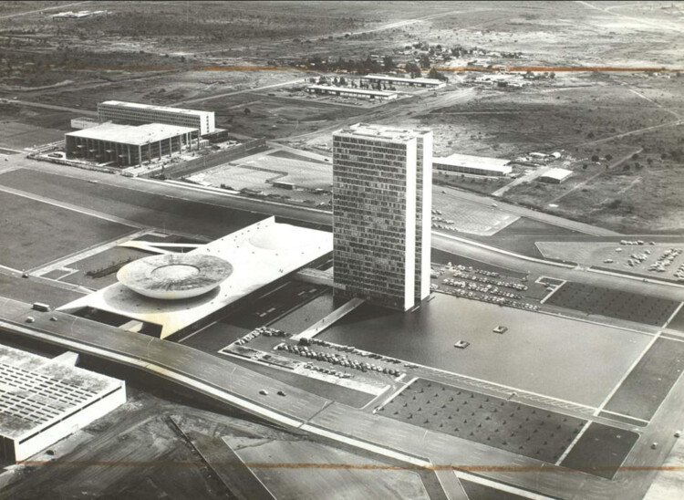
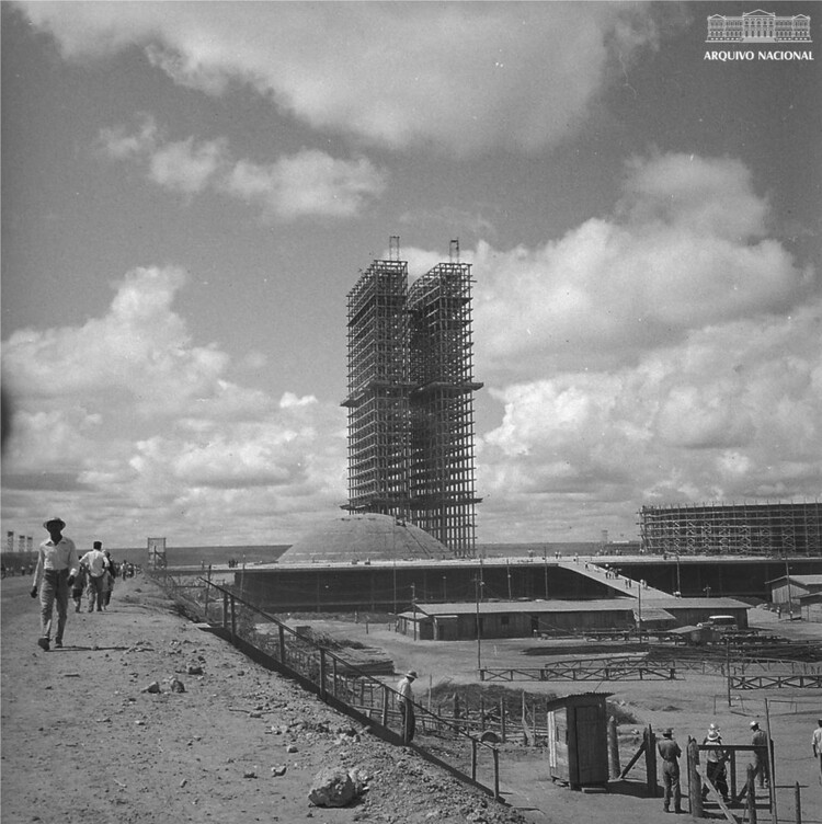
If Fordlândia represented corporate paternalism in the jungle, Brasília was the ultimate expression of mid-century state-sponsored utopianism. Conceived by President Juscelino Kubitschek as part of a sweeping national modernization project, the new federal capital was deliberately planted in the remote, central highlands of Brazil to break decisively with the colonial, coastal legacy of Rio de Janeiro and Salvador.
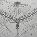
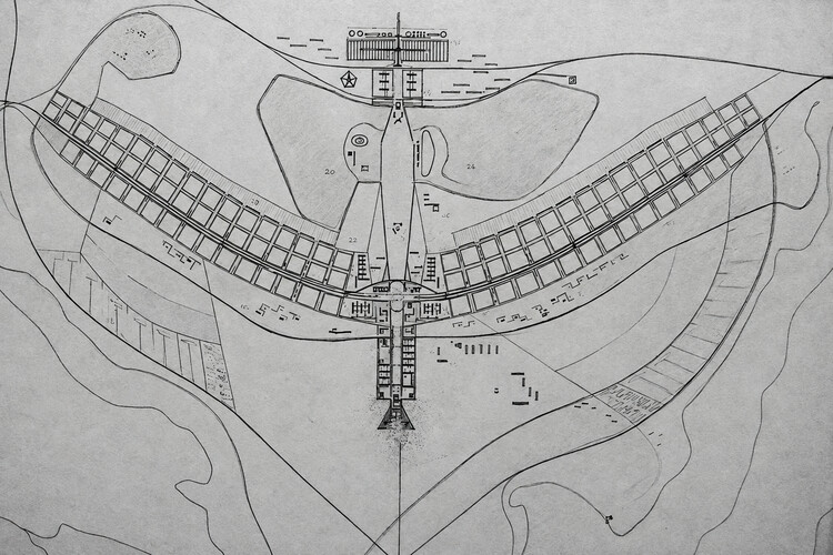
In 1957, architect and urban planner Lúcio Costa won the national competition for the city’s master plan. Costa famously described the inception of the Plano Piloto through a foundational gesture of territorial conquest: two axes crossing at right angles, representing "the very sign of the cross" used by explorers to claim land.
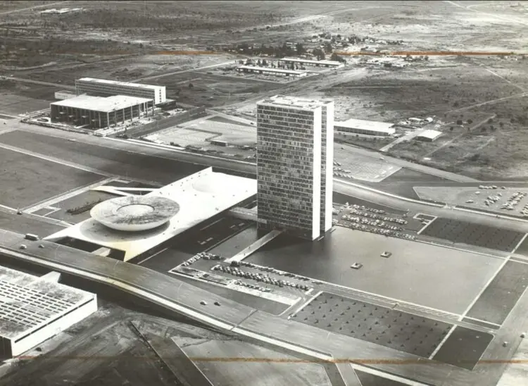
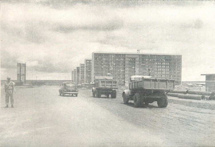
- The Urban Structure: Costa’s plan organized the capital around two distinct ribbons. The Residential Axis curved gracefully across the landscape, containing the famous superquadras—housing blocks raised on pilotis (stilts) to maintain a continuous, open green space underneath. The Monumental Axis concentrated the nation’s civic power, featuring the iconic architectural masterpieces of Oscar Niemeyer, including the National Congress, the Cathedral, and the Palácio da Alvorada.
- The Social Divide: Built in record time, Brasília required an army of construction workers known as candangos, predominantly migrants from Brazil’s impoverished Northeast. While the architects envisioned an egalitarian society of integrated classes living within the rational grid, the reality of construction exposed deep inequalities. The candangos were housed in temporary camps and peripheral settlements like Cidade Livre, intended to vanish once construction concluded. Instead, as the formal city was completed, its working-class creators were systematically pushed out to satellite cities such as Taguatinga and Ceilândia. Today, the UNESCO-protected Plano Piloto houses only a fraction of the Federal District’s population, surrounded by a sprawling metropolitan periphery that the original plan never anticipated.
3. Ciudad Guayana: The Industrial Laboratory of Venezuela (Early 1960s)
In the early 1960s, the Venezuelan government partnered with the Joint Center for Urban Studies of MIT and Harvard to transform the confluence of the Orinoco and Caroní rivers into a major industrial metropolis. Named Ciudad Guayana, the project was designed to harness vast iron ore deposits and hydroelectric potential, turning southeastern Venezuela into a powerhouse of national development.
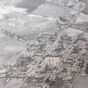
- The Linear Plan: Planners envisioned Ciudad Guayana as a linear city structured along a central spine, Avenida Guayana, which connected heavy industrial zones to commercial districts and residential sectors. Designed as an urban laboratory, the master plan sought to test modern planning theories at the scale of an entire regional economy.
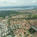
- Pre-existing Realities: Like its predecessors, Ciudad Guayana encountered a landscape already dense with human activity. On the west bank of the Caroní River lay Puerto Ordaz, a sanitized company town designed by CIAM luminary Josep Lluís Sert for American mining executives. On the east bank sat San Félix, a historic fishing village that rapidly absorbed waves of rural migrants. By 1962, tens of thousands of people were living in self-built informal settlements across a site that master planners were still drafting on paper.
While the official plan attempted to integrate housing near western industries, residential patterns fractured along stark socioeconomic lines. Puerto Ordaz remained predominantly middle- and upper-class, while San Félix and surrounding informal quarters accommodated the working classes, creating a fragmented urban reality that defied the clean spatial logic of the MIT-Harvard master plan.
Supporting Context & Metrics
To understand the structural challenges underlying these planned settlements, architectural historians and urban sociologists often analyze the measurable divergence between master plans and ground-level realities:
| City / Project | Primary Driver / Ideology | Core Design Paradigm | Major Failure Point / Disconnect |
|---|---|---|---|
| Fordlândia (Brazil) | Corporate extraction & capitalist paternalism | Prefabricated American mill town | Agricultural blight (monoculture rubber) & labor unrest over imported cultural codes. |
| Brasília (Brazil) | State modernization & geopolitical relocation | Monumental axis and modernist superquadras | Severe socio-spatial segregation; displacement of candangos to peripheral satellite cities. |
| Ciudad Guayana (Venezuela) | State-led industrialization & resource harnessing | Linear spine with multi-nodal industrial zones | Rapid informal settlement growth (San Félix) outpacing official zoning and class-mixing goals. |
A telling methodological study conducted during the planning of Ciudad Guayana by urban designer Donald Appleyard highlighted this perceptual gap. Appleyard asked local residents to draw cognitive maps of their city and compared them directly with the master plans drafted by Harvard and MIT planners. While the official documents depicted the city as a cohesive, rational system of infrastructural nodes and linear transport corridors, resident maps revealed fragmented, highly localized networks of survival, informal commerce, and pedestrian paths that remained entirely invisible to the state’s aerial perspective.
Official Statements & Critical Perspectives
The psychological allure of the tabula rasa has long fascinated architectural theorists, who view it as a symptom of a broader desire for societal control.
"A different social order is easier to imagine when it sits far from the one that already exists. In Latin America, that distance has often been territorial… Seen from above, a territory can look like a clean sheet, ready for an axis or a grid. At eye level, the same ground is already full of people and the paths they use."
— ArchDaily Topic Commentary on Imagined Territories
Historian Greg Grandin, author of the definitive account Fordlândia: The Rise and Fall of Henry Ford’s Forgotten Jungle City, emphasizes the cultural blindness inherent in such projects:
"Ford didn’t just want rubber; he wanted to prove that American industrial discipline could cure the perceived chaos of the tropics. He viewed the jungle not as an intricate ecological web, but as an administrative failure waiting to be corrected by assembly-line logic."
Furthermore, Lúcio Costa’s own writings regarding Brasília reveal an explicit invocation of colonial conquest. In his original 1957 competition report, Costa described the genesis of the Plano Piloto as an act of territorial assertion:
"It was born of the primary gesture of one who marks a place or takes possession of it: two axes crossing at right angles, that is, the very sign of the cross."
This framing ties modern architecture directly to historical traditions of dispossession, demonstrating how the rhetoric of progress often masks an underlying authoritarian geometry.
Future Outlook: Learning from the Lure of Escapism
As contemporary architecture grapples with planetary crises—ranging from climate displacement to rapid urbanization—the temptation to flee existing urban decay through new, idealized master plans remains strong. Neo-utopian proposals, from charter cities and high-tech corporate smart cities to luxury eco-enclaves, continue to promise clean slates away from the complexities of legacy urban centers.
However, the historical lessons of Fordlândia, Brasília, and Ciudad Guayana offer a sobering counter-narrative. Architecture cannot successfully operate in a vacuum. When design ignores the pre-existing ecological realities, indigenous knowledge, and socio-economic dynamics of a site, the resulting spaces invariably generate friction, resistance, and unintended adaptations.
The future of urbanism in Latin America—and globally—depends on shifting from the God-trick of the aerial master plan to a more grounded, inclusive methodology. True innovation does not lie in imagining territories as empty pages awaiting a foreign script, but in learning to read the complex, messy texts already written on the land by the people who inhabit it.