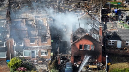
The summer of 2026 will be etched into the collective memory of the British Isles not just for its relentless heat, but for the profound transformation it wrought upon the nation’s rural and urban-fringe landscapes. From the scorched heathlands of the New Forest to the smouldering valleys of south Wales, and the charred residential peripheries of Stourbridge and Stoke-on-Trent, Britain experienced an unprecedented surge in destructive wildfires. These were not the controlled, low-intensity agricultural burns of the past, but fast-moving, volatile firestorms capable of hurdling roads, consuming residential property, and chewing deep into the ancient carbon sinks of British peatlands.
For generations, Britain’s damp maritime climate offered a natural bulwark against catastrophic wildfires. However, as consecutive record-breaking summers give way to chronic, bone-dry droughts, the UK finds itself functioning increasingly as a tinderbox. This ecological shift has exposed a critical vulnerability: the country is structurally and forensically unequipped to investigate, predict, and mitigate the fires threatening its communities.
While frontline fire services respond with immense bravery, a profound knowledge gap persists. The vast majority of vegetation fires are logged with assumed causes based on superficial guesswork rather than rigorous forensic science. Without a coordinated, national framework for wildfire investigation, preventative strategies remain hamstrung by myths—such as the over-villification of discarded cigarettes—while true ignition vectors go undetected. To avert future humanitarian and ecological disasters, researchers, land managers, and specialist fire officers are racing to build a new toolkit of forensic investigation, laboratory experimentation, and high-resolution predictive modeling. The consensus among experts is clear: the war against wildfires cannot be won on the fireground alone; it must be won through rigorous preparation, accurate attribution, and predictive prevention.
Detailed Chronology of the 2026 Wildfire Crisis
The unfolding emergency of 2026 shattered historical precedents across all four home nations, driven by the UK’s hottest summer on record and prolonged, pervasive drought conditions.
Early Summer (June – July 2026): Long before the peak of summer temperatures, meteorological indicators signaled trouble. Extended dry spells pushed moisture levels in foundational grasses and dead vegetation to historic lows. Unlike typical years when landscapes retained early-season greenness, the British countryside began browning at an accelerated rate, effectively extending the historical wildfire season—which traditionally peaked in late winter and early spring—deep into the calendar year.
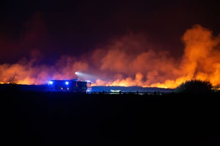
Mid-August 2026 (The Heatwave Peak): A historic heatwave enveloped England and Wales, turning vast expanses of the country into an active fire hazard. In the New Forest, rare heathland ecosystems were heavily ravaged, threatening endemic species. Simultaneously, ferocious grassfires swept through the West Midlands, reducing several suburban homes in Stourbridge to ash.
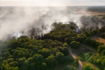
August 10–13, 2026: Firefighters battled catastrophic blazes in south Wales, while in Suffolk, a high-intensity fire engulfed Dunwich Heath, generating thick plumes of smoke that blanketed the coastline. By mid-August, official statistics confirmed that fire services in England and Wales had already attended more individual wildfire call-outs than during the entirety of 2025.
Late August – September 2026: The Met Office officially confirmed the season as the hottest UK summer on record. Fires began penetrating deep into underground peat layers on British moorlands, scorching down up to 20 centimeters into foundational soils. Urban-rural interfaces suffered extensive damage, exemplified by aerial footage of destroyed roofs and gutted residential structures in Stoke-on-Trent.
Supporting Context & Metrics: The Science of Fuel and Seasonality
To understand why the 2026 fires behaved with such unprecedented ferocity, scientists must examine the physics of wildland fuels. For decades, British wildfire research lagged behind fire-prone nations like Canada, Australia, and Portugal, operating under the assumption that UK vegetation was fundamentally too damp to sustain high-intensity mega-fires.
That complacency has been shattered. Research led by institutions such as Swansea University and the University of Exeter has highlighted a dramatic lengthening of the UK’s wildfire season. Empirical studies published in journals such as Environmental Research Letters reveal that the average British fire season expanded from a window of one to four months (2011–2016) to an alarming six to nine months (2017–2021). By 2026, this window expanded to encompass almost the entire spring-to-autumn cycle.
Furthermore, the nature of the fuel has fundamentally shifted. Summer droughts dry out agricultural crops, deep canopy grasses, and undergrowth right up to the thresholds of residential back gardens. When these fuels ignite, they release unprecedented thermal energy.
Laboratory testing at the University of Exeter’s Wildfire Lab has involved burning British vegetation samples inside specialized cone calorimeters. These experiments measure precisely how readily different fuels ignite and the magnitude of thermal energy released at various times of the year. This empirical data feeds directly into the UK’s primary wildfire-behaviour prediction tool, FireInSite. By accounting for ambient weather, seasonal dryness, and vegetation type, FireInSite allows tactical commanders to forecast flame lengths up to five days in advance.
However, predicting how a fire burns is vastly different from predicting where it will go. Unlike models tailored for uniform pine forests in North America, the British landscape is exceptionally heterogeneous. "In the UK, a lot can happen in 30 metres," notes Prof Tom Smith of the London School of Economics. A micro-topographical shift, a narrow path, or a subtle change in canopy composition can determine whether a wall of fire leaps a firebreak or dies out. Consequently, researchers are now designing probabilistic simulation models—running thousands of virtual fire paths across digital terrain maps—to identify high-risk community pinch points and optimize preventative vegetation management.
Official Statements and Institutional Perspectives
The operational blind spots governing British wildfire management have drawn sharp critiques from leading figures within forestry, academia, and emergency response.
"At the moment there is no capability for wildfire fire investigation in the UK, full stop."
— Andy Elliott, Founder of WildfireTaC and the UK’s sole serving fire officer trained in specialist wildfire origin.
Elliott explains that while frontline crews work heroically to suppress flames, they rarely possess the time, mandate, or forensic training required to deconstruct the burnt landscape. Using clues as subtle as heat-frozen leaves pointing to wind vectors, soot deposition on rocks, and the asymmetrical charring of bracken stems, Elliott can crawl on his hands and knees to locate the exact ignition point of a fire. Yet, this level of forensic scrutiny remains an anomaly.
A landmark 2023 Forestry Commission report warned that the causes of most UK wildfires are currently determined by personnel with limited or no specialist training, rendering official statistics "open to scrutiny." Compounding the problem is institutional inertia regarding common ignition narratives.
"Research undertaken by wildfire scientists has determined that the cigarette as a cause is extremely unlikely and has been debunked by most eminent wildfire investigators."
— Forestry Commission Wildfire Investigation Report
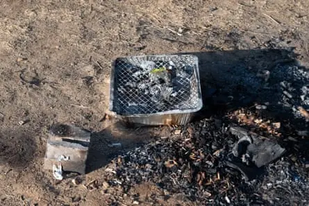
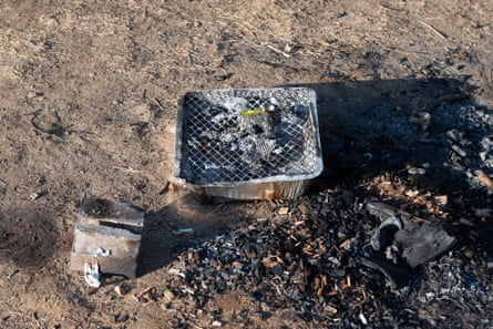
Despite public safety campaigns historically focusing heavily on discarded cigarette butts, scientific consensus points elsewhere. Similarly, while disposable barbecues have faced intense political scrutiny—with figures like Greater Manchester Mayor Andy Burnam calling for outright bans—experts note that current data collection is too poor to quantify their exact contribution relative to other human or environmental factors.
"We’ve got three common causes of wildfires in the UK: men, women and children. Beyond that, we don’t know."
— Andy Elliott, Wildfire Consultant
Rob Gazzard, wildfire contingency planning adviser for the Forestry Commission and co-author of the 2023 report, emphasizes that true resource allocation must pivot from suppression to prevention.
"Preparedness and prevention is where you win the wildfire. It’s not about response."
— Rob Gazzard, Forestry Commission
Without accurate attribution data, millions of pounds in public awareness campaigns risk being misdirected. To combat this, the Forestry Commission has developed comprehensive training courses focused on evidence preservation and origin determination, though their nationwide rollout remains contingent on securing adequate funding.
Future Outlook: Learning to Live with Fire
As anthropogenic climate change locks in warmer, drier summers for the foreseeable future, Britain must transition from a reactive posture to a proactive coexistence with wildfire risk. The traditional image of the British countryside as a damp, immutable sanctuary is gone.
Emerging vulnerabilities compound this new reality. Prof Stefan Doerr of Swansea University points out that as landscapes dry out, unconventional ignition sources—such as lightning strikes or birds striking high-voltage overhead power cables—are increasingly capable of sparking catastrophic events. When an electrocuted bird drops into bone-dry summer vegetation rather than damp spring turf, a minor electrical fault instantly escalates into a multi-hectare conflagration.
The environmental fallout extends far beyond immediate property damage. As Sarah Baker of the University of Exeter notes, deep-seated peat fires consuming up to 20 centimeters of organic soil not only release massive volumes of stored carbon back into the atmosphere—exacerbating global heating—but also permanently compromise the hydrological and ecological integrity of British moorlands, severely delaying natural regeneration.
Mitigating these cascading crises will require heavy investment in national geospatial data infrastructures. Building a high-resolution, nationwide fuel map remains the single greatest technological hurdle for deploying advanced wildfire spread models. Until researchers have precise data on every 30-meter patch of British terrain, predicting the precise trajectory of a fast-moving grassfire will remain fraught with uncertainty.
Nevertheless, the path forward is illuminated by science. By coupling rigorous forensic investigation training with advanced probabilistic computer modeling, land managers can run hundreds of virtual fire simulations safely—testing interventions, establishing strategic firebreaks, and designing robust community evacuation plans before disaster strikes. The 2026 wildfire crisis served as a stark wake-up call. Understanding how these fires start, and mastering where they are likely to travel, represents Britain’s ultimate defense against a fiery future.