

Executive Overview
The American Southwest is reckoning with a new, perilous era of environmental volatility following a catastrophic flash flood that tore through the Grand Canyon. The weekend disaster, centered around the heavily trafficked Bright Angel Creek area, left at least two people dead and nearly 80 stranded hikers requiring emergency helicopter evacuations. As search-and-rescue operations transition into recovery efforts, one individual remains unaccounted for, casting a grim shadow over one of the crown jewels of the United States national park system.
While flash floods are an inherent, documented risk of the region’s summer monsoon season—which spans from June to September—meteorologists and climate scientists emphasize that this event was far from ordinary. Instead of a standard seasonal downpour, the catastrophe was driven by a convergence of overlapping environmental crises: long-term regional drought, the lingering ecological scars of a massive 2025 wildfire, and atmospheric supercharging fueled by a historic El Niño cycle.
This disaster highlights a growing phenomenon known to researchers as "compound extremes." As global temperatures climb, climate hazards are no longer occurring in isolation. Instead, they are colliding, cascading, and overwhelming the natural resilience of iconic landscapes, as well as testing the limits of emergency management infrastructure in remote wilderness areas.
Detailed Chronology: The Unfolding Crisis at Bright Angel Creek
The disaster began without warning on a Saturday afternoon that initially appeared deceptively benign. Millions of tourists visit the Grand Canyon annually, drawn to its sweeping vistas and intricate trail networks, often unaware of how rapidly the desert environment can turn lethal.
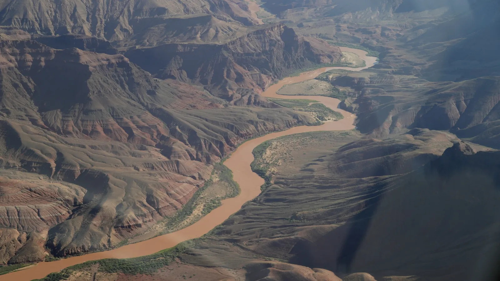
During the peak of summer, clear morning skies in the canyon frequently give way to violent, localized thunderstorms by afternoon. Because the canyon’s topography features sheer, steep, and rocky walls, it acts as a massive natural funnel. Rain falling miles away across the plateau is rapidly channeled into narrow gorges and creek beds, transforming minor trickles into charging, multi-story walls of water within minutes.
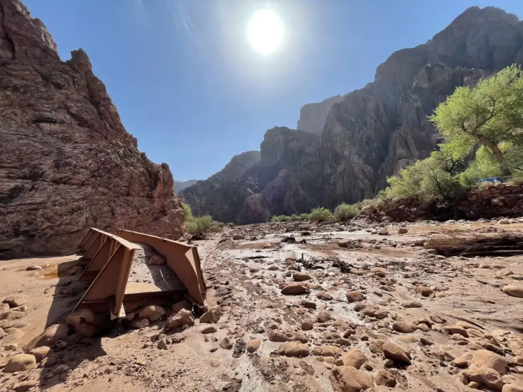
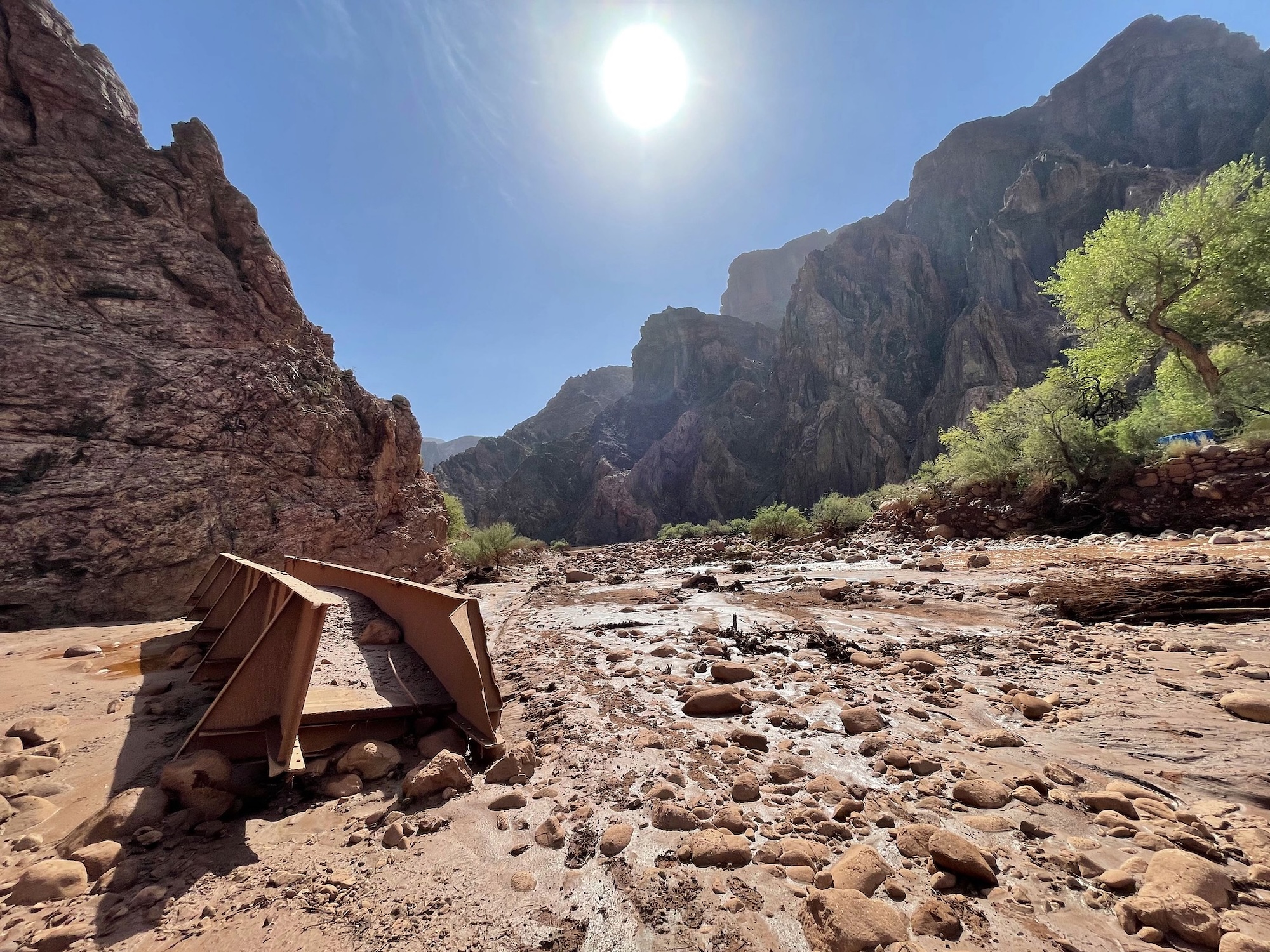
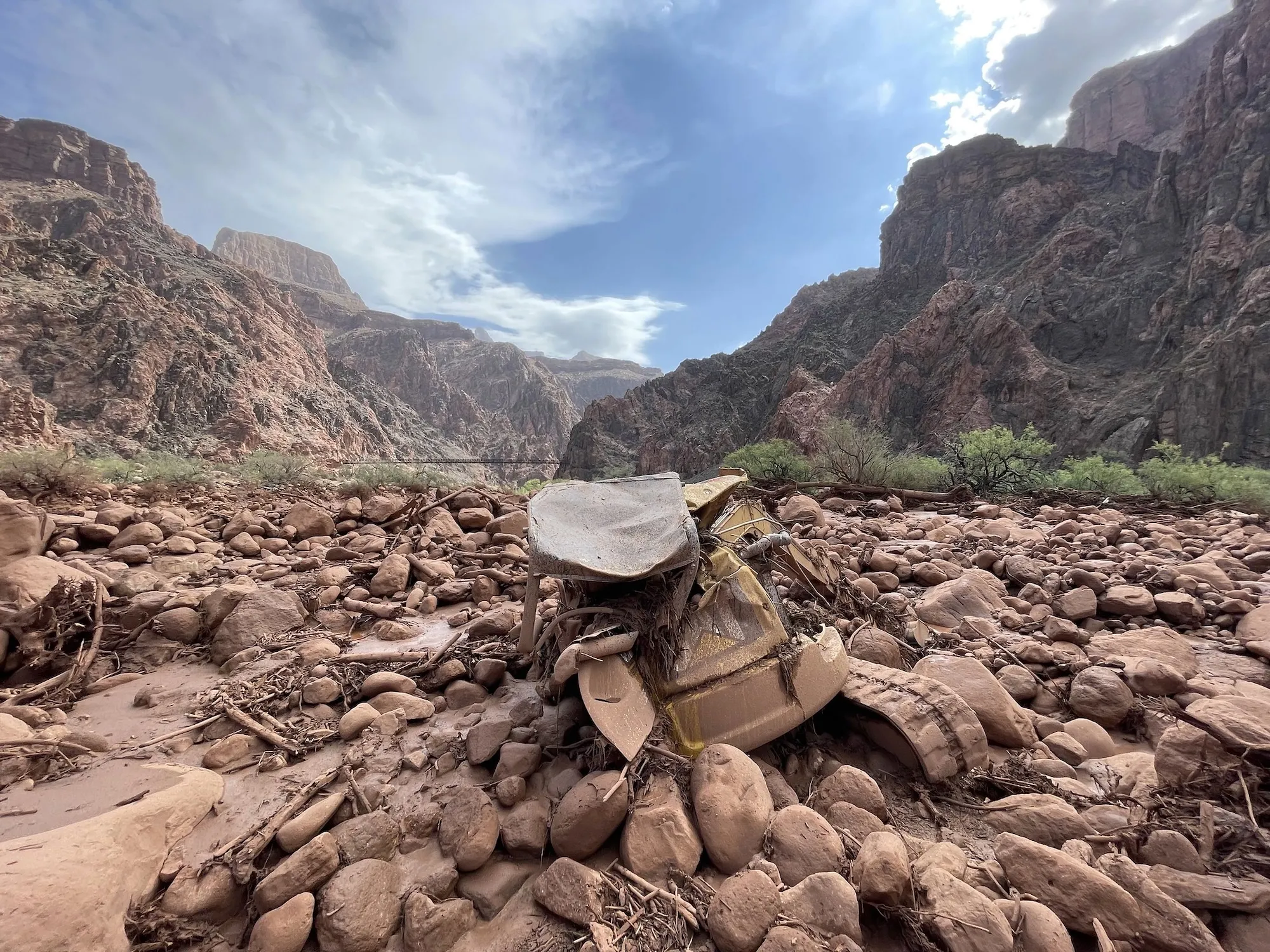
On this fateful Saturday, a severe cloudburst dropped torrential sheets of rain directly over the watershed feeding Bright Angel Creek. The resulting deluge caught hundreds of unprepared hikers and campers off guard. Survivors described a terrifying, surreal transformation of the landscape. Within moments, the pristine waters of the creek turned an opaque, churning black as they mixed with massive volumes of mud, uprooted trees, and heavy debris.
The wall of water obliterated local infrastructure, sweeping away pedestrian bridges, damaging historic utility lines, and isolating campsites. Hikers trapped on elevated ledges or clinging to canyon walls watched helplessly as the torrent swallowed trails.
Emergency response was mobilized immediately, though hampered by the remote, rugged terrain. Over the course of the weekend, National Park Service rangers, alongside specialized multi-agency rescue teams, coordinated nearly 80 daring helicopter extractions. Hoisting survivors from narrow canyon slots amid ongoing hazards, rescuers worked tirelessly to save stranded tourists. Tragically, despite these rapid deployments, two individuals succumbed to the elements, and search teams continue combing the debris fields for the remaining missing person.
Supporting Context & Metrics: The Anatomy of a Compound Disaster
To understand why Saturday’s storm proved so uniquely destructive, researchers are pointing to a sequence of environmental stressors that primed the Grand Canyon for catastrophic failure.
1. The Shadow of the Dragon Bravo Fire
A critical catalyst for the severity of the flood was its intersection with the burn scar of the Dragon Bravo wildfire. That destructive blaze, which swept across the North Rim in July 2025, scorched nearly 150,000 acres of terrain and famously consumed the historic Grand Canyon Lodge.
When a forest burns at high intensity, it fundamentally alters the hydrology of the landscape. Vegetation—which acts as a natural sponge, intercepting rainfall and stabilizing topsoil—is vaporized. Furthermore, intense heat can bake the soil, creating a waxy, hydrophobic layer that actively repels water rather than absorbing it.
Federal models and post-fire assessments conducted by the Department of the Interior’s Burned Area Emergency Response (BAER) teams had explicitly warned of these dangers. Prior to the summer season, federal reports projected that runoff risks in the Bright Angel Creek watershed were between two and eight times greater than pre-fire baseline levels. BAER team reports cautioned that hikers traversing trails downslope from the burned area would face severe stabilization issues and extreme rockfall hazards for at least a year following the fire. These warnings materialized in the worst possible way when Saturday’s storm struck the scarred watershed.
2. Parched Earth and Historic Drought
Compounding the vulnerability of the burn scar is the severe, multi-decade megadrought plaguing the American Southwest and the broader Colorado River basin. Prolonged dry conditions harden desert soils, reducing their baseline capacity to absorb sudden moisture. When heavy rain finally arrives, parched earth behaves almost like pavement, immediately shedding water into local riverine systems rather than allowing subterranean percolation.
3. The El Niño Supercharge
While local topography and burn scars dictated how the water moved, the sheer volume of the rainfall was supercharged by global oceanic phenomena. Scientists link the intensity of the storm to the historic El Niño climate cycle currently driving elevated sea surface temperatures across the Pacific Ocean.
According to Park Williams, a hydroclimatologist at the University of California, Los Angeles, El Niño systems fundamentally alter atmospheric circulation, loading the air above the American Southwest with unprecedented amounts of water vapor. When these moisture-laden air masses hit the high-altitude terrain of the Colorado Plateau, they are forced upward, cooling rapidly and wringing out catastrophic amounts of rain in compressed timeframes.
This dynamic aligns with recent peer-reviewed research. A study published in the journal Weather and Climate Extremes by Dr. Daniel Swain and his colleagues at the California Institute for Water Resources revealed a grim baseline trend: short-term, high-intensity summer downpours across the western United States have grown roughly 10% stronger since the year 2000, directly correlating with human-induced global warming.
Official Statements and Institutional Response
In the wake of the disaster, federal land managers, park superintendents, and climate scientists have faced difficult questions regarding preparedness, public communication, and the escalating risks of managing public lands in the Anthropocene.
National Park Service officials released preliminary updates detailing the scope of the rescue operation, emphasizing that visitor safety remains their paramount concern. Park representatives noted that while staff were acutely aware of the BAER team’s warnings regarding the Dragon Bravo burn scar, predicting the precise location and micro-meteorological intensity of individual monsoon cloudbursts remains an inexact science.
"We are seeing environmental variables that push our historical operational parameters to their absolute limits," stated a regional park spokesperson involved in the coordination efforts. "Our rangers and search-and-rescue partners executed extraordinary maneuvers under extreme duress to save nearly 80 lives, but the sheer velocity of this debris flow underscores the terrifying reality of post-fire flash flooding."
Climate scientists speaking on the disaster have urged a systemic re-evaluation of how wilderness recreation is managed during extreme weather epochs. Dr. Swain emphasized that the tragedy at Bright Angel Creek is a textbook example of how climate change is compressing hazard timelines.
"We are no longer dealing with simple, linear weather events," Swain noted. "When you stack a background warming trend, a supercharged El Niño feeding atmospheric moisture, a multi-year megadrought, and a massive 150,000-acre burn scar all into the same geographic pocket, the margin for human error or unexpected meteorological shifts disappears entirely."
Future Outlook: Managing Wilderness in an Age of Extremes
As search-and-rescue operations wind down and damage assessments begin along the bottom of the canyon, the disaster serves as a sobering wakeup call for federal agencies, tour operators, and outdoor enthusiasts alike.
The infrastructure damage at Bright Angel Creek—including washed-out bridges, compromised utility lines, and buried trail networks—will require months, if not years, of costly remediation. More importantly, the event forces a difficult conversation about the future viability of backcountry recreation in the American West.
With global greenhouse gas emissions continuing to drive record ocean temperatures and atmospheric instability, climate models project that compound extreme events will increase in frequency and severity over the coming decades. For the Grand Canyon, this means that the traditional monsoon season can no longer be viewed as a predictable annual pattern, but rather as a window of heightened, volatile danger.
Park management will likely be forced to adopt more aggressive preventative closures, implement real-time radar-linked evacuation protocols for high-risk zones like burn scars, and invest heavily in public education campaigns that communicate the invisible dangers of upstream watersheds to millions of incoming tourists.
Ultimately, the tragedy at Bright Angel Creek stands as a stark reminder of nature’s raw power. As the climate continues to shift, humanity’s historic relationship with iconic landscapes like the Grand Canyon must also evolve—balancing the human desire to explore the wild with a profound, clear-eyed respect for the rapidly intensifying forces reshaping the natural world.



