

Executive Overview
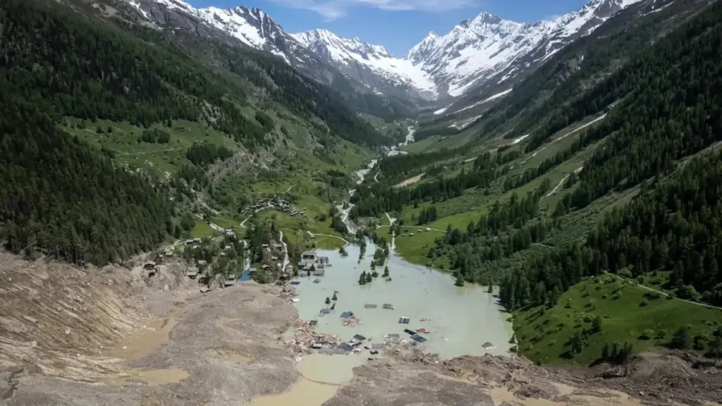
On August 26, a catastrophic mountain collapse near the border between Nepal and Tibet unleashed an unprecedented natural disaster that sent shockwaves across the globe—both literally and figuratively. Seven billion cubic feet of glacial ice and fractured rock—an incomprehensible volume equivalent to filling 100 football stadiums—plummeted roughly a mile straight down into the river valley below.
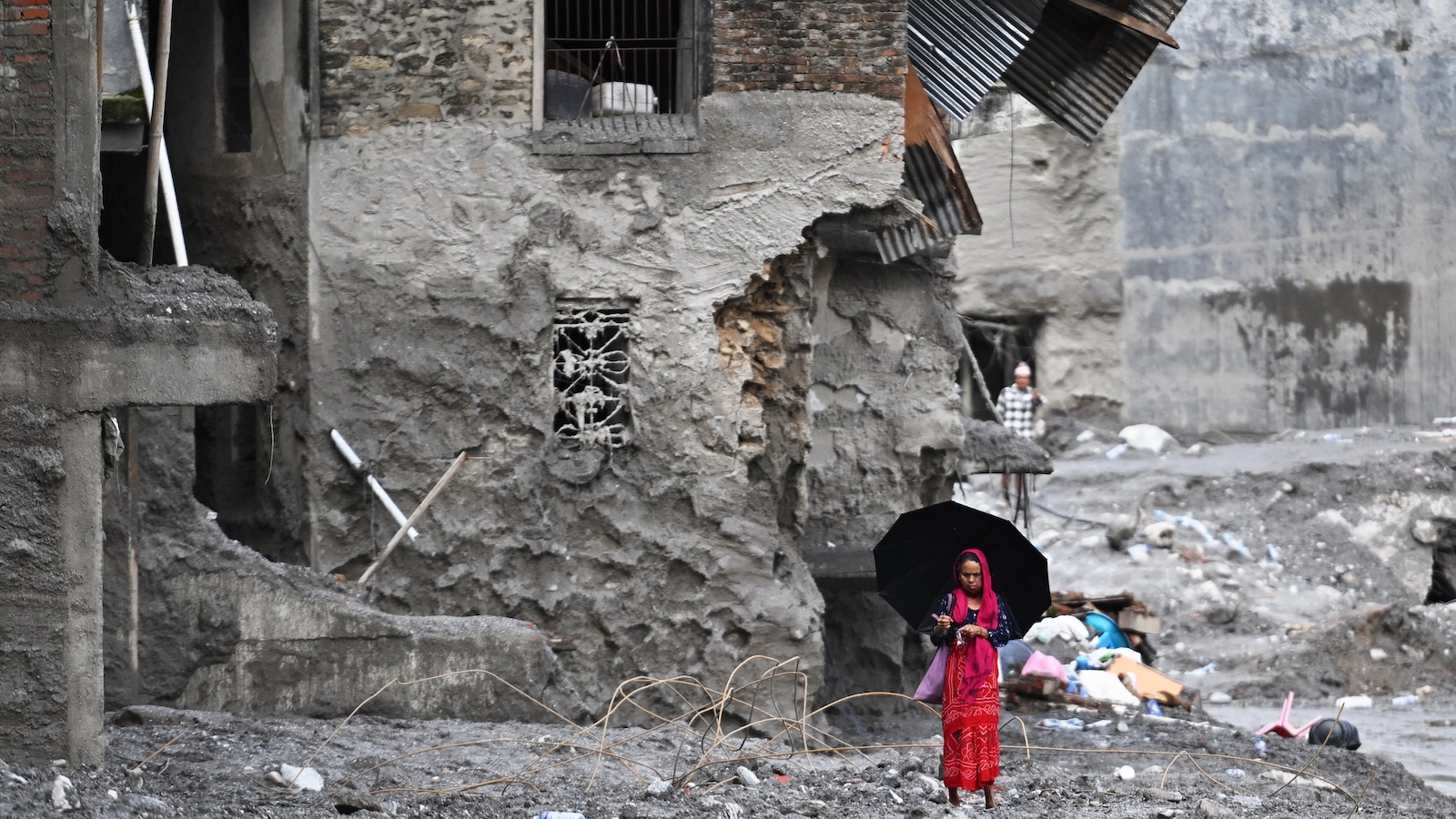
The kinetic impact of this monolithic avalanche generated a hyper-accelerated, muddy wall of water that tore through the valley at velocities reaching up to 100 miles per hour. Entire villages situated dozens of miles downstream were obliterated in minutes. The death toll has surpassed 1,300 lives, while thousands more remain missing, buried beneath meters of debris or swept away by the churning torrent.
While the Hindu Kush-Himalaya region is historically accustomed to periodic floods and landslides, the sheer scale of this catastrophe has stunned the global scientific community. Experts warn that this event is not an isolated anomaly, but rather a terrifying harbinger of a warming world. As global temperatures rise, destabilizing fragile high-altitude ecosystems, the structural integrity of the world’s mountains is failing. Glaciers are shrinking, permafrost is thawing, and the very foundations of the earth are giving way.
Yet, as researchers race to understand the precise mechanics of the August 26 disaster, a grim reality is emerging: while targeted early-warning systems have saved thousands of lives in places like the Alps and the Andes, monitoring every vulnerable peak in sprawling, remote mountain ranges remains an insurmountable challenge. The world’s high-altitude regions are reaching a dangerous tipping point, and humanity must urgently adapt to an era where the mountains themselves are falling apart.
Detailed Chronology of the Disaster
The unfolding of the August 26 tragedy demonstrates the terrifying speed and destructive potential of high-mountain hazards. Although preliminary satellite data and seismic indicators have begun to paint a picture of the sequence of events, a full, forensic understanding of the collapse will take months of rigorous scientific investigation.
The Catastrophic Collapse
At the moment of failure, an entire flank of the mountain near the Nepal-Tibet border sheared off. The mass—composed of ancient glacial ice, loose scree, and unstable bedrock—free-fell approximately one vertical mile. The sheer gravitational energy released upon impact was seismic. Instruments around the world registered the event as equivalent to a 5.2-magnitude earthquake, with shockwaves propagating as far away as Alaska.
The Surge and Downstream Devastation
The impact instantaneously pulverized the ice and rock, mixing it with river water and saturated soil to create a devastating debris flow. Traveling at highway speeds—up to 100 miles per hour—this muddy tsunami overwhelmed natural choke points in the valley. Infrastructure, bridges, agricultural terraces, and remote settlements were swept away before residents had even a fraction of a second to process the danger.
The Race for Survival
Amidst the chaos, isolated stories of quick-thinking heroism emerged. In one downstream community, alerts generated by seismic networks reached a local school just moments before the floodwaters arrived. Thanks to the swift actions of the school’s principal, 900 students were successfully evacuated to higher ground before the raging torrent completely submerged the campus.
However, for thousands of others, no warning came. Search and rescue operations—hampered by destroyed roads, unstable terrain, and remote geography—continue to face immense hurdles, transitioning slowly from rescue missions to recovery efforts as the grim reality of the death toll sets in.
Supporting Context & Metrics: The Crisis of Disappearing Ice
The disaster in Nepal is inextricably linked to the rapid, accelerating retreat of the world’s glaciers. According to climate scientists, global glaciers have shrunk by approximately one-fifth over the past century. Projections indicate they are on track to lose at least another quarter of their total mass by the year 2100.
Every fraction of a degree in global temperature warming accelerates this process, resulting in the loss of hundreds of billions of tons of ice annually. This planetary-scale melt triggers a complex cascade of downstream and structural effects:
- Loss of Buttressing: Glaciers act as heavy, frozen retaining walls supporting steep mountain slopes. As these ice masses retreat and thin, newly exposed silt, loose rock, and unstable valley walls lose their primary structural support.
- Thawing Permafrost: The soil in many alpine regions is permanently bound together by permafrost—a frozen cement-like layer. As atmospheric warming thaws this permafrost, slopes lose their internal cohesion, leading to massive rock slides and landslips.
- Bedrock Erosion: Glacial meltwater infiltrates microscopic cracks and fissures in the underlying bedrock. Through hydraulic pressure and freeze-thaw cycles, this water weakens the structural integrity of the mountain over long periods.
- Megatsunamis: The destabilization of shorelines adjacent to alpine glaciers can trigger catastrophic displacement waves. Last summer, a similar mechanism caused a staggering 1,500-foot megatsunami in Alaska’s Tracy Arm fjord.
- Moraine-Dammed Lakes: As retreating glaciers recede, they leave behind massive ridges of debris known as moraines. These natural dams frequently trap millions of gallons of meltwater and rain, forming glacial lakes that are prone to sudden, catastrophic outbursts when the dams breach.
Official Statements and Expert Perspectives
The scientific community has responded to the Nepal disaster with a mixture of profound grief and urgent warnings.
Mark Carey, a professor of environmental studies and geography at the University of Oregon and a leading researcher in glacial dynamics, emphasized the systemic nature of the threat. "Glacial loss destabilizes slopes in many far-reaching ways that are often unpredictable and catastrophic," Carey noted.
While Carey acknowledged that proactive research and monitoring have successfully saved lives in specific, localized regions, he stressed the sheer geographical impossibility of blanket protection. "In a place like the Himalayas, where thousands of glaciers are spread over vast areas, it’s impossible to predict everything and establish early warning systems everywhere."
Eran Hood, a hydrologist and professor of environmental science at the University of Alaska Southeast, echoed these sentiments while highlighting the immense resource disparities in hazard monitoring. Pointing to Juneau, Alaska—where glacial outbursts from Suicide Basin cause annual flooding—Hood explained how intensive monitoring makes all the difference.
In Juneau, automated sensors, cameras, lasers measuring water elevation, and regular drone mapping allow scientists to track the basin meticulously. "Every single cell phone in Juneau goes off when the lake starts to drain," Hood said. "We have a lake in a known location, we have cameras all over it… and we have the ability to make drone maps every few weeks to update our estimates."
Yet, Hood contrasted these localized success stories with the realities of the Himalayas. "There’s really no effective way to monitor all these glaciers," he stated. "When you’re dealing with something that releases immediately and moves downslope so quickly, how can you find a way to provide people with any warning?"
Similar success stories exist elsewhere. In the Peruvian Andes, decades of government-funded engineering projects to drain high-risk glacial lakes have saved tens of thousands of lives, a history detailed in Carey’s book, In the Shadow of Melting Glaciers. In Switzerland last year, advanced monitoring allowed authorities to successfully evacuate 300 residents from the Alpine village of Blatten mere days before a massive glacier collapse engulfed the settlement.
However, these triumphs rely on concentrated resources, accessible terrain, and years of dedicated infrastructure investment—luxuries that are often unavailable in the remote, politically fragmented, and rugged terrain of the high Himalayas.
Future Outlook: Emerging Technologies and the Tipping Point
As the frequency of high-altitude disasters climbs, scientists and engineers are racing to adapt emerging and repurposed technologies to bridge the monitoring gap.
Seismic Early-Warning Networks
Researchers are exploring whether seismic networks—traditionally built to detect earthquakes—can be reconfigured to catch glacial hazards. In Mexico City, seismic systems routinely provide residents with critical seconds of warning before tremors strike. Because the Nepal glacial collapse registered as a 5.2-magnitude seismic event, experts believe that dense seismic arrays could eventually help detect massive slope failures in real-time, buying vital minutes for downstream communities to evacuate.
Fiber-Optic "Icequake" Detection
Innovation is also taking place directly on the ice. Researchers in Switzerland have experimented with laying fiber-optic cables across active glaciers. These cables are capable of detecting "icequakes"—microscopic fractures and shifts within the ice body that generate minute seismic vibrations. Monitoring these acoustic signatures can provide early clues regarding a glacier’s changing structural stability.
Advanced Satellite Surveillance
Perhaps the most promising technological leap forward involves space-based radar. A newly launched satellite developed jointly by the space agencies of the United States and India—known as NISAR—was specifically designed to detect subtle millimeter-scale shifts in Earth’s surface. Unlike older optical satellites, NISAR can capture detailed imagery of snow and ice cover right through dense cloud cover.
In a chilling validation of its capabilities, post-disaster analysis of NISAR data revealed that the satellite had clearly recorded pre-collapse slumping and shifting on the doomed Nepal mountain slope several weeks before it finally gave way.
The Unyielding Reality of Climate Change
Despite these technological breakthroughs, leading scientists caution against viewing any single tool as a silver bullet.
Dan McGrath, a glaciologist and associate professor at Colorado State University, emphasized that technology can only buy time, not reverse the underlying physical drivers of the crisis. "Many of these mountain ranges are at a tipping point," McGrath warned. "Freezing, or not freezing, is binary. And as temperatures warm above that and permafrost thaws, that is undoubtedly going to lead to an increase in disasters like this."
Ultimately, the catastrophe in Nepal serves as a brutal reminder that climate change is no longer a slow-moving abstract threat. Across the world’s highest peaks, the cryosphere is unraveling, and humanity must confront the sobering reality of a destabilized planet where the mountains themselves are no longer permanent.



