

Executive Overview
Unprecedented. Record-breaking. Baffling. For meteorologists, atmospheric scientists, and emergency management personnel across the United States, the lexicon used to describe weather patterns is being aggressively rewritten. The epicenter of this meteorological shockwave is the American Midwest, where the 2026 tornado season has shattered historical baselines. Illinois—colloquially known as the Prairie State—has emerged as the unlikely epicenter of global tornado frequency, unleashing an astonishing tally of twisters that has left experts searching for answers.
As of late August, 207 cyclones have touched down across the flat expanses of Illinois. This staggering figure handily eclipses the state’s previous all-time record of 142 funnel clouds, set a mere two years prior in 2024. More remarkably, this marks the third consecutive year that Illinois has endured a triple-digit tornado season—a stark departure from its historical climatic average of roughly 50 twisters annually. The impacts have been severe and widespread, ranging from flipped homes and splintered utility poles to the structural devastation of modern solar arrays.
While the Land of Lincoln grapples with this relentless atmospheric siege, a broader, more profound shift is quietly occurring across the North American continent. The traditional geographic boundaries of "Tornado Alley"—long anchored in the wide-open plains of Texas, Oklahoma, and Kansas—appear to be migrating eastward. While the southern Plains and the Southeast experience a surprisingly subdued year, the Corn Belt and the Great Lakes regions are recording their highest levels of tornado activity since the National Weather Service (NWS) began systematic record-keeping in 1950.
This deep dive examines the anatomy of this historic season, analyzes the shifting geography of American severe weather, explores the thermodynamic forces fueled by a warming Gulf of Mexico, and addresses the complex intersections of climate change, technological detection, and atmospheric science.
Detailed Chronology of a Relentless Season
The path to 207 tornadoes did not happen overnight; it has been an unrelenting sequence of violent weather events stretching across the calendar year, defying the traditional seasonality of severe weather.
The onslaught began early. In mid-March, a volatile clash of air masses tore through the Metro East region of Illinois, serving an early warning shot that this year would deviate sharply from historical norms. These early-season storms brought damaging winds and multiple confirmed touchdowns that dismantled infrastructure before the spring agricultural planting season had even begun.
By late spring, the frequency of severe weather events intensified into a nearly continuous drumbeat. In June, a potent severe weather system swept across the Chicago metropolitan area. Packing winds capable of tearing through urban infrastructure, the system spawned tornadoes that disrupted the lives of hundreds of thousands of Commonwealth Edison (ComEd) customers, leaving deep scars in neighborhoods from Englewood to surrounding suburbs. Power lines were felled like matchsticks, and emergency services were stretched to their absolute limits as multiple warnings issued in rapid succession overwhelmed local response networks.
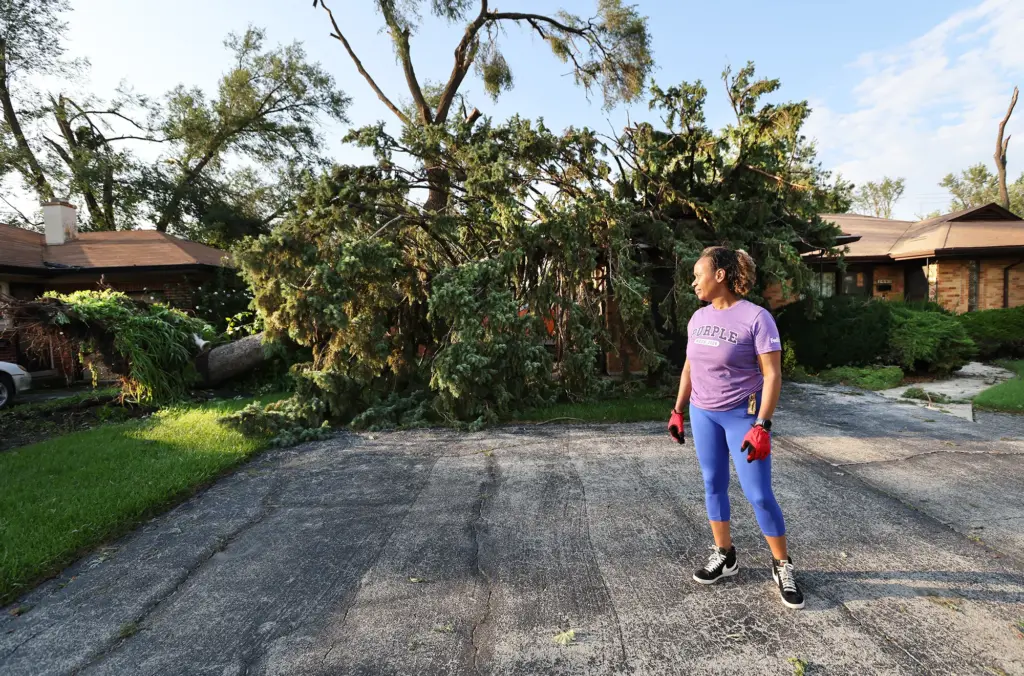
As summer took hold, the atmospheric instability did not wane—it migrated and mutated. August brought a surreal landscape of recovery efforts across Northwest Indiana and Illinois, where residents found themselves cleaning up after tornadoes that struck with little traditional lead time. Even as the season pushes toward its final quarter, ongoing post-storm damage assessments by the National Weather Service suggest that the final count of 207 may yet climb higher. Officials are meticulously combing through high-resolution satellite data, radar archives, and on-the-ground structural surveys to verify marginal touchdowns that might otherwise have gone unnoted.
Supporting Context & Metrics: By the Numbers
To truly grasp the magnitude of the 2026 season, one must place it within the framework of historical climatology and national geographical comparisons.
The Illinois Anomaly
- Current Count: 207 tornadoes (and counting) as of late August 2026.
- Previous Record: 142 tornadoes, set in 2024.
- Historical Baseline: Approximately 50 tornadoes annually.
- Streak: Three consecutive years of triple-digit tornado activity.
While raw counts tell a compelling story, skeptics often point to historical champions like Texas, which recorded an all-time state record of 255 tornadoes in 2015. However, state climatologists and atmospheric researchers urge caution with raw numbers due to massive disparities in land area. Texas is approximately 4.7 times larger than Illinois.
When evaluated through the lens of tornado density—measured by the concentration of tornadoes touching down within standardized 80-kilometer (50-mile) grid squares—the narrative shifts dramatically. According to spatial analyses conducted by Steve Nesbitt, a professor of atmospheric sciences at the University of Illinois Urbana-Champaign, parts of central Illinois have experienced a higher reported density of tornadoes than any other region in the United States as of mid-August.
Furthermore, this is not an isolated local phenomenon. A regional analysis reveals that neighboring states—including Indiana, Iowa, Missouri, Michigan, and Ohio—rank among the top ten nationwide for tornado activity this year. The eastward migration of severe weather even manifested in anomalous coastal events, notably a pair of rare tornadoes that touched down in New York City and Long Island.
Paradoxically, this hyper-localized hammering in the Midwest occurs against the backdrop of a below-average national season. The traditional powerhouse regions of the southern Plains and the Southeast have remained unusually quiet, underscoring a pronounced spatial redistribution of storm tracks rather than a nationwide surplus.
Official Statements and Expert Perspectives
The scientific community is currently grappling with the implications of these shifting weather patterns. The consensus among climatologists and meteorologists is one of cautious bewilderment, balancing observational data against the limits of current predictive modeling.
Trent Ford, the Illinois state climatologist, captures the prevailing sentiment of his field:
"It’s just anything beyond what we would expect."
Ford emphasizes that the persistence of these multi-year spikes points away from simple random chance and toward a systemic shift in regional climate drivers.
Steve Nesbitt highlights the unprecedented nature of the spatial distribution, noting that the historic hammering absorbed by Illinois and Indiana represents uncharted territory since the inception of modern meteorological tracking in 1950.
Meanwhile, Shel Winkley, chief meteorologist at the climate research group Climate Central, breaks down the fundamental thermodynamic engine driving these events. Tornadoes, Winkley explains, are the physical manifestation of atmospheric contrasts and chaos. They require a delicate recipe: moist, low-level air trapped beneath a layer of drier, hotter air aloft—a meteorological sandwich that creates extreme atmospheric instability.
Winkley points to Convective Available Potential Energy (CAPE) as the critical metric for measuring this fuel supply.
"That doesn’t necessarily mean a tornado will form," Winkley notes, referencing the spring data over the East and Southeast, "but we have these higher values of CAPE… during the spring than we used to have." Crucially, Winkley clarifies the current scientific consensus regarding climate change: "At least the science that we have right now, we don’t see a connection between more tornadoes occurring because of climate change. It’s more about where they’re occurring, when they’re occurring, and then again the number that they’re happening on specific days versus others."
Adding a vital operational perspective, Ginno Izzi, a senior meteorologist at the National Weather Service office covering Chicago, points out a human and technological factor that cannot be ignored: observational bias.
"Our radar data has increased in resolution multiple times over compared to even when I started at this office 20 years ago," Izzi states.
The integration of dual-polarization radar, high-resolution satellite feeds, and advanced remote-sensing networks means that contemporary meteorologists are detecting ephemeral, weak, and brief tornadoes that would have gone entirely undocumented decades ago.
The Thermodynamic Engine: Moisture, Heat, and the Gulf of Mexico
To understand why the Midwest is experiencing this historic surge, one must look south toward the Gulf of Mexico. The Earth’s oceans have absorbed more than 90 percent of the excess heat trapped by anthropogenic greenhouse gas emissions since the dawn of the industrial era. The Gulf of Mexico, in particular, has registered exceptionally warm water temperatures in recent seasons.
This thermal anomaly acts as an atmospheric supercharger. Warmer water temperatures increase evaporation rates, pumping massive quantities of warm, moisture-laden air into the lower troposphere. Prevailing wind patterns—specifically the Great Plains low-level jet stream—routinely scoop up this marine moisture and transport it northward across the Mississippi River Valley and into the heart of the Corn Belt.
When this moisture-rich, unstable air mass collides with dry, cold fronts descending from Canada over the flat agricultural plains of Illinois, the thermodynamic release is explosive. This is the exact mechanism that fuels violent supercells capable of rotating updrafts (mesocyclones). While this moisture-loading process is well-understood in the context of intensifying hurricanes and tropical systems, its downstream effects on continental severe weather are proving to be equally profound and destructive.
Future Outlook: Science at the Crossroads
As the 2026 season progresses toward its autumn transition, emergency managers, urban planners, and agricultural communities in the Midwest are forced to confront a new normal. The traditional mental map of severe weather safety—which conditioned generations of Americans to view Tornado Alley as a distant western threat—is officially obsolete. Communities from the Mississippi River to the Indiana state line must now design infrastructure, upgrade building codes, and refine early-warning protocols tailored to a heightened frequency of intense local twisters.
Yet, for the scientific community, this season highlights frustrating limitations in predictive climatology. Unlike massive, sprawling tropical cyclones—which span hundreds of miles and are easily captured by global climate models—tornadoes are profoundly hyperlocal phenomena. They develop rapidly on scales of blocks and miles, making them exceptionally difficult to simulate over long-term climate horizons.
Resolving the fundamental debate over how much of this geographic shift is driven by natural multi-decadal climate variability versus runaway anthropogenic warming requires computational power that is only now coming online. As Shel Winkley observed:
"That’s still one of those things that we just need faster computers and stronger computers in order to be able to do that sort of modeling with it, and we’re just not quite there yet."
Until those technological milestones are reached, researchers will continue to parse the data storm by storm, radar scan by radar scan. For Illinois and the broader Midwest, however, the academic debate takes a back seat to immediate reality. The twisters are touching down, the historical baselines have been shattered, and the region stands uncomfortably at the dynamic new heart of American severe weather.



