

Executive Overview
The serene valleys stretching along the rugged borderlands between Nepal and Tibet have become the epicenter of a humanitarian catastrophe following a series of unprecedented, catastrophic flash floods. The disaster, which struck unannounced on Wednesday, unleashed walls of dense mud, churning boulders, and liquefied debris with a kinetic violence so extreme that international seismological networks initially misclassified the subterranean tremors as a moderate tectonic earthquake. Entire communities were effectively erased from the map within minutes, leaving behind desolate landscapes of slate, mud, and shattered timber where bustling villages once stood.
As of Thursday evening, the confirmed death toll has risen to at least 469 individuals, with hundreds more officially listed as missing. Rescue personnel, hampered by severed communication links, washed-out infrastructure, and impassable seas of thick sediment, are engaged in frantic, round-the-clock search operations. The Nepalese government, working in tandem with local civil defense units and international humanitarian agencies, has mobilized emergency relief supplies, deploying medical teams, heavy-lift transport, and makeshift aid stations to the most severely impacted border regions.
However, the sheer scale of the devastation has severely strained emergency response frameworks. The catastrophe has left thousands of survivors homeless, destitute, and psychologically traumatized, grappling with the sudden loss of their families, livelihoods, and entire community structures. This report provides an exhaustive examination of the disaster, drawing upon eyewitness testimony, chronologies of the event, contextual metrics of regional climate vulnerability, official governmental reactions, and an assessment of the long-term outlook for the battered region.
Detailed Chronology of the Disaster
The Genesis: Wednesday Morning
The sequence of events began unfolding in the early hours of Wednesday, when anomalous meteorological conditions over the trans-Himalayan border region precipitated an unprecedented volume of precipitation in an extraordinarily brief window. While seasonal monsoon rains are standard for the region, the intensity of this localized weather anomaly triggered massive glacial lake outbursts and rapid runoff along steep, unstable mountain gradients.
By mid-morning, local time, the upper tributaries of the region’s river systems were overwhelmed by massive walls of water mixed with topsoil and rock. Unlike traditional riverine floods that offer hours of gradual warning, this event manifested as an instantaneous, high-velocity wall of slurry.
The Seismic Misidentification
At approximately 08:30 local time, the force of the descending debris torrents generated severe ground vibrations. Seismographs operated by international monitoring agencies registered a sudden jolt. Because the earth shook with such synchronized ferocity, automated alert systems and geologists initially logged the anomaly as an earthquake originating near the Tibetan border. It was only as frantic emergency calls began piercing through patchy cellular networks that authorities realized the ground was shaking not from tectonic shifts, but from the kinetic hammer-blow of millions of tons of mud and rock cascading down valley walls.
The Strike on Mountain Communities
Communities situated along the low-lying river corridors and alluvial fans were given virtually no time to evacuate. In villages such as those in the Rasuwa district, residents reported hearing a deep, subterranean roar—likened by survivors to a catastrophic tectonic rupture—moments before the muddy torrents engulfed their homes.
Trekking guide Sonam Dorjee, who had departed his home village of Rasuwa Syafru at 08:00 local time—just an hour before the disaster struck—recounted the terrifying moments of realization. Driving toward Kathmandu, Dorjee heard the horrifying acoustic signature of the flash flood echoing through the canyon.
"It sounded like an earthquake," Dorjee told the BBC. "My house has collapsed… I have seen a photo."
His sister, Dechen Tamang, along with her husband and several other relatives, remain among the missing.
The Immediate Aftermath: Thursday Rescue Operations
By Thursday dawn, the full panorama of destruction came into sharp focus as rescue teams trudged through thick, suffocating layers of mud and debris. The landscape had been radically altered; riverbeds had shifted, bridges were sheared from their foundations, and access roads were buried under feet of silt and rock.
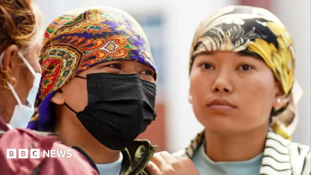
In Kathmandu’s Tribhuvan University (TU) Teaching Hospital, an agonizing vigil unfolded. Families of the missing converged on the facility, transforming its corridors into centers of anxious waiting and grief. Ram Khumari Shrestha clutched her mobile phone, staring at the screen that bore her husband’s image. Her husband had traveled to Rasuwa for work as a professional driver and had maintained contact until 8:00 PM on Wednesday before his phone went dead.
Similarly, Mani Shrestha Bishwa spent Wednesday night camped at the hospital, praying for news of his younger brother, cousin, uncle, and friend. "I last contacted them at 8:30 in the morning," he said, encapsulating the helplessness felt by hundreds of families whose loved ones vanished into the path of the torrent.
Supporting Context & Metrics
Casualties and Infrastructural Impact
- Confirmed Fatalities: At least 469 deaths have been officially documented across the border districts of Nepal and the adjacent Tibetan zones. Experts warn that this figure is preliminary and expected to rise significantly as rescue teams penetrate remote mountain hamlets.
- Missing Persons: Several hundred individuals remain unaccounted for, complicating official census and recovery efforts.
- Infrastructure Destruction: Dozens of complete villages have been wiped out. Major arterial roads, suspension bridges, hydroelectric micro-grids, and agricultural terraces have been obliterated, severing communication lines and cutting off entire administrative zones.
- Economic and Agricultural Devastation: The floods have swept away vast swaths of fertile agricultural land, livestock, and stored grain reserves. Goma Pandit, a displaced local farmer, lamented the total loss of her livelihood: "My farmland is also swept away. Ten sacks of mustard seeds, tons of corn and rice paddy are all gone. Nothing is left."
Geographical and Climatic Vulnerability
The geography of the Himalayan frontier makes it acutely susceptible to catastrophic hydrological events. Steep, vertical topography coupled with fragile geological formations creates natural funnels for heavy water discharge. In recent decades, rising global temperatures have accelerated the melting of Himalayan glaciers, increasing the volume and frequency of glacial lake outburst floods (GLOFs).
When combined with increasingly erratic and intense monsoon patterns driven by global climate change, these mountain corridors are transformed into high-risk zones. Meteorological analysts point out that traditional historical data models are no longer adequate for predicting the severity of modern weather events in the region. The sheer volume of water released in Wednesday’s event underscores the urgent need for enhanced early-warning systems tailored to high-altitude transboundary watersheds.
Official Statements and Humanitarian Response
Government and Civil Defense Mobilization
In the wake of the disaster, the government of Nepal declared a state of emergency across the worst-hit districts. Prime Minister and senior disaster management officials convened emergency cabinet sessions to direct the deployment of the Nepal Army, Armed Police Force, and local civilian volunteers into the disaster zones.
"Many survivors are now left without homes and they need emergency rescue and evacuation, as well as food, temporary accommodation, and medical support," noted local humanitarian coordinators on the ground.
Logistical hurdles, however, have severely hampered the deployment of heavy relief equipment. With roads blocked by massive landslides and bridges destroyed, authorities have had to rely heavily on aerial reconnaissance and rotary-wing aircraft to drop emergency rations, water purification tablets, and medical kits to isolated pockets of survivors.
International Aid and Cross-Border Coordination
Given that the disaster zone straddles the volatile border between Nepal and Tibet (administered by the People’s Republic of China), bilateral coordination has become vital. Diplomatic channels have opened to facilitate cross-border rescue intelligence, meteorological data-sharing, and joint humanitarian efforts.
International bodies, including the United Nations Office for the Coordination of Humanitarian Affairs (UNOCHA) and the Red Cross, have begun mobilizing emergency funds and relief supplies. Neighboring nations have offered specialized search-and-rescue teams equipped with canine units and thermal-imaging gear to assist in locating survivors trapped beneath the debris.
Future Outlook
Immediate Priorities: Search, Rescue, and Relief
As the search operations extend into their critical second and third days, the immediate priority remains the recovery of trapped survivors and the prevention of secondary humanitarian crises. Public health officials have expressed grave concerns over potential outbreaks of waterborne diseases, such as cholera and dysentery, due to contaminated water supplies and the lack of sanitation facilities in makeshift displacement camps. Establishing clean drinking water infrastructure and deploying mobile field hospitals are paramount tasks for the coming days.
Long-Term Reconstruction and Climate Resilience
Looking beyond the immediate emergency response, the disaster forces a sobering reckoning regarding long-term regional planning and climate adaptation.
- Infrastructure Redesign: Future rebuilding efforts cannot simply replicate the vulnerable structures that were swept away. Roads, bridges, and housing developments must be engineered to withstand high-velocity debris flows and relocated away from high-risk alluvial fans and active river corridors.
- Advanced Early-Warning Systems: Investment in high-altitude meteorological monitoring, automated river-gauge sensors, and satellite-linked community alarm systems is urgently required. Providing vulnerable mountain communities with even a 15-to-30-minute advance warning can mean the difference between life and death.
- Ecosystem Management: Reforestation and slope-stabilization projects along fragile Himalayan watersheds must be prioritized to mitigate soil erosion and reduce the kinetic energy of future runoff events.
Conclusion
The catastrophic flash floods of Wednesday have left an indelible scar upon the collective psyche of the Himalayan region. As families mourn the loss of entire lineages and search through the mud for traces of their past, the disaster stands as a stark, tragic reminder of the raw power of nature and the accelerating vulnerabilities induced by a changing global climate. For the survivors camped outside hospitals in Kathmandu and huddled in temporary shelters in the mountains, the road to recovery will be arduous, long, and fraught with sorrow—demanding an enduring, coordinated response from the international community.



