

Executive Overview
The American landscape is undergoing a perilous transformation. What was once viewed as the idyllic pursuit of the open West—nestling residential communities against sweeping, high-desert vistas, mountain ranges, and rugged shrubland—has collided with a punishing climatic reality. Across the United States and Canada, an era of compounding, hyper-destructive wildfires is redefining the boundaries of human habitation.
Nowhere is this collision more evident than in places like Somersett, a peaceful residential enclave just a short drive from downtown Reno, Nevada. Characterized by high-desert views, winding roads, and pristine golf courses, Somersett sits on the razor’s edge of a volatile environment. In August, months of relentless heat and low humidity primed this landscape to burn. When the Hawk Fire ignited on a Saturday morning, it capitalized on dry grasses and powerful winds to consume more than 23 miles in a matter of days, placing 90,000 people on evacuation notice, blanketing the city in dense, toxic smoke, and reducing dozens of suburban homes to ash.
This disaster is far from an isolated anomaly. It is part of a systemic, nationwide crisis driven by two converging forces: a rapidly warming planet and the explosive growth of the wildland-urban interface (WUI)—the high-risk zones where housing developments push deep into flammable forests, grasslands, and chaparral. As scientists warn that climate change is supercharging fire seasons across North America and Europe, experts argue that the nation’s housing policies, zoning laws, and demographic shifts are steering millions of Americans directly into the path of inevitable infernos.
Detailed Chronology: The Anatomy of the Reno and Pacific Northwest Blazes
The unfolding catastrophe in the American West follows a terrifyingly predictable arc, defined by parched landscapes, rapid ignitions, and explosive wind-driven spreads.
The Somersett and Reno Catastrophe
The sequence of events leading to the Hawk Fire began months before a single spark was struck. Record-low winter snowpacks across the Sierra Nevada and Great Basin deprived the regional ecosystem of the deep, lingering moisture that typically seeps into the soil throughout the summer months. This deficit was compounded by prolonged, record-breaking heat waves that baked the high desert of northern Nevada. By August, Reno had secured its dubious distinction as the fastest-warming city in the United States, according to Climate Central.
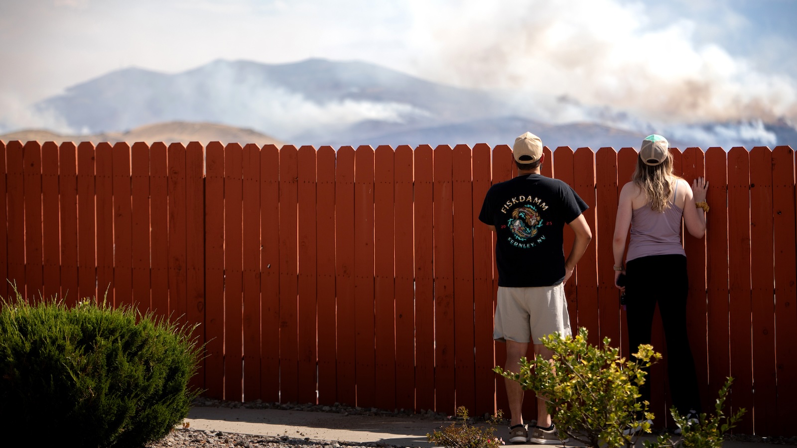
On the morning of August 22, the Hawk Fire erupted in the shrublands surrounding Somersett. Fanned by fierce, unpredictable winds, the flames tore through dry, highly combustible grasses. In just hours, the fire ballooned by thousands of acres, marching relentlessly toward populated neighborhoods. The inferno forced the closure of U.S. Route 395—a vital transit artery hugging the Nevada-California border—and triggered mass evacuation orders that left residents scrambling to escape.
The Hawk Fire did not occur in a vacuum. Just two weeks prior, the massive Bug Fire had chewed through 150 square miles of terrain just north of the same region, overtaxing regional firefighting resources and signaling an exceptionally volatile late-summer fire season.
Parallels Across the West and Pacific Northwest
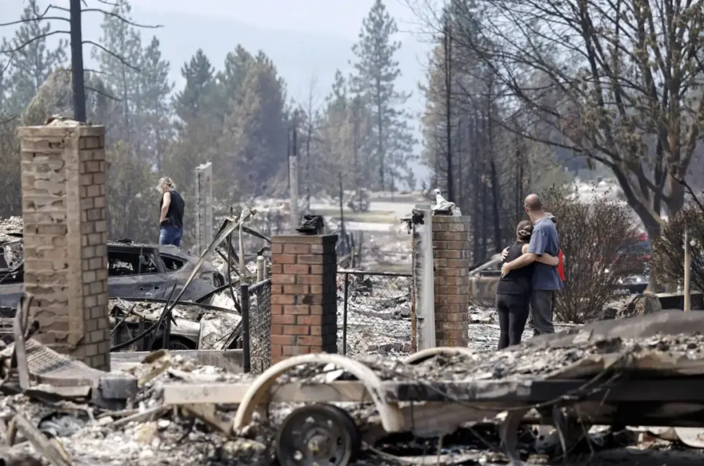
The nightmare playing out in Nevada mirrors devastation seen across the Western United States and Canada. Earlier in the month, a trio of massive wildfires swept through suburban fringes near Spokane, Washington—the state’s second-largest city—incinerating more than 900 structures and leaving behind scenes of utter devastation as families sifted through the charred wreckage of their neighborhoods.
Further south, the terrifying reality of WUI fires was underscored earlier in the year by the Eaton and Palisades fires, which tore through the brush-heavy suburban sprawl surrounding Los Angeles in January 2025. Those blazes forced more than 200,000 residents to flee and reduced thousands of homes and commercial buildings to rubble.
North of the border, the crisis has been equally devastating. First Nations communities and residents across Ontario have borne the brunt of more than 5,100 fires nationwide, feeding into a continental burn zone that has consumed over 7.9 million acres in the U.S. alone this year.
Supporting Context & Metrics: The Science of Sprawl and Climate Amplification
To understand why modern wildfires are increasingly catastrophic, researchers point to a toxic synergy between ecological disruption and human geography.
The Climate Connection
Scientists with organizations like World Weather Attribution have repeatedly established clear causal links between anthropogenic climate change and the severity of modern fire seasons. Rising global temperatures evaporate soil moisture faster, creating vast swaths of dead or dying vegetation that acts as tinder.
In the Western U.S., the lack of adequate winter snowfall is a primary culprit. Historically, deep snowpacks slowly melt over the spring and early summer, keeping the forest floor and underbrush hydrated. As winters grow warmer and drier, this natural insurance policy has vanished, leaving landscapes primed for explosive combustion by mid-July.
The Wildland-Urban Interface (WUI) Phenomenon
While climate change provides the match, suburban sprawl builds the bonfire. Tim Brown, director of the Western Regional Climate Center at the Desert Research Institute in Nevada, notes a decades-long demographic shift toward high-risk ecosystems.
"What’s happened over the last decades is we’ve had explosive population growth in naturally fire-prone areas," Brown said. "People are moving in to where fire happens."
Driven by urban housing shortages, skyrocketing home prices in city centers, and a cultural desire for space and scenic outdoor recreation, millions of Americans have relocated to the outskirts of towns. Today, more than a third of all homes in the continental United States are situated within the WUI.
This expansion has fundamentally altered risk calculations. A recent landmark study published in Natural Hazards, a Nature research journal, revealed that the compounding effect of WUI expansion and climate change has quadrupled the risk of destructive wildfires in California alone.
The convergence of housing density and volatile vegetation has led experts like Brown to suggest a terminology shift: "Maybe we need to stop calling it the WUI and call it what it is: fire-prone."
Official Statements & Frontline Perspectives: Voices from the Crisis
Local officials, wildfire experts, and federal spokespeople are sounding the alarm over the compounding vulnerabilities of human infrastructure in the face of mega-fires.
The Human Spark
According to Chris Buckley, a public information officer with the U.S. Forest Service, the sheer volume of people living adjacent to wildlands drastically increases the baseline probability of disaster. Reno’s population has surged by 26 percent over the last 15 years, swelling past 283,000 residents.
"It’s a very beautiful place to make your home," Buckley noted. "But during this type of weather in this part of the country, anything that can cause a spark is just so dangerous."
Much like the vast majority of wildfires in the United States, the Hawk Fire was ultimately determined to be human-caused—sparked by accidents, equipment, or negligence in an environment with zero margin for error.
The Evacuation Crisis
When these fires strike, evacuation logistics often transform into life-threatening bottlenecks. Many WUI neighborhoods were built decades ago with narrow, winding roads and single-lane ingress and egress routes.
During the recent Spokane fires, escaping residents faced hours-long traffic jams, sitting trapped in their vehicles as advancing flames illuminated the sky. These terrifying scenes echo the nightmarish gridlock of the 2018 Camp Fire in Paradise, California, where trips that typically took 25 minutes stretched into hours.
Brett Taylor, who works on wildfire mitigation with the Truckee Meadows Fire Protection District near Reno, highlighted the architectural mismatch between modern suburbs and wildfire realities:
"Our roads are not built for all people to leave all at once," Taylor explained. He stresses that public safety relies heavily on early, preemptive evacuations before mandatory orders are issued, which prevents gridlock and preserves critical roadways for emergency apparatus. "We really lose our effectiveness if all we’re worrying about is evacuating people and not fighting the fire."
Future Outlook: Mitigation, Toxicity, and Adaptation
As the frequency of WUI fires accelerates, public agencies and researchers are confronting the reality that suppression alone is no longer a viable strategy. Mitigating future disasters requires a multi-pronged approach addressing construction, vegetation management, and the hidden public health dangers of urban smoke.
The Hidden Killer: Toxic Smoke
The immediate trauma of flames and falling embers is only the beginning of the threat. Public health researchers estimate that wildfire smoke is on track to claim up to 70,000 American lives annually by 2050 as warming temperatures expand burn zones.
When fires infiltrate suburban and urban environments, they consume more than just timber and dry grass. The burning of automobiles, residential structures, synthetic building materials, and household plastics releases a cocktail of highly toxic pollutants. Studies examining the aftermath of the Los Angeles fires revealed that millions of residents were exposed to alarming concentrations of chromium-6, a potent cancer-causing heavy metal.
"You can smell the difference in the smoke," Taylor noted, contrasting the clean-burning scent of pine needles with the acrid, chemical-laden plumes of modern suburban fires.
Hardening Homes and Managing Landscapes
Recognizing these mounting dangers, states like California have instituted stringent wildfire-safety regulations, mandating that homeowners clear defensible space by removing flammable vegetation within specific radiuses of structures. According to Tim Brown, building materials and architectural techniques that prevent wind-driven embers from infiltrating attics and crawlspaces are equally critical: "Many homes burn from the inside out."
On the municipal level, agencies are racing to alter the landscape before nature does it for them. Taylor and his team at the Truckee Meadows Fire Protection District utilize federal, state, and local grants to fund mechanical thinning projects—cutting down dense thickets of trees and overgrown grasses to establish natural firebreaks.
Yet, despite millions of dollars poured into these preventative measures, resources remain vastly overmatched.
"We’re making a dent," Taylor conceded regarding ongoing thinning operations. "But it’s a tiny fraction of what needs to be done."
Ultimately, the fires sweeping through Somersett, Spokane, and Los Angeles serve as a stark warning. Unless municipal planners, developers, and homeowners fundamentally rethink where and how communities are built in an era of climate change, the destructive collision between suburban sprawl and unyielding wildfire will continue to rewrite the American landscape in ash and smoke.



