

Executive Overview
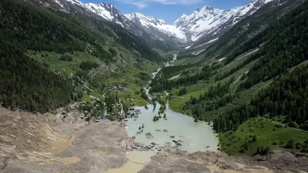
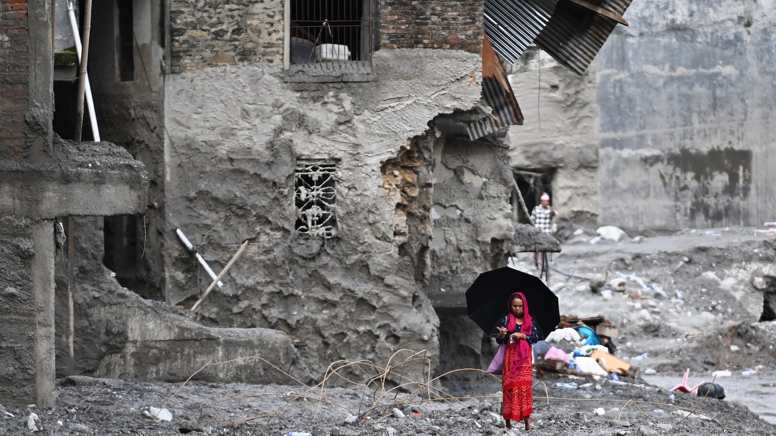
On August 26, a catastrophic structural failure near the border of Nepal and Tibet triggered one of the deadliest high-altitude disasters of the modern era. An estimated seven billion cubic feet of glacial ice and fractured rock—a mass sufficient to fill 100 football stadiums—plunged nearly a mile straight down into the valley below. The resulting impact unleashed a raging, muddy torrent that tore through the landscape at speeds reaching 100 miles per hour. The wall of water obliterated downstream villages, claimed more than 1,300 lives, and left thousands of others missing.
While the region is no stranger to seasonal flooding and mountain hazards, the sheer magnitude of this catastrophe has shocked the international scientific community. It underscores a terrifying reality driven by a rapidly warming planet: as global temperatures rise, the cryosphere is destabilizing at an unprecedented pace. The physical processes that hold towering mountain ranges together are unraveling, rendering historic safety margins obsolete.
Although targeted engineering and early-warning projects have successfully mitigated risks in places like the Peruvian Andes, the Swiss Alps, and southeastern Alaska, the vast and remote terrain of the Himalayas presents a nearly insurmountable monitoring challenge. Scientists warn that without revolutionary approaches to hazard detection, tragedies of this scale will transition from statistical anomalies to recurring nightmares.
Detailed Chronology: The August 26 Catastrophe
To understand the mechanics of the disaster, researchers have had to piece together seismic records, satellite telemetry, and eyewitness accounts from the few survivors who managed to outrun the deluge.
Weeks prior to the collapse, advanced spaceborne radar systems—specifically the joint U.S.–India NISAR satellite—had quietly registered subtle, incremental slumping along the mountain slope near the Nepal-Tibet border. These microscopic shifts went undetected by local human monitors, eclipsed by the sheer scale and remoteness of the terrain.
On the morning of August 26, the structural threshold was breached. Without warning, a colossal wedge of the mountain face sheared off. The mass consisted of an unstable matrix of ancient rock and glacial ice. Dropping approximately 5,280 feet straight down into the river basin, the kinetic energy of the impact was immense, instantly liquefying debris and creating a localized atmospheric shockwave.
The impact generated seismic waves equivalent to a 5.2-magnitude earthquake. These vibrations propagated rapidly through the Earth’s crust, registering on seismographs as far away as Alaska.
Within minutes, the displaced water, ice, and debris formed a hyper-concentrated mudflow that channeled down the valley. Traveling at highway speeds, the debris flow bypassed standard geographic barriers. While the advance warning time was measured in precious minutes, it proved critical in isolated instances. For example, a fast-acting school principal downstream received an automated regional alert and successfully evacuated 900 students just moments before the muddy torrent submerged the school grounds. For most villages along the path, however, the wall of water struck with absolute suddenness, leaving zero margin for escape.
Supporting Context & Metrics: The Physics of Mountain Collapse
The tragedy in the Himalayas is not an isolated event; it is part of a global acceleration of glacial retreat and permafrost degradation. Over the past century, the world’s glaciers have shrunk by approximately one-fifth. Projections indicate they will lose at least another quarter of their remaining mass by the year 2100. Hundreds of billions of tons of ice are vanishing annually, driven by incremental fractions of a degree in global warming.
The geomorphological consequences of this vanishing ice are complex, pervasive, and intensely destructive:
- Loss of Buttressing: Glaciers act as massive physical anchors supporting steep valley walls. As these ice masses retreat, the newly exposed silt, gravel, and shattered bedrock lose lateral support, becoming highly susceptible to gravitational failure.
- Permafrost Thawing: High-altitude soils and rock fractures are often cemented together by permafrost—a permanently frozen layer that acts as natural mortar. As rising temperatures thaw this ice, the "glue" holding mountain slopes together fails.
- Hydraulic Fracturing: Accelerated glacial meltwater infiltrates microscopic cracks in the bedrock. As water pressure builds within these subterranean fissures, it widens the cracks, progressively weakening the structural integrity of the mountain.
- Moraine Instability: Retreating glaciers frequently leave behind massive ridges of loose rock and debris known as moraines. These natural ramparts often impound vast volumes of meltwater and rainfall. When these unstable earthen dams are breached by internal erosion or seismic activity, they release catastrophic outburst floods known as Glacial Lake Outburst Floods (GLOFs).
This destabilization is a global phenomenon. Last summer, a similar catastrophic slope failure in Alaska’s Tracy Arm triggered a staggering 1,500-foot megatsunami. In the European Alps, rising temperatures are forcing authorities into a permanent state of emergency management.
Official Statements & Scientific Perspectives
The scientific community views the Nepal-Tibet disaster as a critical warning regarding the limits of current monitoring infrastructure.
"Glacial loss destabilizes slopes in many far-reaching ways that are often unpredictable and catastrophic," said Mark Carey, a professor of environmental studies and geography at the University of Oregon, who leads a research laboratory dedicated to glacial dynamics. While Carey acknowledges that proactive research and localized monitoring have saved tens of thousands of lives—pointing to decades of engineering work in Peru where high-risk glacial lakes have been safely drained—he notes that the Himalayas present a wholly different tier of complexity. With thousands of glaciers distributed across remote, rugged terrain, "it’s impossible to predict everything and establish early warning systems everywhere."
Eran Hood, a hydrologist and professor of environmental science at the University of Alaska Southeast, contrasted the Himalayan disaster with success stories closer to home, such as the annual monitoring of Suicide Basin near Juneau, Alaska. Since 2011, glacial meltwater has filled and repeatedly breached this side basin, causing predictable property flooding but zero fatalities.
"Every single cell phone in Juneau goes off when the lake starts to drain," Hood explained, detailing a sophisticated network featuring real-time cameras, laser water-elevation sensors, and bi-weekly drone mapping. "We have a lake in a known location… and the ability to update our estimates of the volume of water in the lake."
However, Hood emphasized that such intensive surveillance is economically and logistically impossible across the sprawling, high-altitude ranges of Central Asia. "There’s really no effective way to monitor all these glaciers," Hood noted. "When you’re dealing with something that releases immediately and moves downslope so quickly, how can you find a way to provide people with any warning?"
Dan McGrath, a glaciologist and associate professor at Colorado State University, underscored the binary nature of the threat. "Many of these mountain ranges are at a tipping point," McGrath stated. "Freezing, or not freezing, is binary. And as temperatures warm above that and permafrost thaws, that is undoubtedly going to lead to an increase in disasters like this."
Future Outlook: Technology and the Race Against Time
As the frequency of high-altitude hazards increases, researchers and disaster management agencies are turning to emerging and repurposed technologies to bridge the gap between sudden failure and human survival.
1. Seismic Early-Warning Networks
Originally designed to detect tectonic earthquakes—such as the advanced warning systems deployed in Mexico City—seismic networks are being evaluated for their ability to detect the ground vibrations of massive landslides and glacial collapses. Because the initial impact in Nepal registered as a 5.2-magnitude seismic event that traveled thousands of miles, researchers believe that integrating seismic sensors into high-altitude monitoring can shave precious seconds or minutes off response times, enabling automated downstream alerts.
2. Fiber-Optic "Icequakes"
In the Swiss Alps, researchers have pioneered the use of fiber-optic cables laid directly across glacial surfaces. These cables function as distributed acoustic sensors, capable of detecting microscopic fractures—or "icequakes"—deep within the ice. By monitoring these high-frequency vibrations, scientists can track shifts in stress and strain long before a catastrophic fracture occurs.
3. Advanced Satellite Telemetry
The recent deployment of the NISAR satellite, a joint venture between NASA and the Indian Space Research Organisation (ISRO), represents a major leap forward in space-based observation. Unlike previous satellite sensors that struggled with dense cloud cover or low-resolution imagery, NISAR is engineered to detect millimeter-scale shifts in Earth’s surface across remote regions. Retrospective analysis of NISAR data following the August 26 disaster confirmed that the satellite had indeed captured subtle slope sagging weeks before the collapse—highlighting a future where space-based analytics could provide the ultimate early-warning baseline.
Conclusion
The catastrophe on the Nepal-Tibet border serves as a grim milestone in an era defined by climate disruption. While engineering interventions, satellite surveillance, and community-level preparedness can mitigate risks in accessible areas, the sheer scale of global cryospheric decay demands a fundamental reassessment of human settlement patterns in mountain valleys. As global temperatures continue to push alpine slopes past their structural tipping points, science, policy, and technology must converge rapidly to protect the millions of lives in the shadow of the world’s melting peaks.



