

By Ben Rich
Lead Weather Presenter
Executive Overview
Thousands of miles away from the British Isles, across the vast and dynamic expanse of the tropical Pacific Ocean, a powerful climatic phenomenon is quietly taking shape. El Niño—a recurrent climate pattern characterized by the warming of surface ocean waters along the central and eastern tropical Pacific—is currently developing at an unprecedented scale. While its most immediate and violent manifestations are typically centered around South America, where it can unleash catastrophic floods and landslides in Peru and Ecuador, and Oceania, where it fuels severe droughts and raging wildfires in Australia, its atmospheric footprint respects no borders.
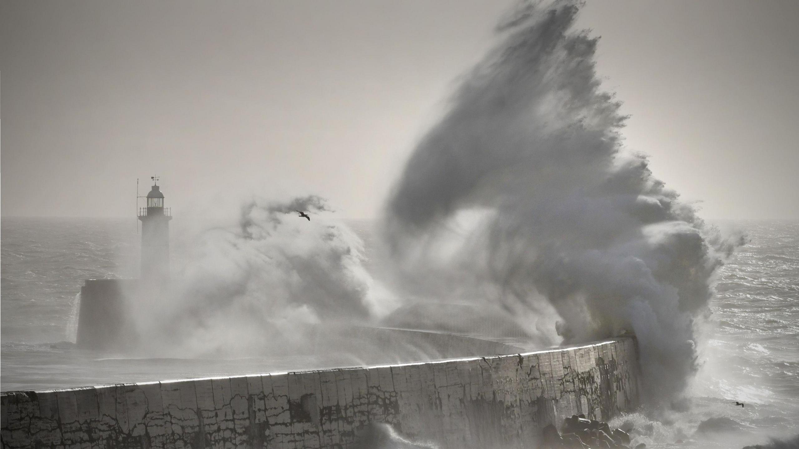
By fundamentally altering global jet streams and atmospheric circulation, El Niño triggers a cascading series of teleconnections that ripple across the entire planet. According to the UK Met Office, this massive injection of oceanic heat and shifting wind patterns will significantly influence Britain’s weather systems. As the phenomenon approaches its peak leading into the latter half of the decade, the UK faces an increasingly high probability of a turbulent, wet, and stormy autumn, followed by an intensely volatile winter.
Yet, meteorologists are quick to sound a note of caution: while El Niño loads the dice for certain types of extreme weather, no two events are identical. Set against the backdrop of a rapidly warming world driven by human-induced climate change, this developing Pacific cycle introduces a complex new variable into long-range forecasting, threatening a season of disruption for transport networks, infrastructure, and communities nationwide.
Detailed Chronology: From Pacific Warmth to British Gales
The journey of an El Niño event begins deep beneath and across the surface of the equatorial Pacific. Trade winds, which normally blow from east to west across the ocean, weaken or even reverse. This dynamic allows warm water massed near Asia to surge back eastward toward the Americas. As millions of cubic kilometers of warm water accumulate, heat is transferred from the ocean into the atmosphere, altering global air pressure systems and shifting the position of the jet stream—the high-altitude river of air that steers weather systems across the globe.
As this cycle matures, its effects propagate outward in predictable yet complex waves. The Met Office has been closely monitoring the current trajectory of the Pacific anomalies, noting that the scale of the developing event is exceptionally rare in modern instrumental records.
- Late Summer to Early Autumn: As the Pacific warming intensifies, the shifting jet stream begins to destabilize weather patterns across the North Atlantic. For the UK, this transitionary period—historically characterized by a mellowing into autumn—is projected to warp into an aggressive sequence of low-pressure systems.
- November and December: Forecasters have identified robust early signals indicating a dramatic surge in rainfall and localized storminess across the British Isles as autumn gives way to early winter. The convergence of moisture-laden Atlantic air masses and energized wind streams creates a fertile breeding ground for rapid-genesis autumn gales.
- Late Winter to Early Spring: Moving past the turn of the year, the atmospheric influence of El Niño reaches its maturity window. Historically, this phase has occasionally correlated with severe cold air outbreaks across Western Europe, though the statistical link remains more volatile during the deeper winter months.
This chronological progression highlights a stark departure from typical seasonal baselines, moving the UK from a backdrop of persistent drought and record-breaking summer heat straight into a gauntlet of autumnal tempests.
Supporting Context & Metrics: Historical Parallels and Climate Realities
To understand the potential severity of the upcoming months, climatologists frequently look to historical precedents where strong El Niño cycles coincided with notable British weather anomalies.
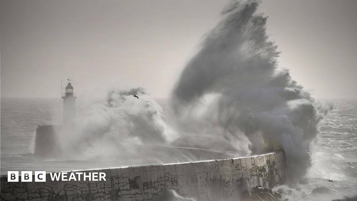
A striking parallel can be found in the winter of 2015 and 2016. Coinciding with one of the strongest El Niño events ever recorded, that winter subjected the UK to a relentless succession of major storms—including Desmond, Eva, and Frank. The resulting torrential downpours delivered what hydrological experts classified at the time as the most extensive and extreme flooding on record, leaving thousands of homes submerged, devastating local economies, and testing infrastructure to its absolute limits.
Furthermore, the physical dynamics of the atmosphere during an El Niño event dictate a global temperature bump. On average, a very strong El Niño lifts global mean temperatures by approximately 0.2 degrees Celsius. While this figure may appear modest on paper, when stacked on top of the relentless upward trajectory of human-induced global warming, it acts as a force multiplier for extreme weather events.
However, this systemic heating does not translate into uniform impacts. While tropical regions experience predictable shifts, the UK sits at the intersection of maritime and continental influences, making local weather responses highly sensitive to the exact positioning of the jet stream.
At the same time, the UK enters this period emerging from a summer marked by record-breaking heat and acute, long-term drought conditions across large swaths of the country. While a wet autumn might initially appear as a welcome relief for depleted reservoirs and parched agricultural soils, the underlying mechanics of climate change complicate the outcome. Warmer air can hold significantly more moisture—roughly 7% more per degree of warming—meaning that when rain does fall, it increasingly arrives in the form of intense, high-volume cloudbursts rather than steady, beneficial soaking rains. Consequently, the anticipated storms carry an elevated risk of flash flooding, severe wind damage, structural disruption, and widespread power outages.
Official Statements and Expert Analysis
The unprecedented nature of the current Pacific cycle has prompted leading figures in meteorological science to voice heightened concern regarding long-range predictability and regional vulnerability.
"I have not seen an event like this developing in our forecasts before," stated Professor Adam Scaife, Head of Long-Range Forecasting at the Met Office. Emphasizing the sheer magnitude of the anomaly, Professor Scaife noted that the physical scale of the growing El Niño exceeds historical baselines recorded in modern climate archives. As the phenomenon marches toward its anticipated peak, its global teleconnections are expected to amplify rapidly.
"We already see signals for increased rainfall and storminess in autumn here in the UK," Professor Scaife added, pointing specifically to the heightened risk profile spanning November and December. He stressed that while the statistical modeling points clearly toward increased precipitation and gale frequencies, the chaotic nature of the atmosphere means communities must remain vigilant rather than complacent.
The compounding threat of climate change alongside Pacific ocean anomalies was further emphasized by Dr. Akshay Deoras, a climate scientist at the University of Reading. Addressing the broader picture of thermal trends, Dr. Deoras noted:
"Long-term global warming remains the more significant driver of the UK’s rising temperatures and increasing risk of extreme heat. It is still too early to say what next summer will bring for the UK; however, El Niño’s additional warming, coupled with the UK’s already warmer climate, could provide the conditions for a hot summer."
Dr. Deoras’s analysis underscores a crucial reality: El Niño does not operate in a vacuum. It interacts with an already altered global climate system, magnifying existing vulnerabilities while introducing new layers of meteorological unpredictability.
Future Outlook: Navigating Uncharted Meteorological Waters
As the UK looks ahead to the remainder of the decade, the interplay between the tropical Pacific and North Atlantic weather machine serves as a stark reminder of the interconnected nature of Earth’s climate.
While the immediate focus centers on the threat of an unusually wet, windy, and potentially disruptive autumn and early winter, questions persist regarding the longer-term trajectory. El Niño events are historically associated in some academic literature with cold late-winter spells—such as the infamous "Big Freeze" of the 2009/2010 winter, which also coincided with an active El Niño phase. Yet, meteorological data remains stubbornly mixed on this front; the El Niño winter of 2006/2007, by contrast, proved to be unseasonably mild. This historical divergence illustrates the limits of long-range forecasting: the further out meteorologists look, the wider the margin of uncertainty becomes.
What remains clear, however, is that the margins for error in infrastructure resilience, flood defense, and emergency planning are narrowing. The convergence of a powerhouse El Niño event with an atmosphere fundamentally altered by greenhouse gas emissions means that British weather is entering a phase of heightened volatility.
For emergency planners, local authorities, and the public alike, the message from the scientific community is unequivocal. The approaching autumn and winter demand rigorous preparation for severe weather contingencies. Whether manifesting as destructive coastal gales reminiscent of past winter tempests or sudden, high-intensity flash floods overwhelming urban drainage networks, the upcoming months will test the adaptability of the nation in the face of a changing, interconnected global climate.



